
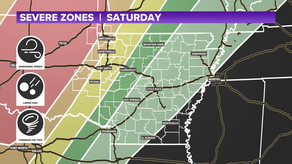
FAYETTEVILLE, Ark. — Storms are expected to push into 5COUNTRY overnight tonight into Sunday morning bringing the chances of strong winds, hail cores, and an isolated tornado threat. The latest timing has storms arriving very early in the morning Sunday and lasting into the early afternoon. We enter into a bit of a break during the midday, before storms pickup again into the afternoon and evening hours.
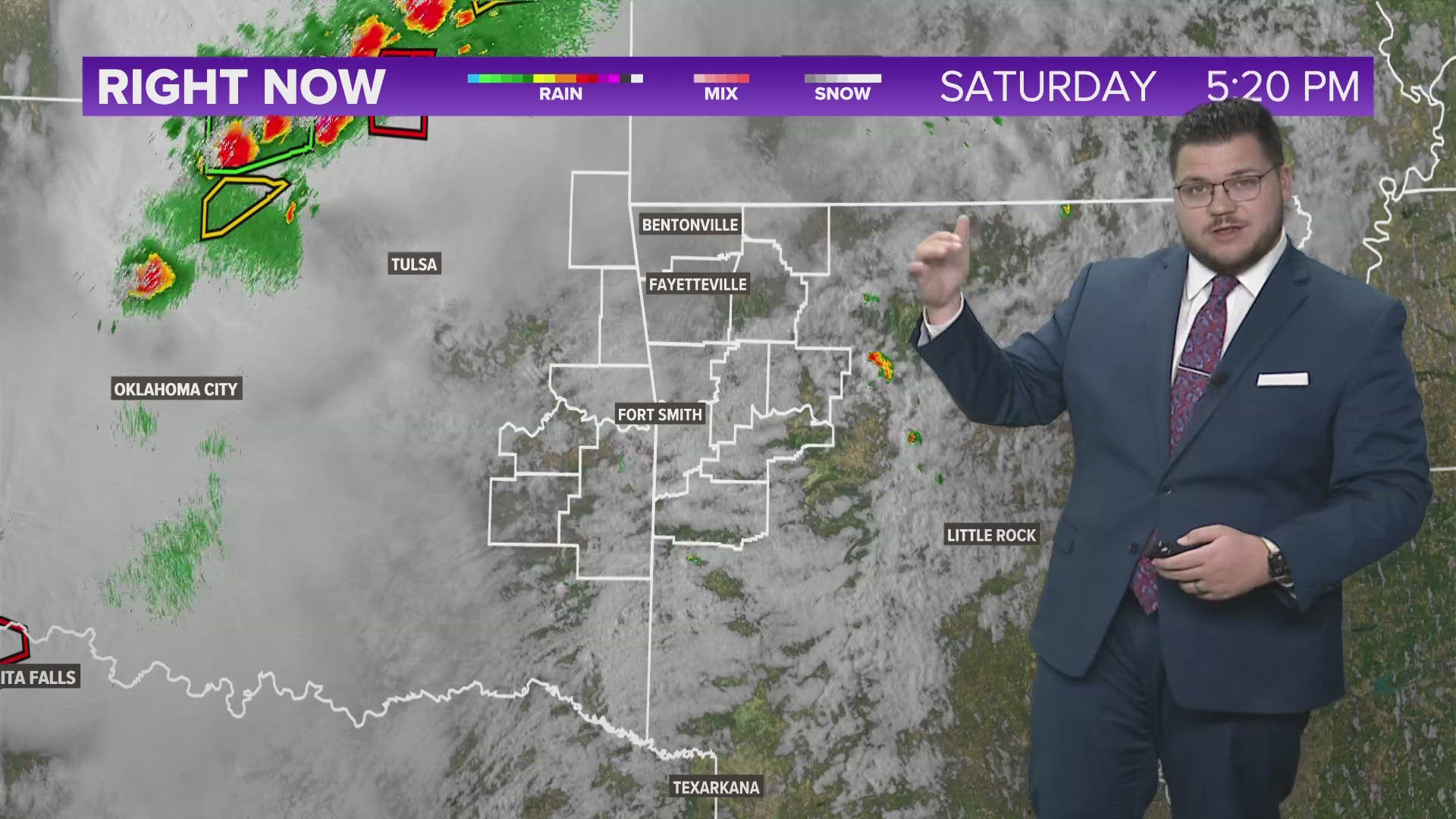
Tap HERE to check our interactive weather radar.
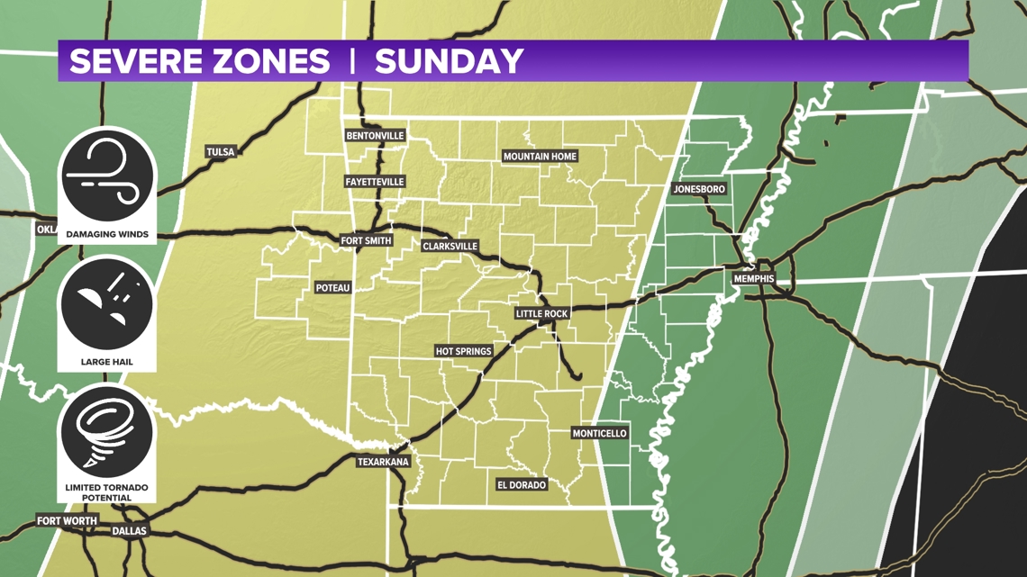
Redevelopment will be possible into Sunday afternoon and evening hours bringing back the chances of strong to severe thunderstorms. Strong winds, hail cores, and an isolated tornado will be possible again.
SATURDAY
- Scattered Showers (20%)
- Mostly Cloudy
- Highs in the 70s/80s
- Humid and Muggy
SUNDAY
- Scattered Storms (80%)
- Highs in 70s
STRONG STORM CHANCE INTO SUNDAY MORNING
Sunday is going to be an active day, with multiple chances of storm development. Strong to severe thunderstorms will be possible early tomorrow morning into the early afternoon. All threats will be at play during this event. We enter into a break during the midday, before redevelopment will be possible in the afternoon and evening hours of Sunday. Once again, all threats will be available throughout the day on Sunday. The 5NEWS Weather Team will be tracking storms and providing updates on our live streaming platforms and on 5NEWS.


Watch 5NEWS on YouTube.
Download the 5NEWS app on your smartphone:
Stream 5NEWS 24/7 on the 5+ app: How to watch the 5+ app on your streaming device
To report a typo or grammatical error, please email KFSMDigitalTeam@tegna.com and detail which story you're referring to.