
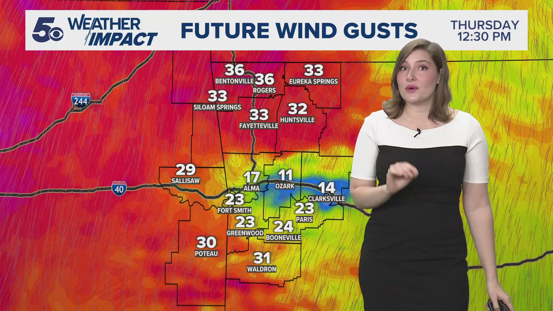
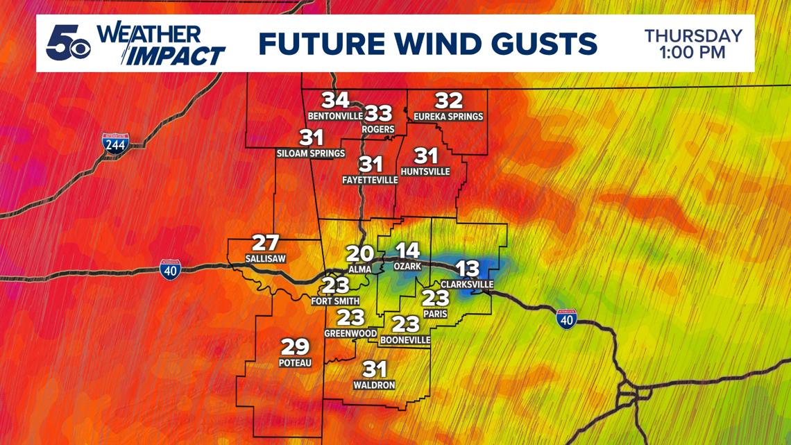
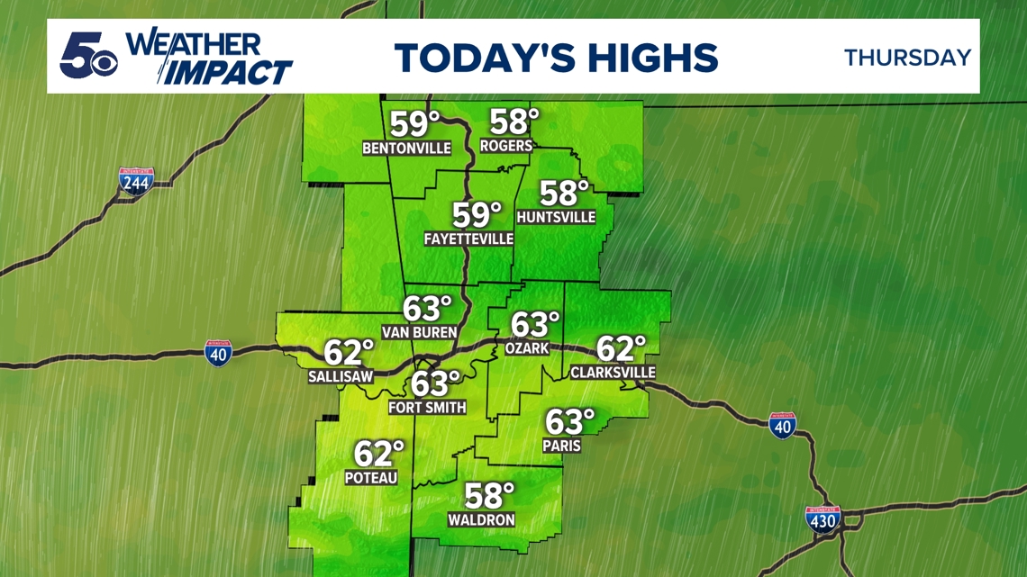
FAYETTEVILLE, Ark. — Heat is building across Northwest Arkansas and the River Valley today as southern flow streams in. Temperatures peak in the upper 50s and 60s this afternoon. Breezy southern winds gust up to 35 mph today before settling over the evening. Cloud coverage increases this evening as moisture levels surge.
Tap here for an hour-by-hour forecast.
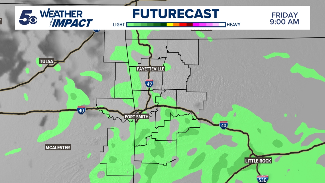
Isolated showers will sprinkles across Arkansas and Oklahoma throughout the day Friday, with a majority of rain dropping over the evening. Scattered showers slow overnight, but build again on Saturday. A rumble of thunder or two will sound over Saturday morning before skies start to dry over the afternoon.
Here's a look at current radar across Northwest Arkansas and the River Valley.
Warm air continues to dominate despite the weekend showers with highs in the 50s and 60s. Another round of rain works into our area Monday morning along a cold front. Showers are expected to be a bit heavier within the second rain system and thunder rumbling a bit longer. Once that front passes, temperatures start to drop back toward normal.


TODAY
- Building clouds
- Highs in the 50s/60s
- Southwestern winds 10 to 20 MPH | Gusts up to 35 MPH
TONIGHT
- Mostly cloudy
- Lows in the 40s
- Southerly winds 5 to 10 MPH | Gusts up to 20 MPH

Watch 5NEWS on YouTube.
Download the 5NEWS app on your smartphone:
Stream 5NEWS 24/7 on the 5+ app: How to watch the 5+ app on your streaming device
To report a typo or grammatical error, please email KFSMDigitalTeam@tegna.com and detail which story you're referring to.