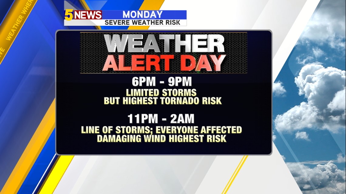
Severe weather will continue to be a risk for our area this evening into the overnight hours.
Initially, only a few storms will develop ahead of the cold front in the evening hours. There may only be one or two storms but those storms will have the highest potential to become supercells with higher risk for tornadoes.

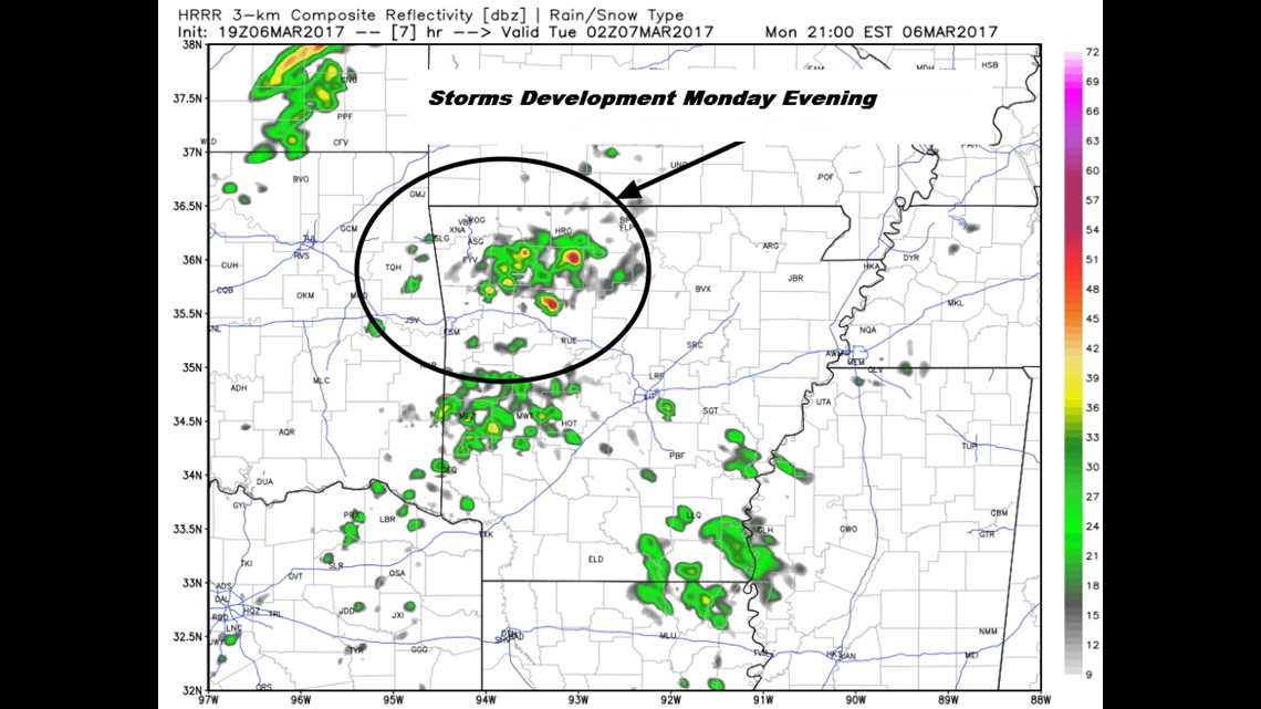
Although it’s not possible to determine exactly where the first storms will develop, the area in this circle is most favored for isolated supercell storms with a greater tornado risk. Time would be 6pm-9pm.

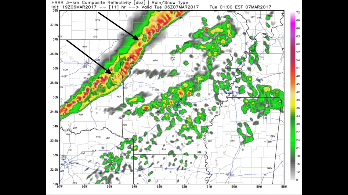
This map shows midnight. The line of storms will form along and ahead of the cold front with the risk for damaging winds along the front the line should have a higher risk of wind damage as opposed to tornadoes. Those pesky pockets of rotation will be possible on the leading edge of the line that tend to produce weak spin-up tornadoes.
The severe threat should be over or ending by 2am Tuesday.

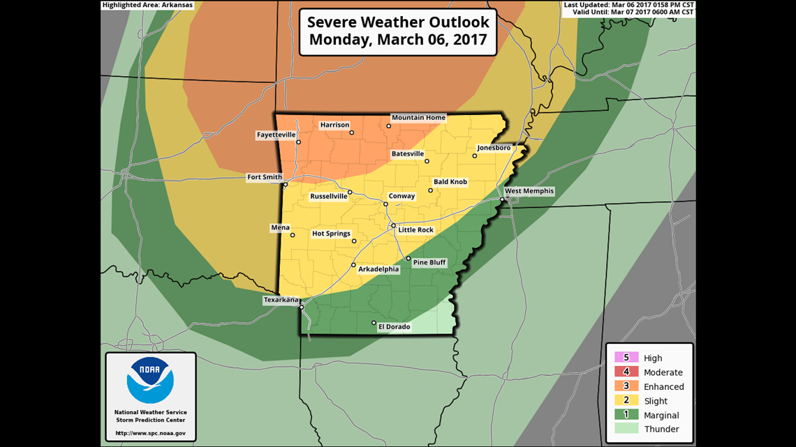
This map shows the latest Enhanced Risk and the locations expected to be most affected by the strong to severe storms later in the evening/overnight.
-Garrett