
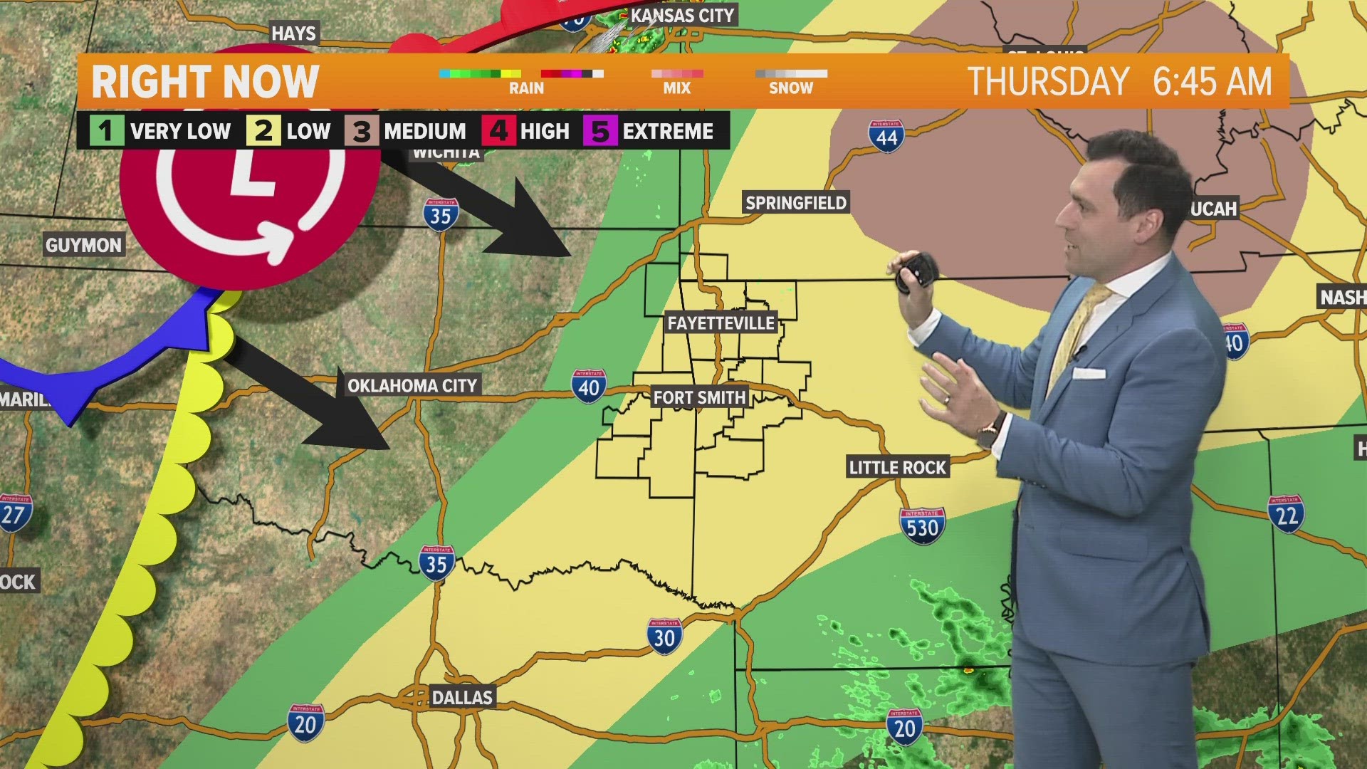
ARKANSAS, USA — Storm chances are back into the forecast, and this time the timing isn't great.
We will once again get into the mid-80s for our daytime highs before the cold front arrives around 3 to 4 PM. With storm chances coming during peak heating hours, we will have a lot of energy available to fuel these storms.
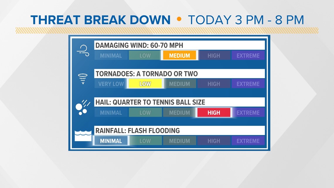
Our top severe weather threats are strong damaging wind gusts, large hail cores, with a lower potential of seeing an isolated tornado.
AREAS OF CONCERN
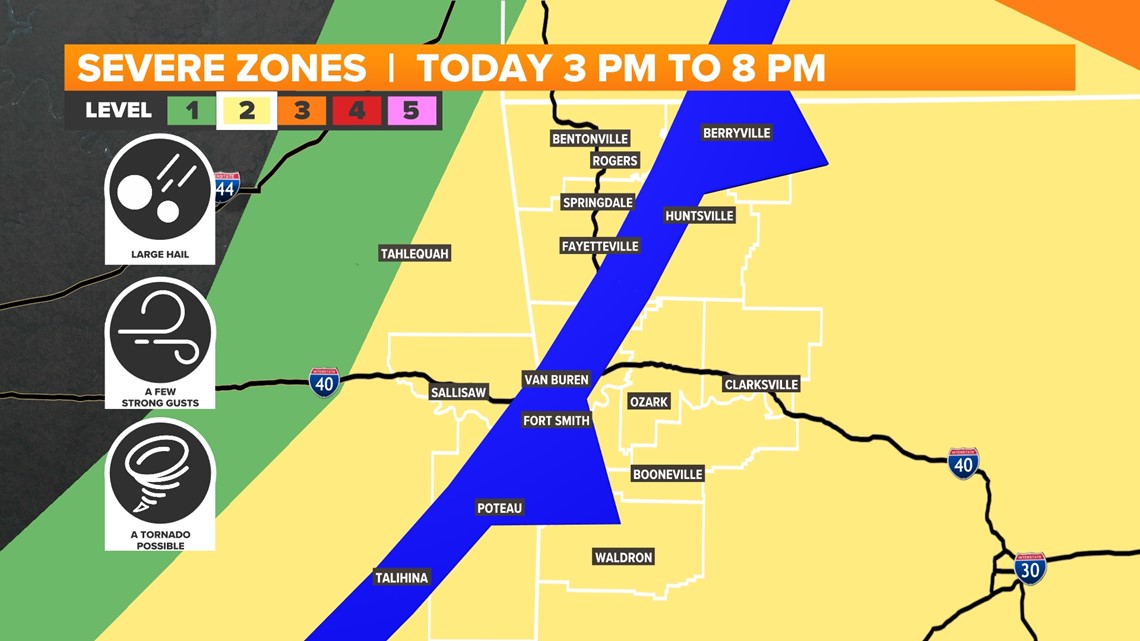
These storms will develop right over Northwest Arkansas before pushing into the River Valley. As it stands right now, we have a 'Level 2 Risk' across all of 5COUNTRY. Meaning, we expect at least a few severe storms late Thursday, but widespread severe weather is not anticipated.
A lot of energy and fuel will be available, so these storms have the potential to pop up very quickly and produce some strong to severe thunderstorms. A severe thunderstorm watch will likely be needed for parts of eastern Oklahoma and Arkansas by later this afternoon. Have multiple ways to get alerts and stay connected with your 5NEWS Weather Team on TV, online, and on social media.

STORM THREATS
Our main concern is large damaging hail cores that could range from as small as dimes up to the size of tennis balls. These strong to severe storms will also be capable of producing a few wind gusts 50 up to 70 mph. The tornado threat is lower, though a tornado to two cannot be ruled out.
Though any storm that develops could produce very heavy rainfall, storms are expected to move fast enough to forgo any flooding headlines.

STORM TIMING
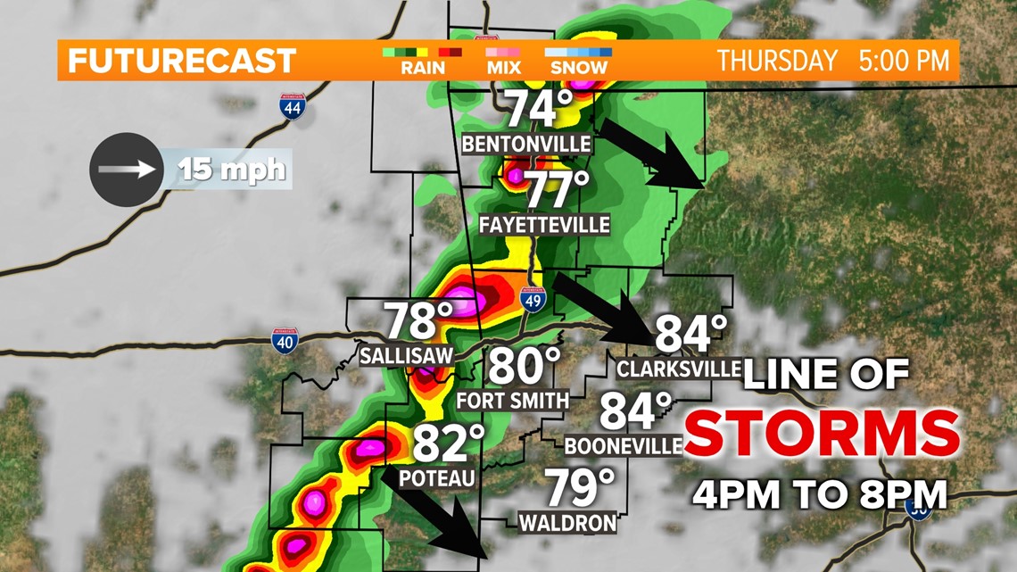
Storm development is expected to fire up around 3 PM to 4 PM near NW Arkansas. Scattered showers and thunderstorms are likely to strengthen and mature as they spread southeast into the River Valley around 4 to 6 PM. The shower and thunderstorm activity will likely exit areas from Scott to Logan to Johnson counties around 7 to 8 PM. Strong to severe storms will push into central and eastern Arkansas overnight.
The 5NEWS Weather Team will be tracking these storms during our evening shows and on live streaming platforms.

- Meteorologist Zac Scott
Watch 5NEWS on YouTube.
Download the 5NEWS app on your smartphone:
Stream 5NEWS 24/7 on the 5+ app: How to watch the 5+ app on your streaming device
To report a typo or grammatical error, please email KFSMDigitalTeam@tegna.com and detail which story you're referring to.