
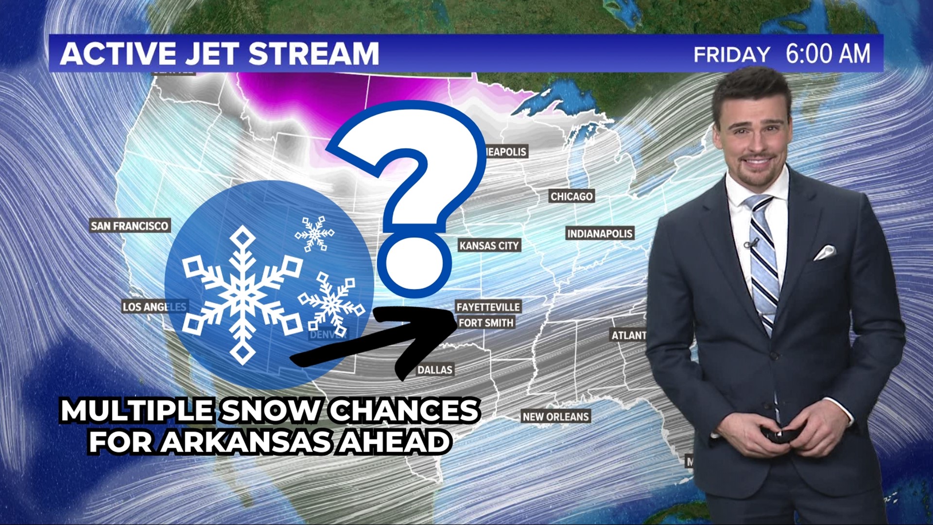
ARKANSAS, USA — Buckle up, multiple rounds of snow chances are on the way for Arkansas, starting on Friday, Jan. 5. Each chance of snowfall will have some rain mixed in as well, but during the nights and mornings as temperatures cool, some snow will likely fall.
There are three storms on the way:
- Friday (Jan. 5)
- Monday night (Jan. 8) - Tuesday morning (Jan. 9)
- Friday (Jan. 12) - This one is still very far out, but something may come.
Tap here for our interactive radar to track the incoming rain and snow.
Overall summary
Each storm will bring small accumulations to Arkansas. We haven't had snow stick across the state yet this winter. Ground temperatures are still warm so it will be tough for the snow showers to stick. At times, a burst of snow may try to cover the ground with a dusting or so. Snowfall totals will range from town-to-town for each storm, but these are our best guesses.
Generally, the greatest snowfall totals for each storm will be in higher elevations, NW Arkansas, and NE Oklahoma. The farther south you go, the higher the rain chance.
Rain/snow chances: Friday, Jan. 5
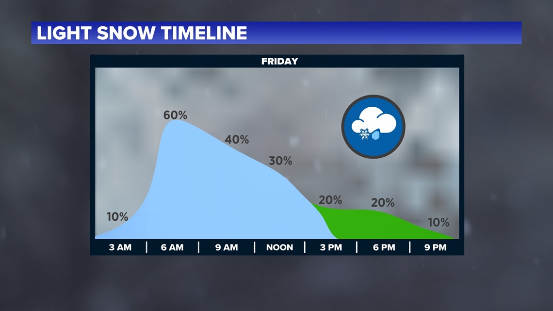
Friday morning's commute may get slick in spots as snow showers move into eastern Oklahoma and western Arkansas, crossing the state line near 4-6 AM. Most of these snow showers will be light, with some quick bursts of snow at times. Temperatures will be near the freezing mark at the start of the morning, so mostly snow is expected. In the late morning hours, as temperatures warm, light raindrops will start to mix in, cutting down on possible snow chances.
Q: When will I get snow?
Below we have your Friday timeline. Snow showers will pick up near or just before sunrise. This will be the best time for accumulation thanks to colder temperatures. Expect scattered snow until 1-3 p.m. Afterwards, the sky will stay cloudy with some light raindrops possible.
Warmer air will try to come back for Friday night into Saturday, just barely helping us to stay above freezing. You may get light, on-and-off rain showers on Friday night and Saturday. Rainfall totals would be extremely light and stay under a tenth of an inch. Every once in a while a snow flurry is possible during this time too in higher elevations where it's colder.

Q: How much snow will I get?
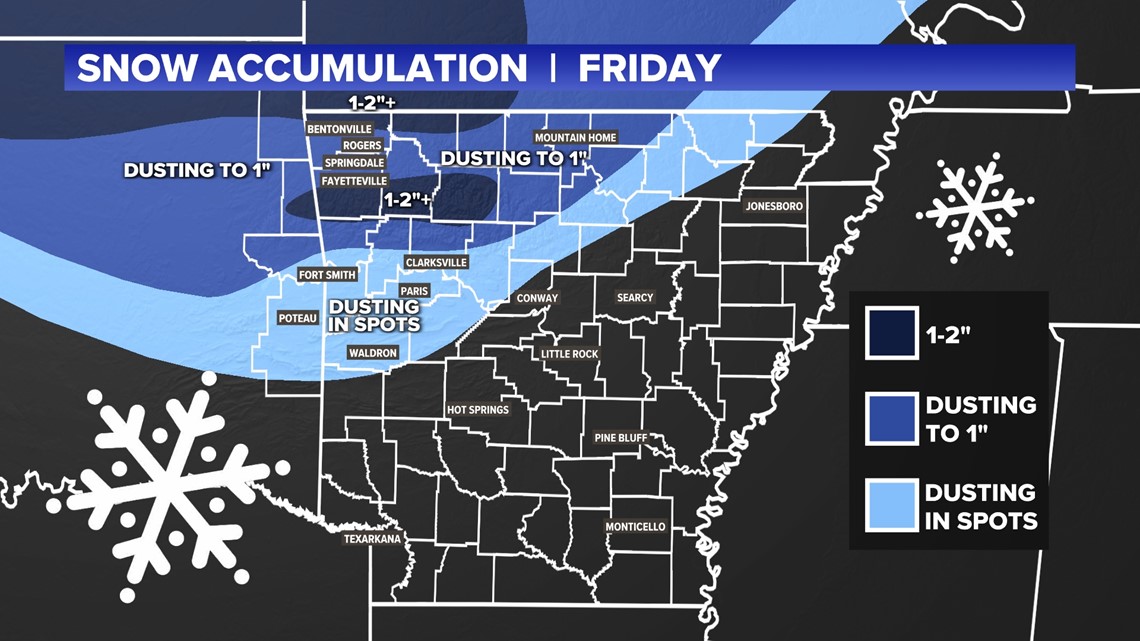
Everyone will get something different, but here is our best guess. With light snow showers for 4-8 hours across western Arkansas, some snowflakes will likely stick, especially to grass, trees, elevated surfaces, and vehicles. Roads will likely mostly stay wet with some slick spots on bridges, overpasses, and road showers.
- Northwest Arkansas: A dusting or so is possible across most of Benton, Carroll, Madison, and Washington counties. There may be closer to an inch or two in northern Benton County.
- Boston Mountains: Up to an inch or two will be possible.
- River Valley: Snow showers may have a bit harder time sticking, but there may be a dusting in spots.
- Ouachitas: Expect a dusting in spots.

Q: How will the roads be Friday morning and midday?
Most of the roads should stay wet with more of the snow sticking off the road. However, bridges and overpasses could become slick.
As temperatures cool Friday night, there may be some refreezing on bridges in the mountains, if they are still wet going into the night.
Rain/snow chances (Jan. 8-9)
On to the next storm! This one has a lot more precipitation in it. Heavy rain will move in throughout Monday. Expect up to an inch of rainfall across much of Arkansas. Colder air will start coming in late Monday night, helping us to switch over to snow for Tuesday morning.
No severe weather is expected in Arkansas on Monday. Temperatures will be too cool for tornadoes and hail. Expect just rain and some windy conditions at times.
Then we will likely switch to snow showers on Tuesday. We don't have a lot of details on how much snow because there may be some dry air that starts to work into the snow bands. Still, these snow showers may produce light accumulations across the western half of the state, especially in NWA and the mountains. This storm is still a few days out, so watch for updates.

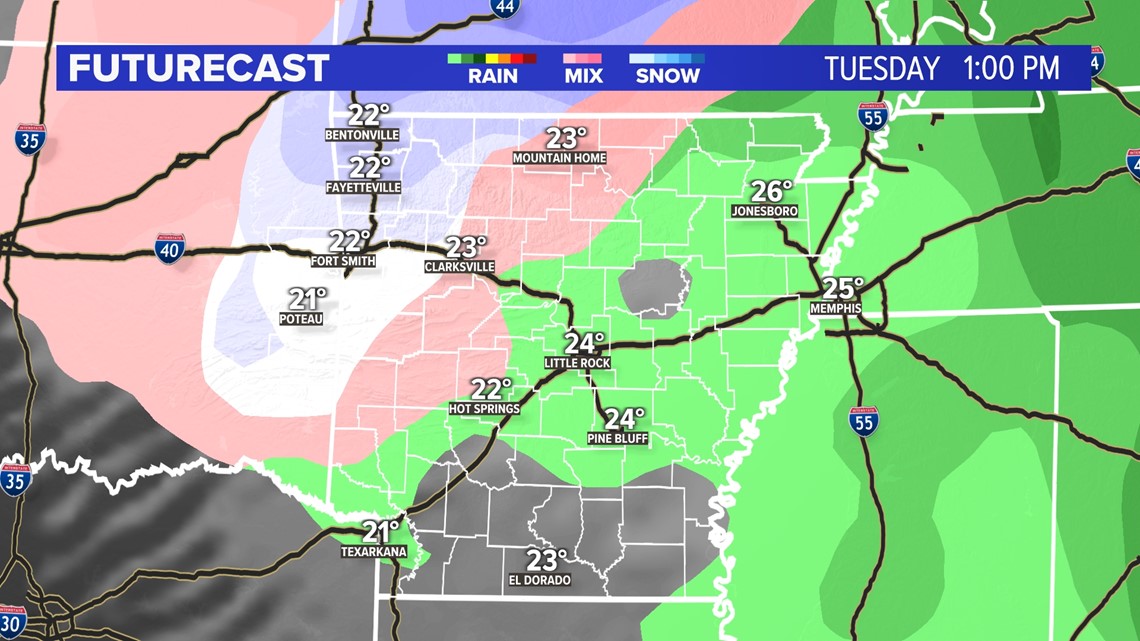
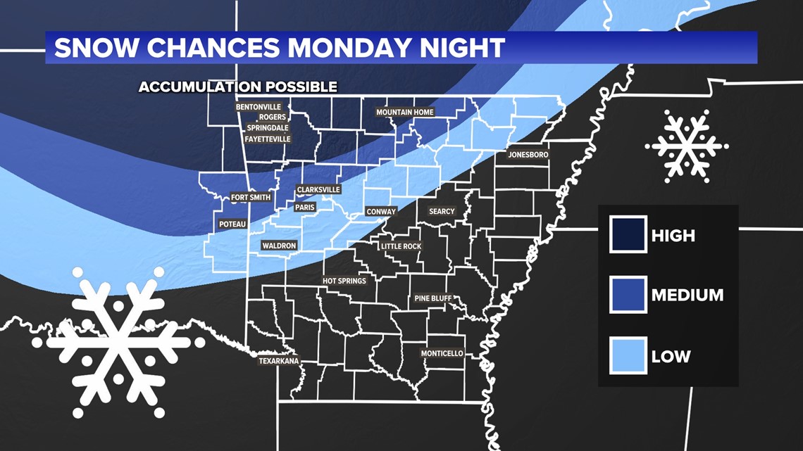
Q: How much snow will I get Monday night and Tuesday?
We are not ready for accumulation maps yet, but below we have a snow chance map. This shows areas that have a decent shot at some light accumulations, and areas that will likely get some light snow showers but possibly no accumulation. The farther north you go, the higher the snow chance will be.

Friday wintry chances (Jan. 12)
This is still way out there, but another dip in the jet stream may bring precipitation quickly back to Arkansas and Oklahoma. Because it's moving in so quickly after the Monday-Tuesday storm, temperatures may not have enough time to warm up a lot. Expect a mix of rain and snow showers late that week. This is a very early look.
Check back for updates. There's a good chance the jet stream angles itself a bit differently, making this storm system go just north of Arkansas.
Last-minute thoughts
January is historically the snowiest month of the year for Arkansas, so it is no surprise that we are not only tracking on system but three.
Again for Friday, this is the first of three systems that we are expecting. Later on, Monday looks to be very cold and very rainy. As we get into Tuesday afternoon, that rain could transition into another round of snowflakes and a wintry mix. Once again, any accumulation looks decent across Northwest Arkansas, but as of now we still need to work on the exact forecast for Tuesday evening.
As always, stay tuned! As the potential snow comes in, we will track it with multiple updates.