ARKANSAS, USA — After two storms already with a mix of ice and sleet, one more storm will hit Arkansas this week with possible heavy freezing rain. Expect the ice to begin to cross in from Oklahoma to Arkansas by 4-6PM Wednesday. Freezing rain will last much of the night. (scroll down for power outage forecast)
Tap HERE for our interactive radar to track the incoming sleet.
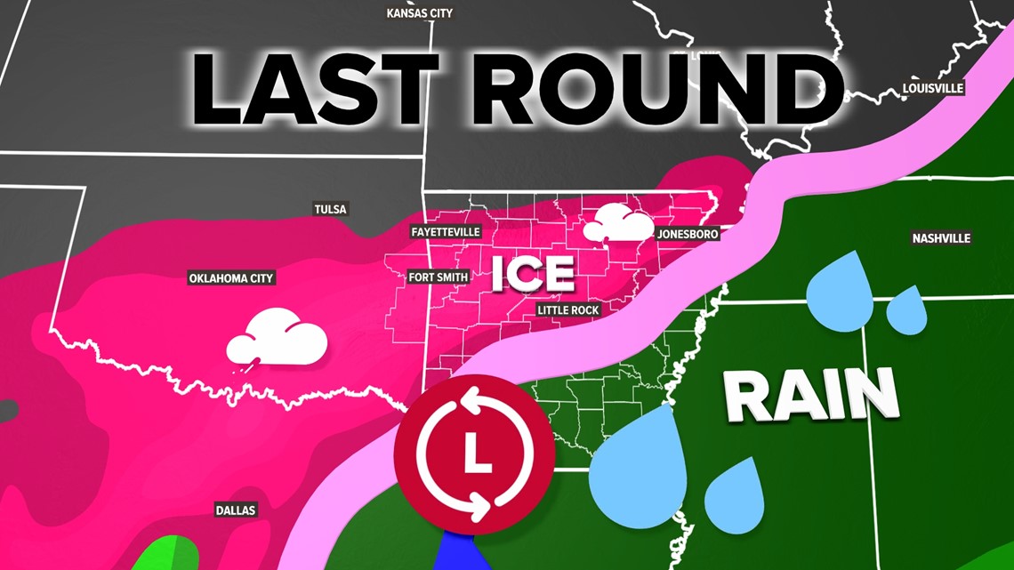
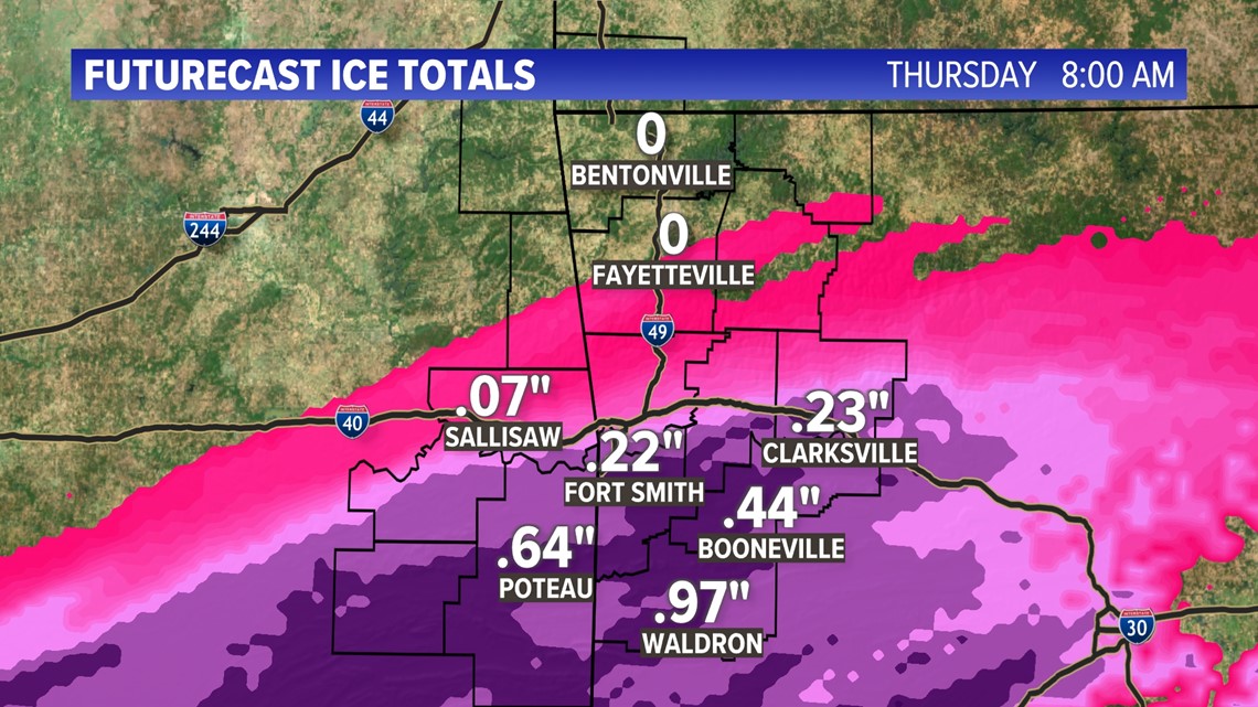
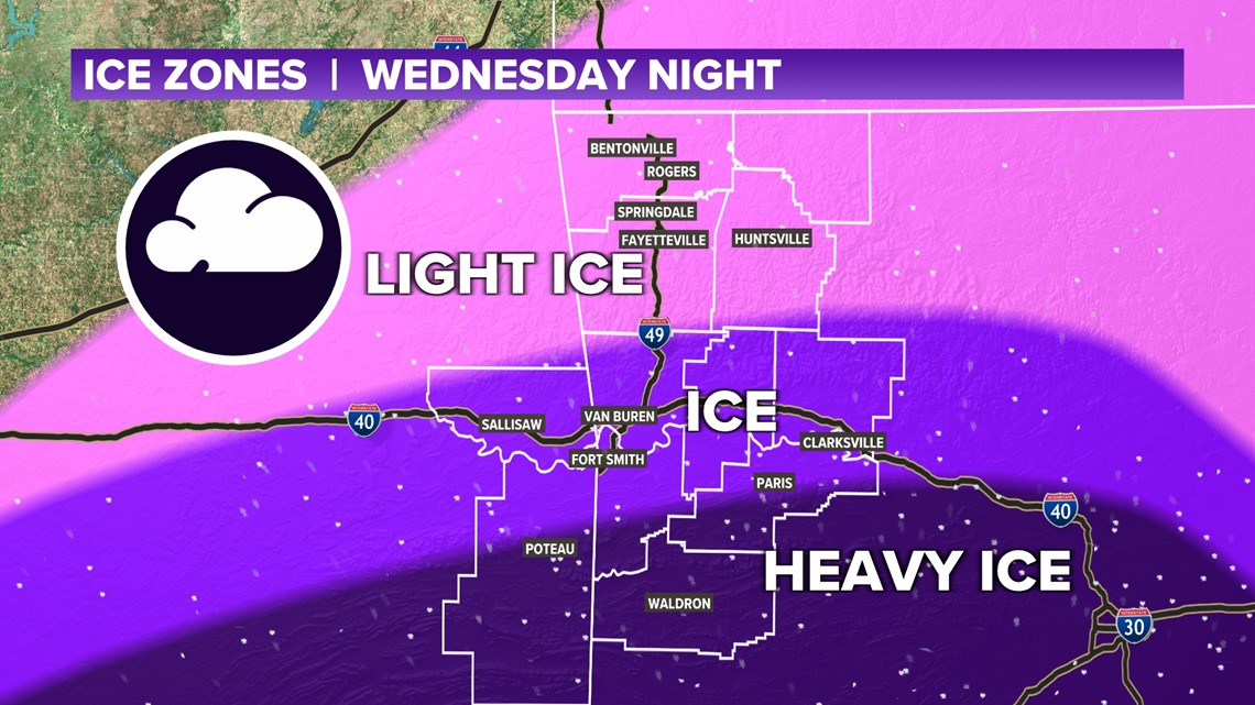
The worst ice conditions are expected in the Arkansas River Valley, east to central Arkansas around Little Rock. Areas farther north may have less moisture in the atmosphere, resulting in lighter accumulations. More than a half inch of ice is expected south of the Arkansas River.
WEATHER SETUP
A low pressure system will swing in from the southeast. Areas north of the light pink line (below) will likely pick up freezing rain. The more northern counties of Arkansas may have a mix of light sleet and freezing drizzle. Counties closer to the line will pick up the most ice.

HOW MUCH ICE CAN WE EXPECT
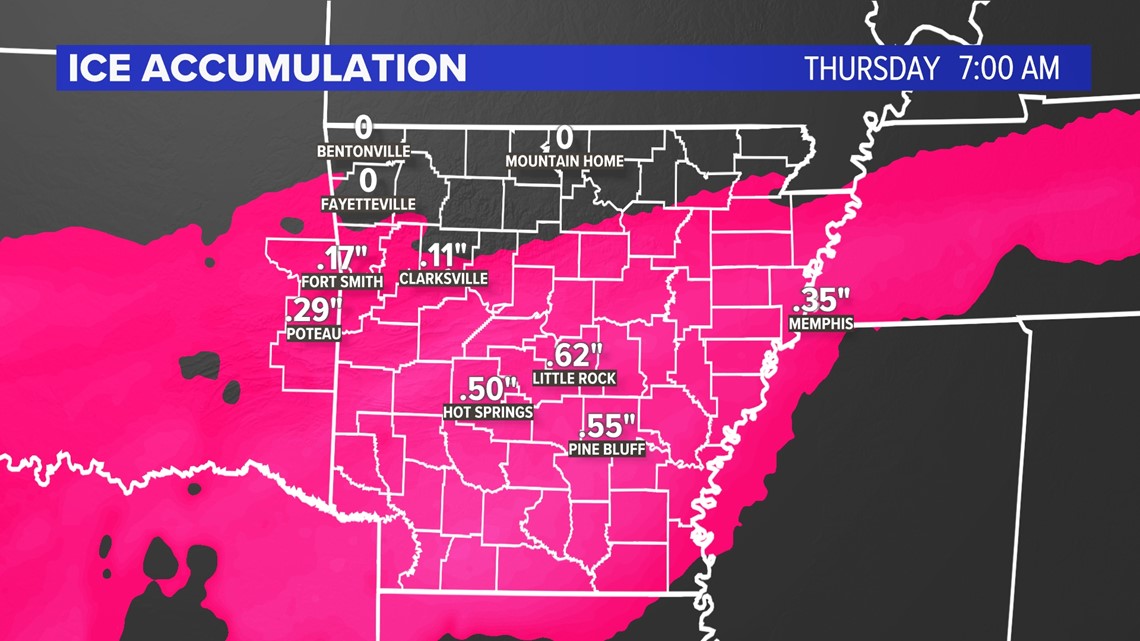
Ice forecasts are difficult because out of the freezing rain, how much will freeze and how much will drip off? Generally expect nearly a quarter inch of ice in the River Valley and maybe a half inch of ice in central Arkansas. Some counties near the northern Ouachitas (like Scott and Logan countie) may pick up a half inch of ice, or more, as well.

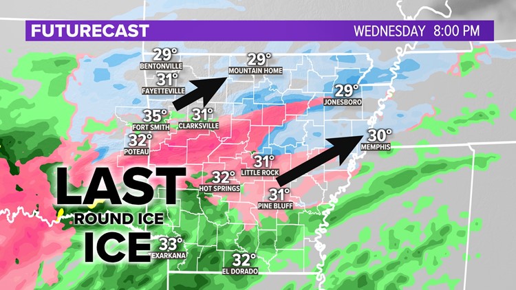
WHEN CAN I EXPECT ICE?
The worse of the freezing rain will be Wednesday night through early Thursday morning. Later in the morning on Thursday, we may start to warm up above freezing, helping some rain to mix in with the ice.

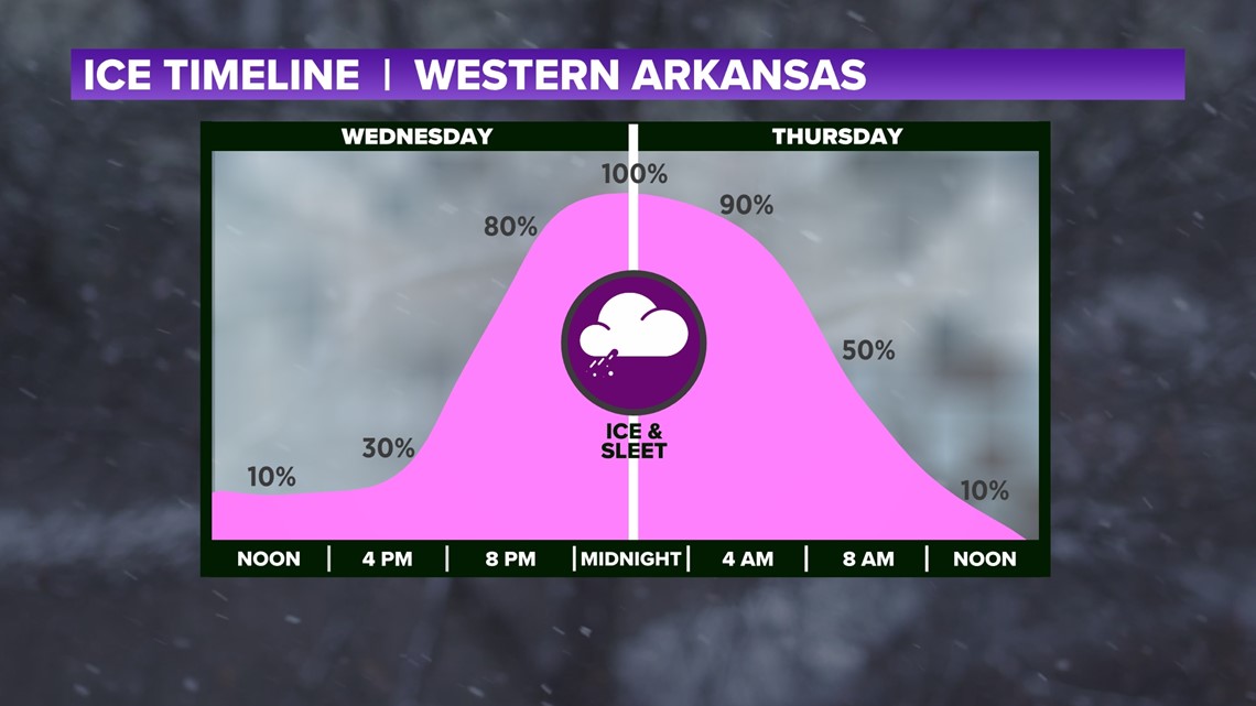
Expect roads to remain icy and dangerous for most of Thursday with lots of melting taking place Friday.
Quick note: There may be some re-freezing into Friday morning.
CLOSER LOOK AT POTENTIAL ICE TOTALS
In the southern River Valley

POWER OUTAGE FORECAST
The heavier the ice, the higher the power outage chance. Minor power outages are expected in the medium purple color (Fort Smith, Van Buren, Sallisaw, Ozark, Clarksville). The dark purple color may have numerous power outages that could last a day or two (Poteau, Greenwood, Booneville, Waldron).

-5NEWS Weather