ARKANSAS, USA — Arkansas is going to see some active weather patterns on Friday, April 26, and into the weekend with multiple chances of strong to severe thunderstorms.
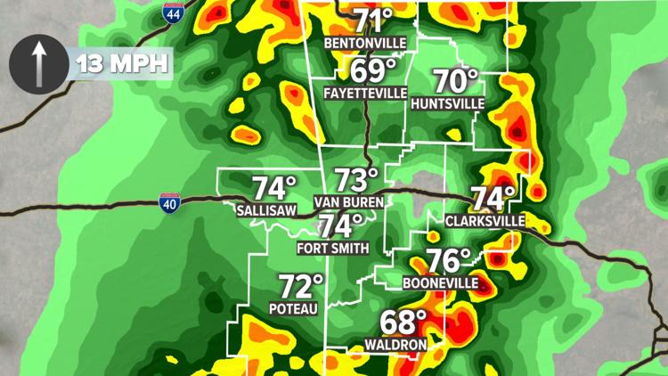
After a rainy Thursday, energy picks back up going into Friday morning with showers and thunderstorms expected for the morning commute. If energy can recover in the afternoon and evening hours, we could have a few strong storms that will bring the chances of strong winds, isolated hail, and pop-up rotation.
Saturday looks muggy and humid throughout most of the day, which is just energy building up for another round Saturday night into Sunday morning.
Storm chances for Friday
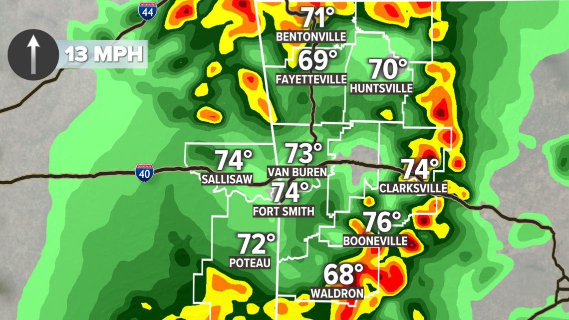
Heavy showers and thunderstorms are expected Friday morning through the afternoon. We will have the chance of some isolated thunderstorms and potential flash flooding in the morning, but the greater storm threat is in the afternoon and evening hours.
Depending on how much energy is left over in the afternoon, we could have a few more storms develop that will have some energy to use up. If we reenergize the atmosphere in the afternoon, we will have the potential of strong winds, isolated hail cores, and rotating supercells.
Again, it all depends on how much energy is left over after the morning showers and thunderstorms push through. If those storms come back together later in the day, which looks likely at this point, then the severe threats will be greater.

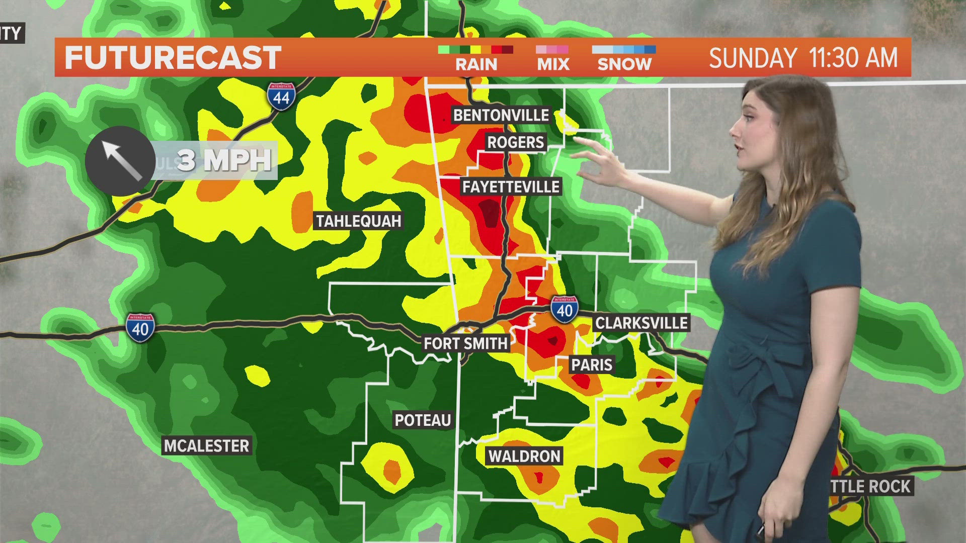
Storm chances overnight into Sunday
Throughout most of the day on Saturday, it'll be warmer and muggy as energy continues to build for the overnight storm threats. Most of the storm activity looks to be pushing into Northwest Arkansas and the River Valley through Sunday morning and into the afternoon.
All threats will be available, meaning the possibility of strong winds, hail cores, and rotating supercells. Don't be surprised if on Saturday we don't have much in the way of storm activity, and if we do, it'll be late in the evening hours.

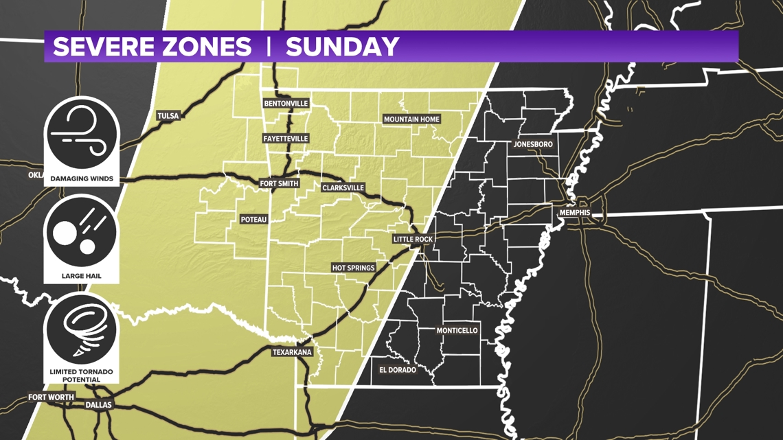
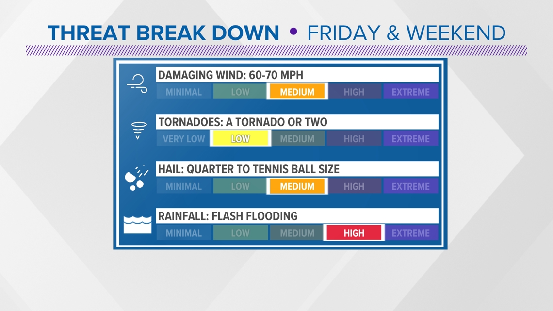
Threats through the weekend
While both systems are going to look very different they bring the same type of threats. Strong winds and isolated hail cores look probable for both Friday and Sunday morning.
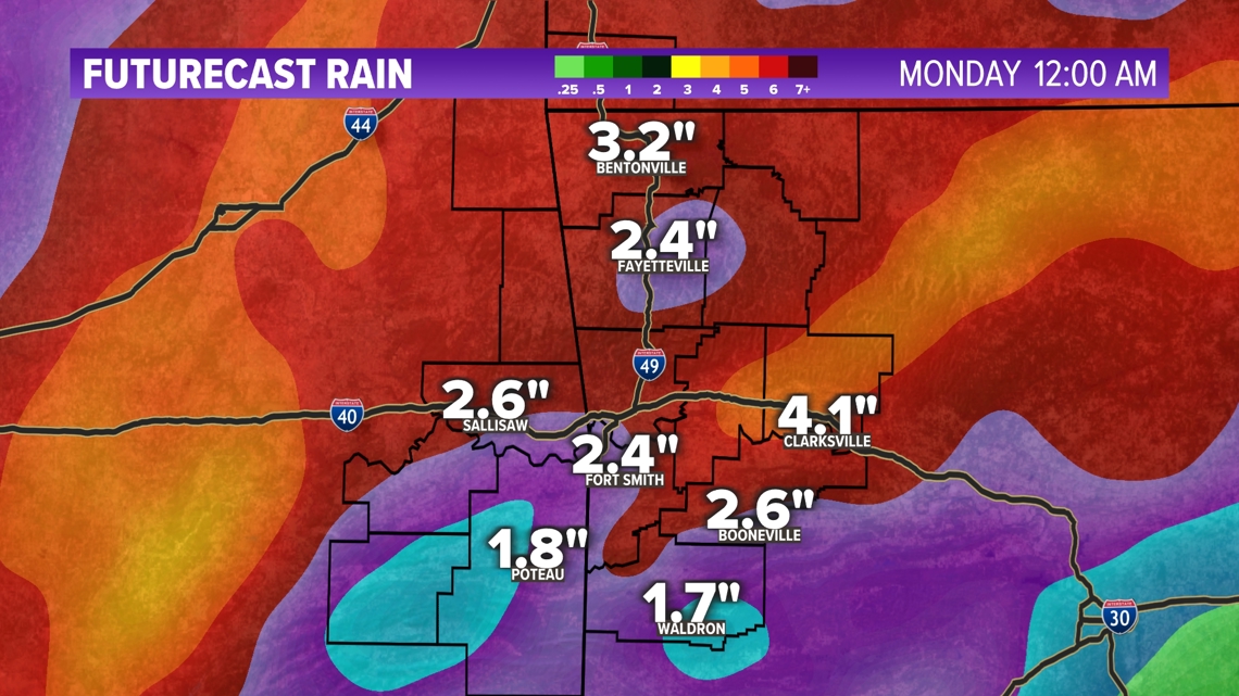
We are also going to pick up a lot of water with what we already picked up today, and what is to come through the weekend.
Estimations range anywhere from 2" to 4" of rainfall which could lead to some flash flooding events. As for the tornado probability, Sunday looks like our best chance to get some slight rotation, but we can't rule it out for Friday afternoon and evening.