
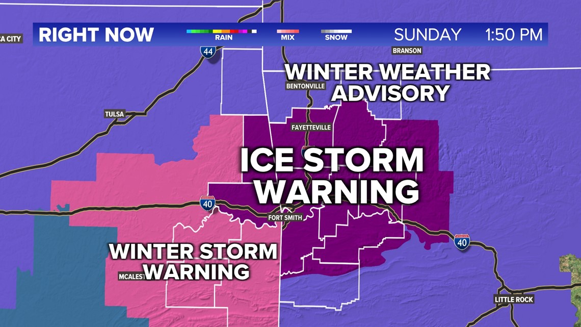
ARKANSAS, USA — A Winter Weather Advisory has been issued for Benton, Carroll, and parts of Scott counties ahead for light ice accumulation Monday morning.
An Ice Storm Warning has been issued for most of 5COUNTRY ahead of significant ice accumulation anywhere from .10" up .50" of ice accumulation. This will cause the potential for dangerous road conditions and potential power outages.
A Winter Storm Warning has been issued for Le Flore county ahead of moderate ice accumulation.
UPDATE: -- Again, The National Weather Service has issued multiple watches and warnings across 5COUNTRY for Ice accumulation anywhere from .10" up to .50"

Tap here to track the winter storm coming in from the west.
Tap here for the latest forecast, specifically for western Arkansas and eastern Oklahoma.
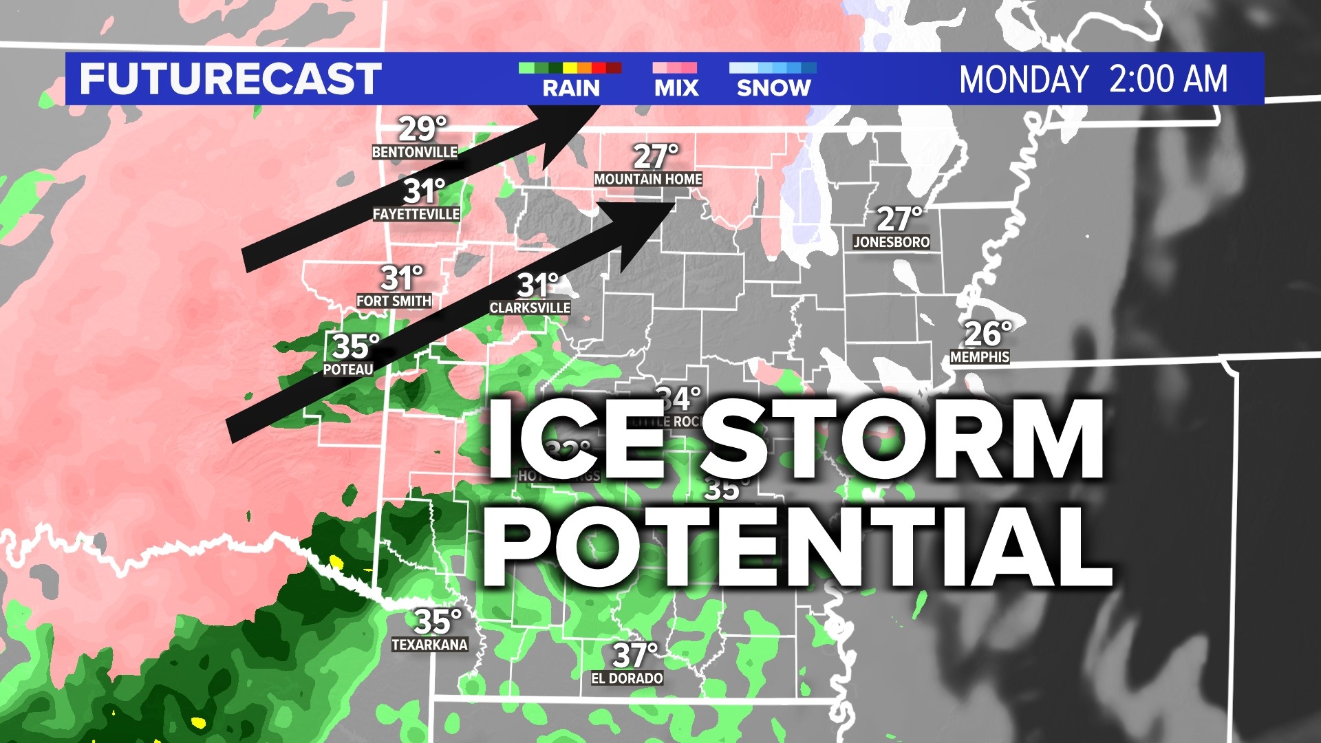
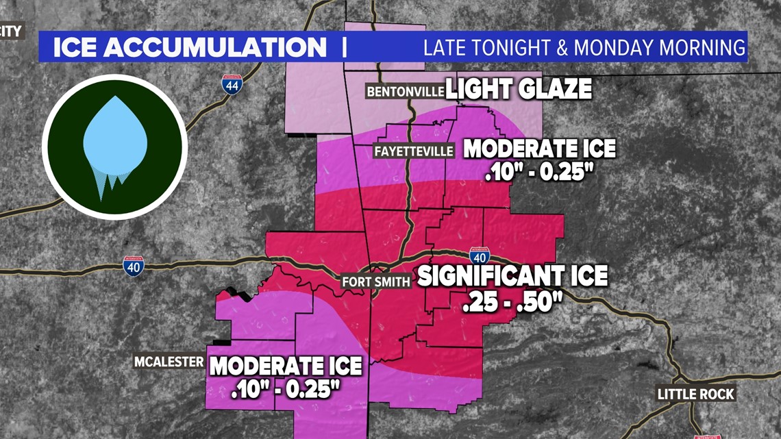
HOW MUCH ICE ARE WE GETTING?
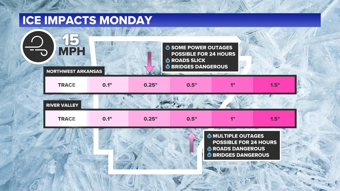
Generally, we are looking at anywhere between 0.10" to 0.50"" when it comes to accumulation. Places of higher elevation will have a greater chance to see more accumulation. Right now, we are expecting significant ice accumulation across the River Valley, with totals anywhere from .25" up to .50". Northwest Arkansas should expect moderate ice accumulation anywhere from .10" up to .25".

WHEN WILL THE FREEZING RAIN ARRIVE?
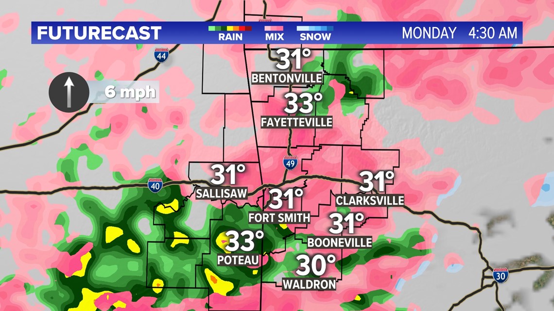
Our latest timeline has us anywhere between 11 p.m. Sunday night through 9 a.m. Monday morning. Models right now are keying in on that we will definitely get that freezing rain, but still fighting to see exactly when. We believe that the most intense freezing rain will be very early Monday morning and then transition over into regular rainfall, right around midday Monday. The good news is that we warm-up after Monday back into the 50s, so this system will not have long lasting effects when it comes to road conditions.

WHAT ARE THE IMPACTS?
Power outages should be expected, especially across the River Valley with significant ice accumulation. Ice will build on top of those power lines, causing them to hang and potentially snap. Roads will become very slick and bridges and overpasses will become dangerous. It is hard to grab any sort of traction on the roadways when it comes to ice versus snow.
Ice threats are based on three things:
- Freezing rainfall rate
There is a goldilocks approach to how heavy the freezing rainfall rate could be. If the freezing rain is very light, then it can ice pretty easily, but you may have lower accumulation amounts. If the freezing rainfall rate is high—meaning heavy rain—there may be too much water to freeze, especially if temperatures are very close to freezing. Too much water means we will stay wet with only a few surfaces getting coated with ice. If you have something in the middle, then you can get substantial ice accumulation.
- Duration (how long the icing event lasts)
This one is pretty simple. If the event lasts longer with ice, the more icing you can get.
- Winds
As the icing event takes place, and afterwards, the wind can cause even more problems. Windy conditions can easily break electrical lines and branches. Very light or calm winds can allow power lines to hold more ice without breaking. Essentially the higher the wind speed, the worse the impacts could be.

Any good news?
Ice is never good news, but at least we will warm up in the afternoon with more rainfall. That should help melt a lot of the ice. The worst impacts will be in the morning and midday hours. The faster we can stop the freezing, the better shape we will be in.
-5NEWS Weather
Watch 5NEWS on YouTube.
Download the 5NEWS app on your smartphone:
Stream 5NEWS 24/7 on the 5+ app: How to watch the 5+ app on your streaming device
To report a typo or grammatical error, please email KFSMDigitalTeam@tegna.com and detail which story you're referring to.