
LITTLE ROCK, Ark. — Preliminary data shows the large tornado that devastated part of West Little Rock could have traveled almost 30 miles in total as it toppled trees and destroyed businesses and homes.
While an official report from the National Weather Service is forthcoming, THV11 meteorologist Corallys Ortiz shows the apparent path the tornado took on Friday:
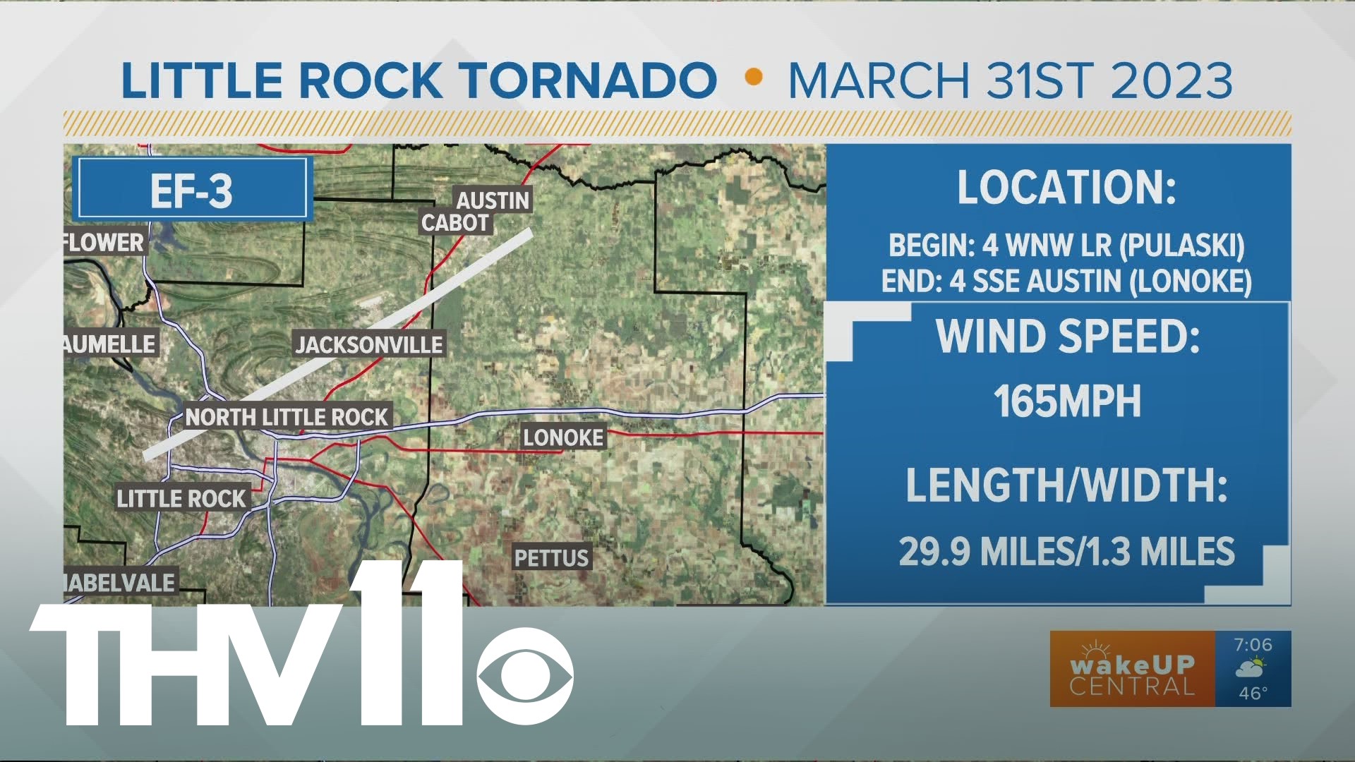
The National Weather Service confirmed damage from an EF3 tornado in Little Rock. Winds from the tornado reached up to 165 mph, according to the NWS. The tornado's path was about 29.9 miles, beginning 4 miles west-northwest of Little Rock in Pulaski County and ending in Austin, Arkansas. The storm was 1.3 miles wide.
The storm survey is expected to take several days to complete.
A radar loop shows how the storms moved through the area:
As of Sunday morning, at least five deaths were confirmed in the state. Four of those were in Wynne, Arkansas.