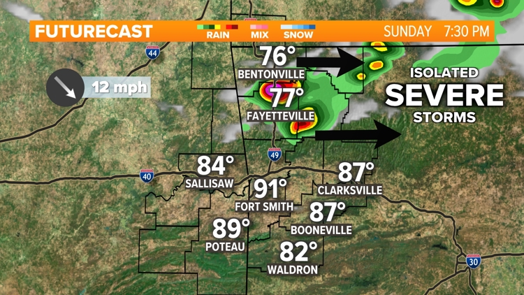
FAYETTEVILLE, Ark. — The sun is shining after an active early morning across Northwest Arkansas. Temperatures are climbing quickly across 5COUNTRY with afternoon highs pushing into the 80s and lower-90s.
Thanks to high levels of humidity, heat index values across the area will break into the mid to upper-90s today. The sunshine and humidity building this afternoon is leading to another chance for thunderstorms, with a few of those storms having a chance to be severe.
To view our live weather radar, click here.
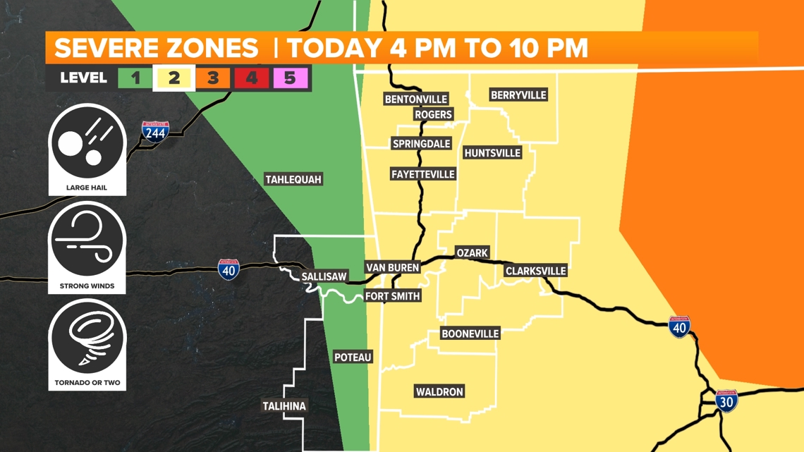
A cold front drops through Oklahoma and Arkansas this afternoon and evening. Isolated thunderstorms will be possible along the front from 4 p.m. to 10 p.m. Widespread rain and severe weather are not anticipated, though just like Saturday night it only takes one severe storm to impact a large area.
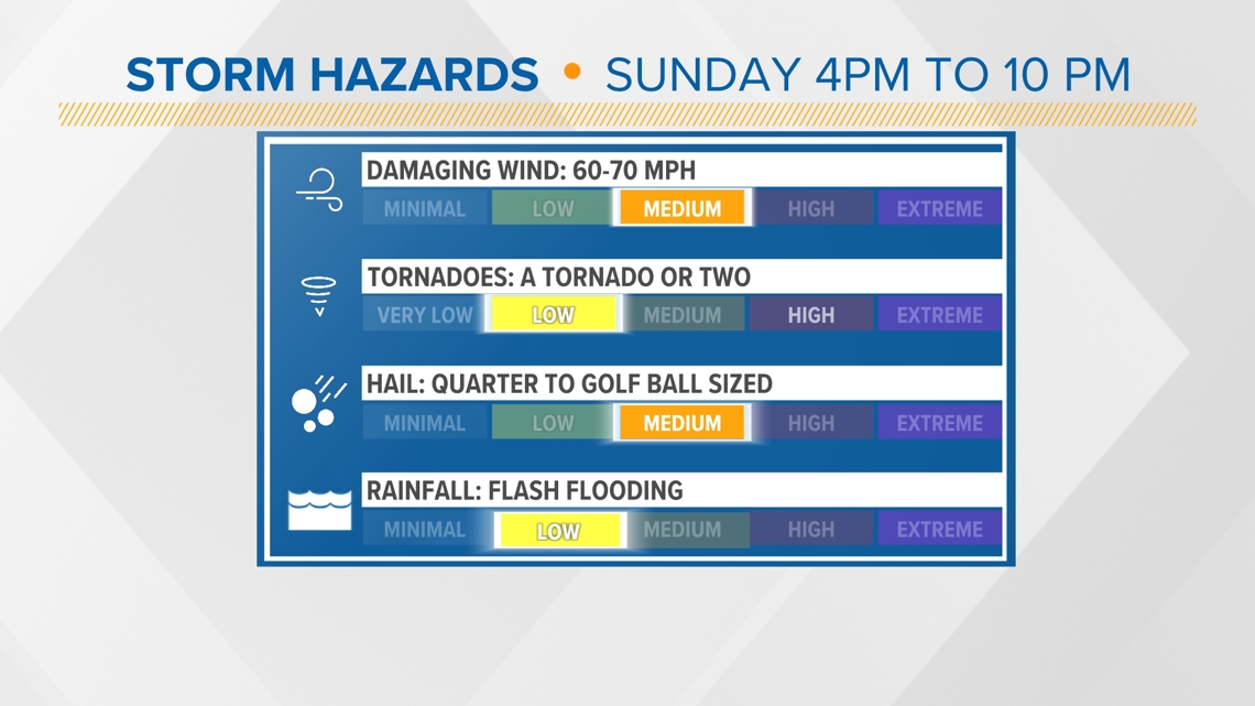
Currently, most of 5COUNTRY is under a level 2 out of 5 risk for the evening. This means not everyone will be impacted, with just isolated severe weather possible. Severe storms Sunday will be capable of producing damaging hail, damaging wind gusts, and a few tornadoes.
A Tornado Watch has been issued for Benton, Carroll, Madison, and Washington counties until 9 p.m.

Timeline
Our current timeline for severe risks starts as early as 3 pm this evening as the cold front starts to slide into Northwest Arkansas. The River Valley could see thunderstorms fire up closer to 5-6 pm. Reminder shower and storm activity is expected to be very isolated. Many areas could stay rain and storm-free.
Placement
The front will stretch across all of 5COUNTRY before clearing to our southeast. The best chance for storms seems to be in Northwest Arkansas and the eastern half of the River Valley. However, spotty showers could fire up anywhere along the front.
Impacts
The top risk associated with these isolated storms is large hail. A few damaging wind gusts, tornadoes, and flash flooding is possible with any strong storm cell. The unstable atmosphere today could produce quarter to golf ball size hail and 60 to 70 mph wind gusts. It is only on the backside of the front that the weather will start to calm as cooler, dry air takes over.


- Meteorologist Bella Grace
Watch 5NEWS on YouTube.
Download the 5NEWS app on your smartphone:
Stream 5NEWS 24/7 on the 5+ app: How to watch the 5+ app on your streaming device
To report a typo or grammatical error, please email KFSMDigitalTeam@tegna.com and detail which story you're referring to.