
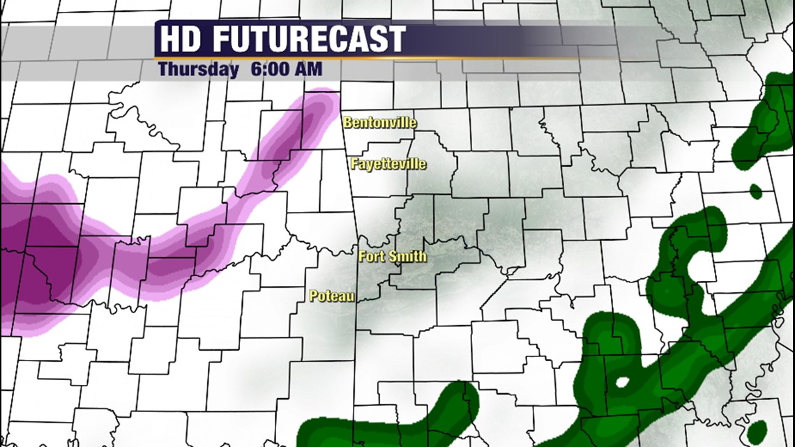
6AM Thursday: Precipitation will begin moving into the area with temperatures continuing to fall. At this point, most roads should be free and clear of any problems. There could, however, be some slick bridges and overpasses if anything manages to develop ahead of the main area.

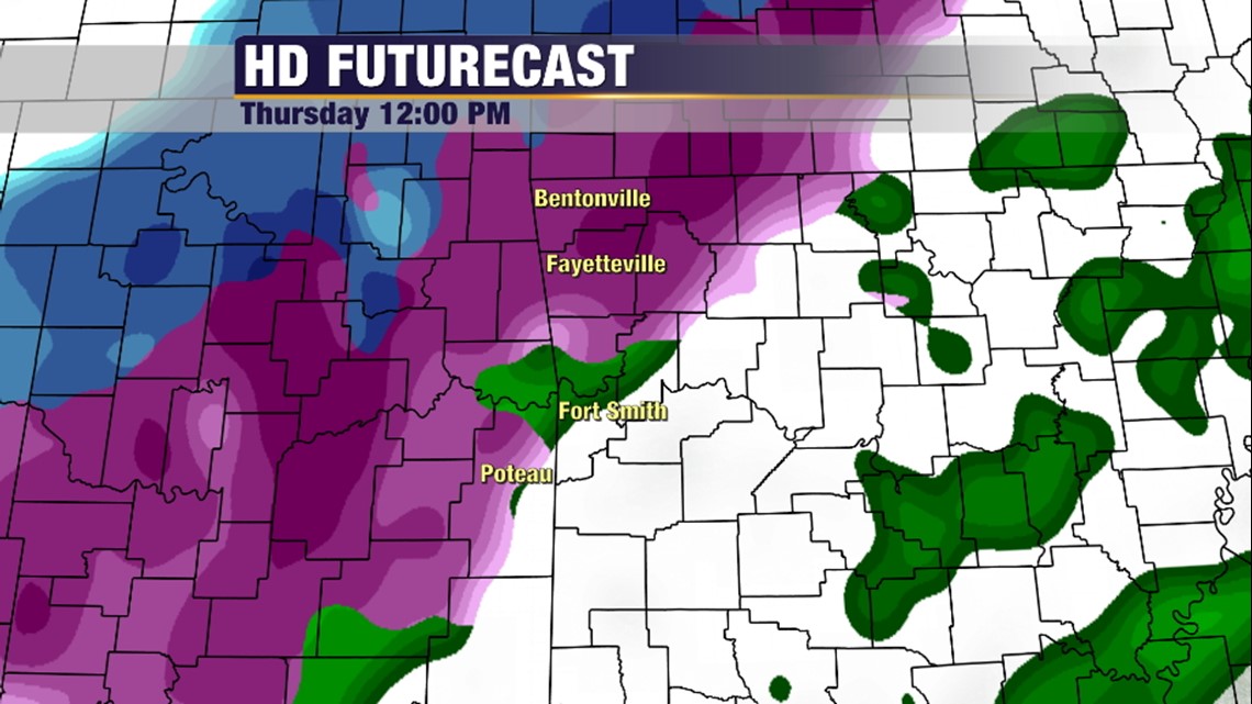
Noon Thursday: Widespread freezing rain and sleet will be occurring in Northwest Arkansas with a cold rain in the Fort Smith area mixing with sleet at times. It’s possible Sallisaw may see freezing rain at this point and all elevations over 800ft such as Mountainburg, Nicut, etc will see freezing rain and sleet. Traffic problems will begin to increase. Expected temperatures for major metros are around 27 in Bentonville, Fayetteville, Rogers, & Springdale. Closer to 33 in Fort Smith and Van Buren.

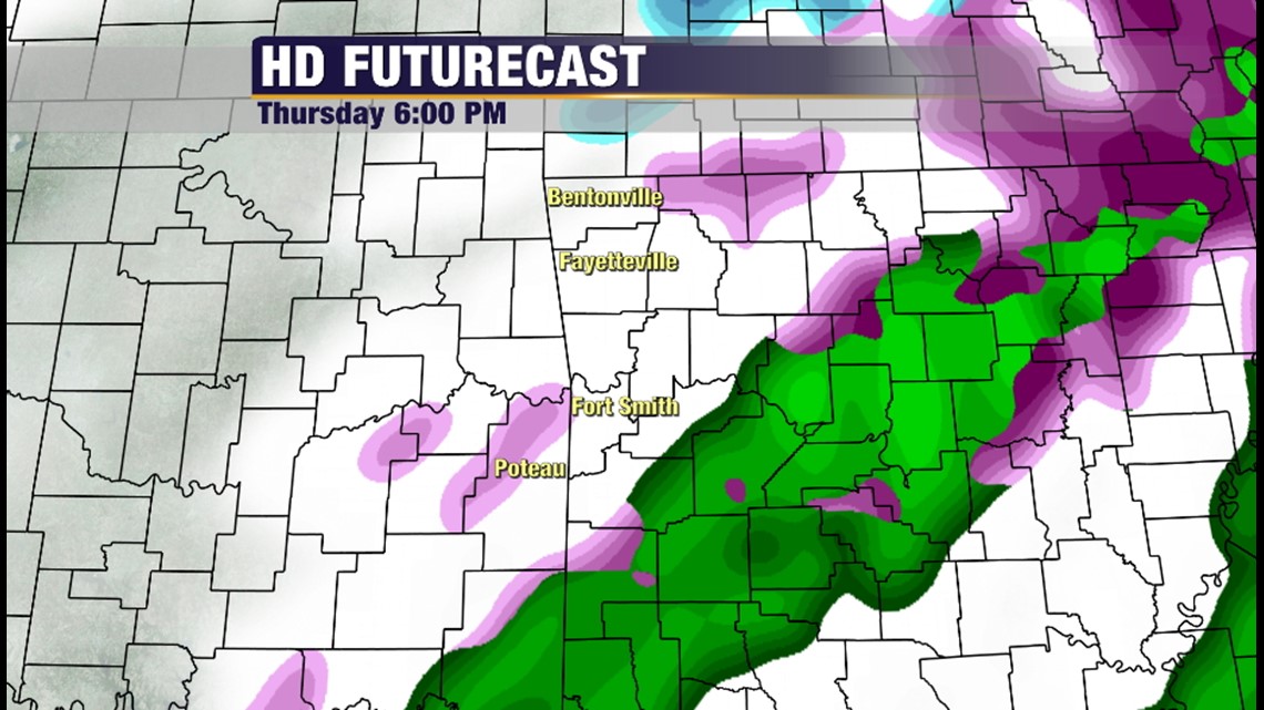
6PM Thursday: Lingering areas of sleet and freezing rain will be possible but the main wave of precipitation will have passed.

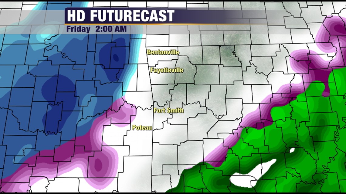
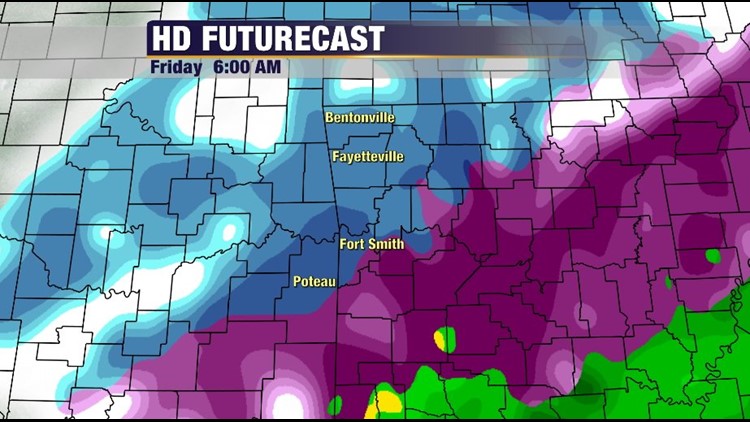
2AM Friday: Here comes round two!!! Mostly snow and sleet area headed for the area after midnight. Temperatures at this point will be around 16 in NWA and around 24 in Fort Smith area. Anything that falls will readily accumulate.


6AM Friday: Widespread snow, freezing rain, and sleet will be occurring across much of the area. Depending on wind speeds, there could be some power outages if ice is able to build up on blowing branches. Totals of the 4 different types will vary from point to point, in some cases a large difference within just a few miles. In general expect a coating of ice on the bottom, some sleet on top of that, and perhaps an inch or more of snow on top of that. Widespread road problems and cancellations are anticipated if this scenario plays out. Confidence is high that roads will be affected.
A few more updates tomorrow on totals. We should have a good handle on exactly how deep the cold air mass is once it’s sampled by the 6am balloon launches Wednesday morning across the country. One more note, another round of sleet and snow is possible on Sunday with similar travel hazards into Monday.
-Garrett