Severe storms that developed in Oklahoma and Kansas late on Wednesday will weaken as they move close to Arkansas into the early morning hours on Thursday. There is a chance for a few storms early on Thursday with a minimal hail risk.
A line of strong storms will develop in northeast Oklahoma around lunch time. The line should move into Northwest Arkansas between 1 p.m. and 4 p.m. and into Fort Smith sometime between 3 p.m. and 8 p.m. All storms will be long gone by 10 p.m. Thursday.
A quick look at the recent data:

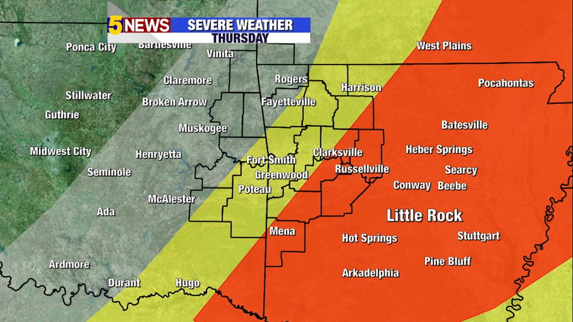
Severe storms will ramp up again on Thursday with a squall line of intense storms essentially developing right on top of our area. Wind is the primary risk. There is a lower tornado risk, but it is present.


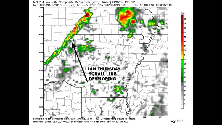
Data now showing the squall line developing right on the cold front around 11 a.m.

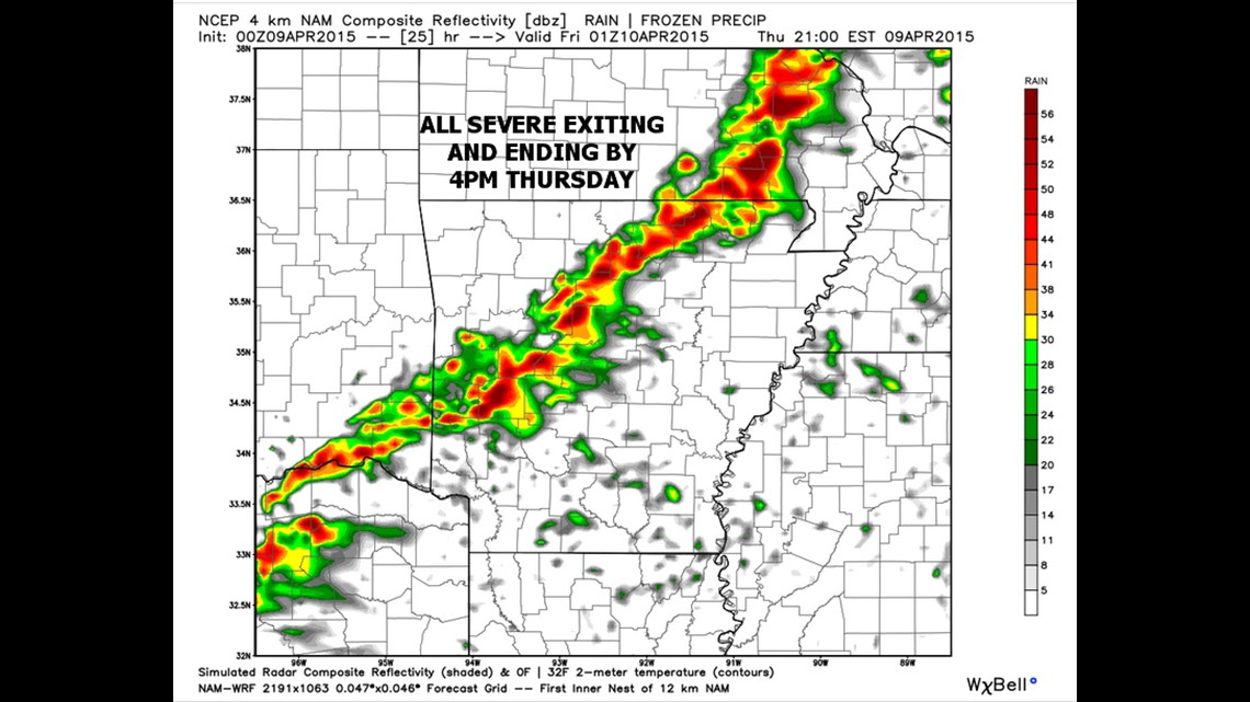
The NAM4k model is particularly fast with it’s movement and evolution (maybe too fast?) with storms quickly exiting the region to the east.

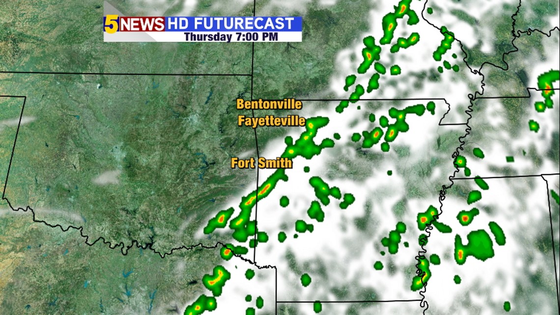
It’s worth noting that Futurecast is slower with storms exiting by around 7 p.m. Somewhere in the that three hour window is probably most accurate.
-Garrett