FAYETTEVILLE, Arkansas — Strong storms are forecast to rapidly develop Wednesday afternoon and evening, beginning in Northwest Arkansas and then possibly making its way toward the River Valley.
An abundance of strong storm fuel is in place, creating a high possibility of thunderstorms producing tornadoes, very large hail, and damaging straight-line winds between 60 and 80 mph.
The National Weather Service issued a tornado watch for all of 5COUNTRY until 10 p.m. this evening. A tornado watch means conditions will be favorable for the development of tornadoes. If a tornado warning is issued, it means danger is imminent and you should take shelter immediately.
Alerts in effect
- Flood Warning for Franklin County, Johnson County, and Logan County until tomorrow early afternoon
The river is expected to rise to the flood stage, at 357 feet. At the flood stage, flooding affects agricultural use lands along the river downstream of the lock and dam in Franklin County. Gas fields are also subject to flooding downstream. Equipment and livestock should be moved to higher ground. North 5th Street in Logan County near the Six Mile Levee begins to flood and may cut off access to a nearby residence.
- Tornado Watch in effect until 10 p.m. includes seven counties
Northwest Arkansas
- Benton
- Carroll
- Madison
- Washington
River Valley
- Crawford
- Franklin
- Sebastian
- Johnson
- Logan
- Scott
Eastern Oklahoma
- Delware
- Adair
- Sequoyah
- Le Flore
Tap HERE to check our interactive weather radar.

What to expect
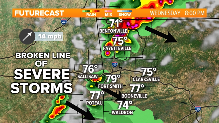
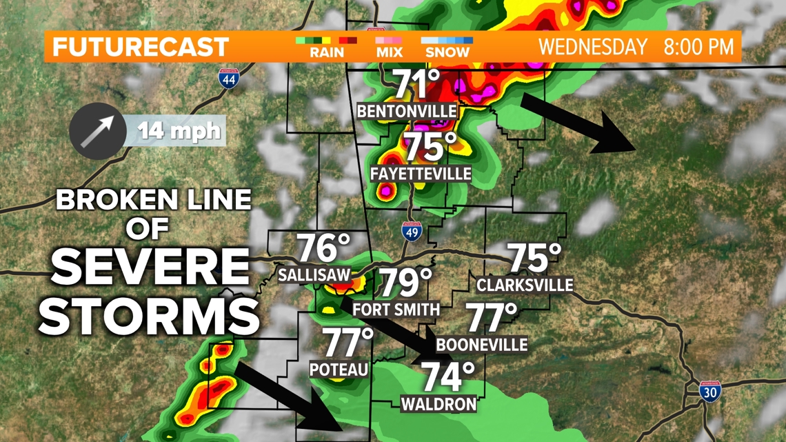
Initially, isolated supercells will develop ahead of a cold front. It's in this phase where very large hail and tornadoes will be most possible. Given the excessive amount of "storm fuel", supercell updrafts will support the development of 2-4 inches of hail.
As the storms evolve with time, they should merge into a group of storms arranged in a line, called a squall line. While tornadoes can and do spin up from within a squall line, the more likely hazard will be damaging straight-line winds 60-80 mph. With winds that fast, any patio furniture should be brought in that could blow away or cause damage.
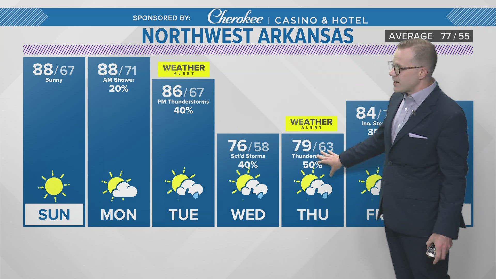
Timeline of thunderstorms
Beginning mainly after 4 p.m., showers and thunderstorms will hit Northwest Arkansas and the River Valley, with the most severe weather likely between 5 p.m. and 9 p.m.
By 10 p.m., the line of storms should be moving out of the area into parts of Central Arkansas.
Behind this system, high pressure will build in, resulting in a quiet stretch of weather into the weekend. Temperatures and humidity values will be notably lower for the rest of this week.


Send weather tips and photos straight to the 5NEWS newsroom:
- Text (479) 785-5000
- Email news@kfsm.com
- Upload a video on the 5NEWS mobile app