
ARKANSAS, USA — While Arkansas saw warm and windy weather through the first half of the week, severe thunderstorms are expected across the Northwest region and into the River Valley by Thursday afternoon. Here's what we know so far, and what you need to know ahead of the threat.
Hail, strong winds, and even an isolated tornado are possible based on the latest data and state of the atmosphere over 5COUNTRY. The 5NEWS Weather Team is categorizing Thursday, March 14, as a Red Weather Alert Day, which signifies a very legitimate severe weather threat in our area, and to communicate to viewers the importance of knowing when the threat is possible and when to be cautious.
When is severe weather expected?
Some spotty showers can't be ruled out for Thursday morning, however, it won't be until early to mid afternoon on Thursday for 5COUNTRY to start to see the effects of severe weather.
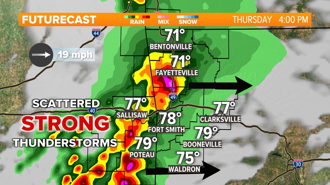
The potential for severe thunderstorm chances increase on Thursday by around 1 p.m. to 4 p.m.
By then, eastern Oklahoma and western Arkansas can expect isolated thunderstorms to start popping, with enough instability to create a few strong to severe storms—an isolated tornado can't be ruled out.
The main threat during this time is for large to destructive hail to produce sporadic damage and to make it dangerous to be caught outside. Strong wind gusts along with the ingredients for an isolated tornado are secondary threats.
Not every shower or thunderstorm will be severe, but the 5NEWS Weather Team does expect at least a few severe storms to mix in around eastern Oklahoma and western Arkansas.
Showers will begin to taper off Thursday evening by midnight, potentially in the early hours of Friday. The potential dangers of storms are also expected to be over by that time as the atmosphere becomes more stable.
Cooler winds from the north will push through the area on Friday, cooling 5COUNTRY once again.
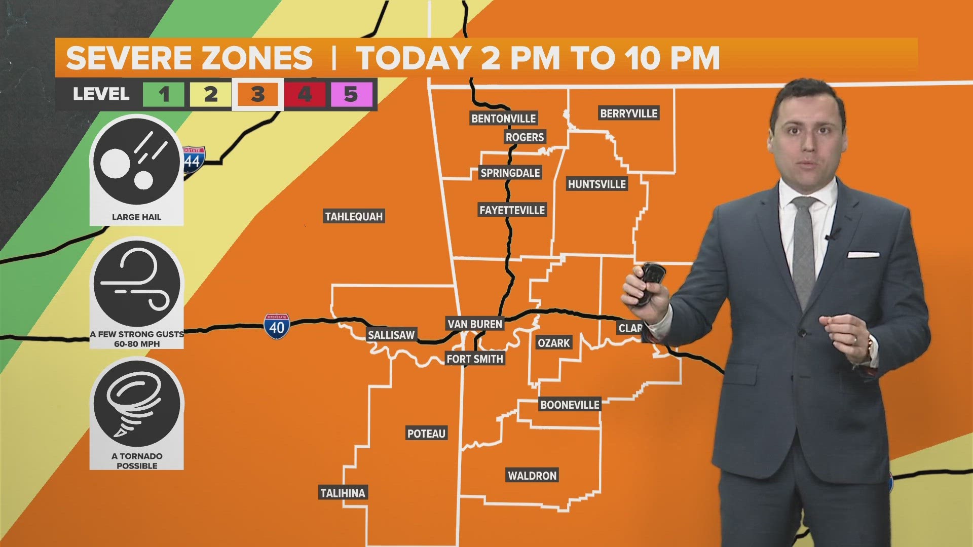
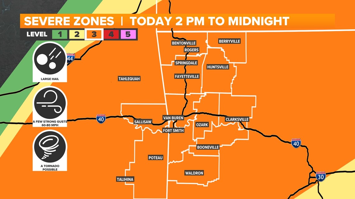
Overall, the timing of severe weather is expected between 2 p.m. and midnight on Thursday.
What type of severe weather is expected?
Details:
- A few winds gusting 60 to 80 mph
- Pockets of hail quarter to tennis ball size
- Limited tornado threat | A tornado or two possible
- Rain timing: Spotty shower 7 a.m. to noon | Scattered to widespread storms 2 p.m. to midnight
- Severe timing: 2 p.m. to midnight
- Isolated storms to start the afternoon
- More thunderstorm clusters by the evening
Weather models for Thursday
Here are some weather models visualizing the severe weather outlook across eastern Oklahoma and western Arkansas.
5COUNTRY on Thursday afternoon is categorized as a level 3 severe zone out of five.

Across Northwest Arkansas and the River Valley, hail is expected. During the timeframe of severe weather, all of 5COUNTRY has the potential to see quarter to tennis ball-sized hail.


Watch 5NEWS on YouTube.
Download the 5NEWS app on your smartphone:
Stream 5NEWS 24/7 on the 5+ app: How to watch the 5+ app on your streaming device
To report a typo or grammatical error, please email KFSMDigitalTeam@tegna.com and detail which story you're referring to.