FAYETTEVILLE, Ark. — Severe weather is developing throughout Oklahoma and into Arkansas Tuesday morning.
Multiple tornadoes were reported in central Oklahoma where a rare Level 5 risk is in place, which is the most extreme level.
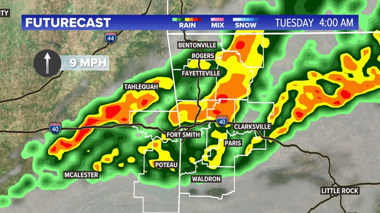
These individual supercells are expected to merge into a line of storms before moving into 5COUNTRY. At this point, the most possible threat will be damaging winds between 60 and 80 mph, with a few embedded tornadoes.
Benton, Carroll, Crawford, Franklin, Johnson, Logan, Madison, Scott, Sebastian, Washington, Adair, LeFlore, and Sequoyah Counties are under a tornado watch until 5 a.m.
Given the amount of rain we've seen the last several days, it may not take much wind to knock over some trees.
Northwest Arkansas and parts of the River Valley are under a Level 3 out of 5 risk area, while Franklin, Johnson, Logan, and parts of Sebastian counties are under a Level 2 risk.
Watch live:
TIMELINE
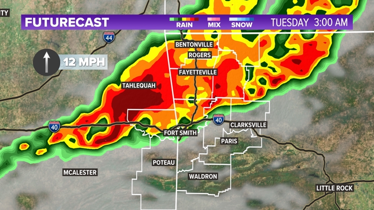
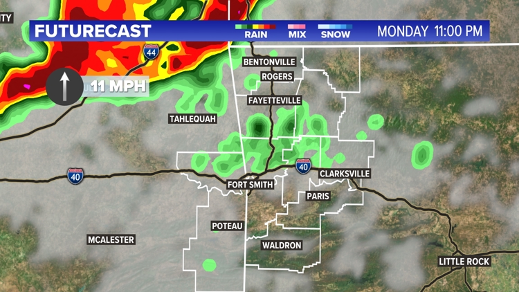
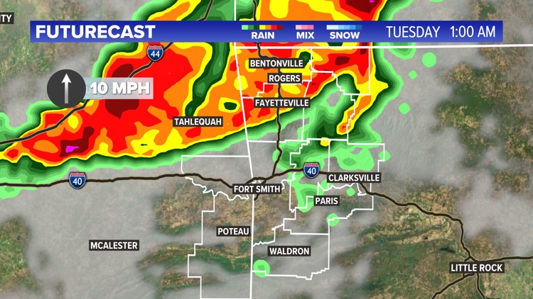
The leading edge of the storms is expected to move into Northwest Arkansas around or shortly after midnight, and eventually moving into the River Valley shortly after. The leading edge of the line will be where the highest winds are expected and where spin-up tornadoes may develop.
We have a high degree of confidence that the line of storms will impact 5COUNTRY, but it's also possible a discreet cell may develop out ahead of the main line. While our confidence is lower in this happening, if it does, the storm would be capable of large hail and quickly become tornadic. We're tracking this very closely tonight.
Given the late nature in which these storms will track through the area, we recommend having multiple ways to receive weather warnings should they be issued. The free 5NEWS app is a great resource as well as NOAA weather radios.
Tap here to track storms on our interactive doppler radar.


Storm Timeline


TUESDAY | LOW RAIN CHANCE
Storms should weaken below severe limits by early Tuesday morning, eventually to just scattered rain by sunrise. Most of the day will be dry, though warm and breezy with highs in the 80s.
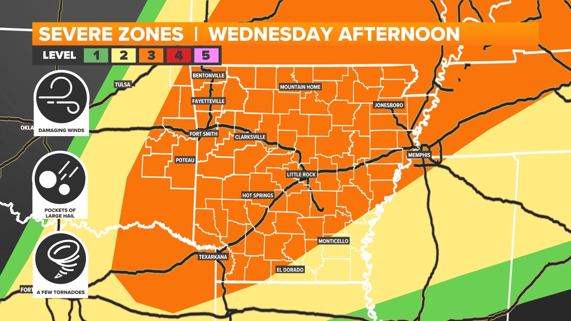
WEDNESDAY | SEVERE WEATHER CHANCES RETURN
Wednesday will begin warm and muggy. Strong southerly flow will keep temperatures well above normal while also ushering in abundant moisture from the Gulf of Mexico. Non-thunderstorm wind gusts out of the south will range from 20 to 30 mph before storms arrive. The abundance of moisture, spin in the atmosphere, and an approaching strong cold front will set the stage for a classic spring-time battle of the air masses.
These weather patterns often result in severe weather across 5COUNTRY. It's still too early for specifics, but current data suggests all types of severe weather (tornadoes, large hail, and damaging wind gusts) will be possible. Currently, we believe these storms will develop over us Wednesday afternoon into the early evening hours. Latest trends are pushing the best chances for thunderstorms more into central and eastern Arkansas.
The 5NEWS Weather Team will continue tracking these evolving disturbances and provide frequent updates here on online as well as on air.


CALM WEATHER ON THE HORIZON
After what will have been a very active two-week period, calmer weather is on the horizon. Looking to the end of the workweek, we find drier weather. As of right now, we have some low-end rain chances for the weekend. We're still several days away, so continue to check back for updates.