

ARKANSAS, USA — Snow in Arkansas can be a nightmare or a playground, depending on who you ask! On the fun side, if you want to have a good snowball fight or to make a snowman, you need wet snow so it can pack and hold its shape. Dry snow is powdery and does not pack well. Every snowstorm is different, so how to meteorologists forecast whether a snow will be wet or dry?
WATER IN SNOW
Snow is just water in ice crystal form. The more water a snowflake has, the stickier it is and will more easily compact and form whatever shape you want to make. We can measure how much water there is inside a snowflake by melting it. But we can't measure every snowflake that falls in a snowstorm, so we use snow ratios to figure out how wet or dry a snow is.
SNOW RATIOS

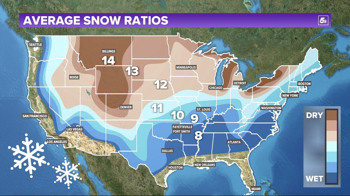
This map shows the average snow ratios across the USA, or how many inches of snow you get with one inch of snow. Wet snow usually has a ratio of 10 or less, while dry snow usually has a ratio of 11 or more.

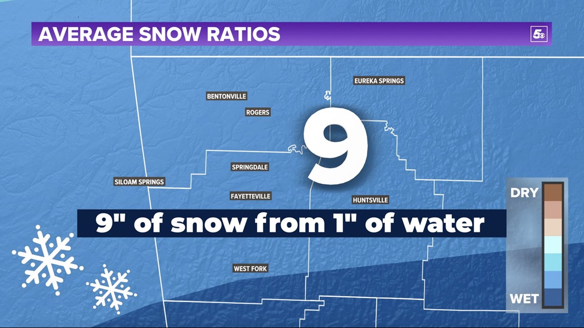
In Northwest Arkansas, the average snow ratio is 9, which means you get 9 inches of snow from 1 inch of water.

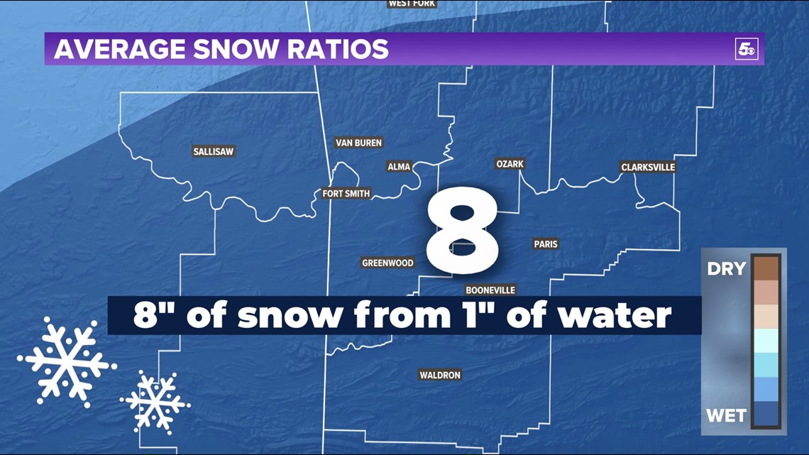
In the River Valley, the average snow ratio is 8, which means you get 8 inches of snow from 1 inch of water. The state of Arkansas is entirely below the 10 ratio threshold so our snows on average are wet and good snowball making snows! The south usually gets the wettest snows while the far north and great lakes tend to get dry snows. The midwest tends to get something in between. But these are averages. Sometimes our snows can be even wetter and stickier than that, and sometimes they can be really dry. Here's how we forecast the difference.
FORECASTING THE DIFFERENCE

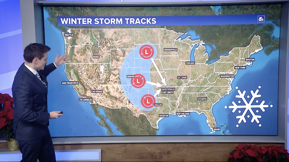
Colder temperatures bring drier snow and warmer temperatures bring wetter snow. The temperature is determined by the direction our storm systems track. When we get storms from the south, snows are warmer and wet because they are using heat from the gulf of mexico. Storms coming in from the west are somewhere in between. The snow usually sticks but it may take some extra packing for a good snowball . Storms coming in from the northwest are usually very dry because they are coming from the cold, dry plains and canada. These are powdery, dusty snows.
Once we know where a snowstorm will form and track, we generally have a good idea on how wet or dry a snow may be. Ratios then help us figure out how much snow will fall for us to enjoy, or hate!
-5NEWS Weather Team
MORE FROM ARCTIC ARKANSAS
5NEWS official winter weather outlook 2021-2022