
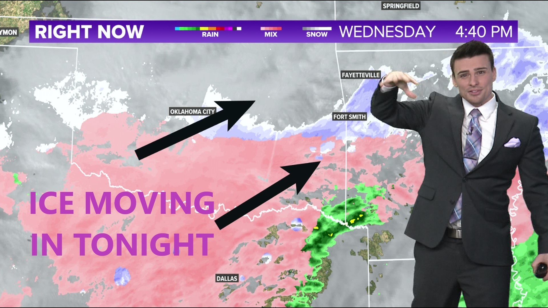
ARKANSAS, USA — Just one more round to go of winter weather for this week, but this one may pack the biggest punch of ice to parts of southern and central Arkansas. How much ice will fall where you live? (scroll down for power outages forecast)
Tap HERE for our interactive radar to track the freezing rain.
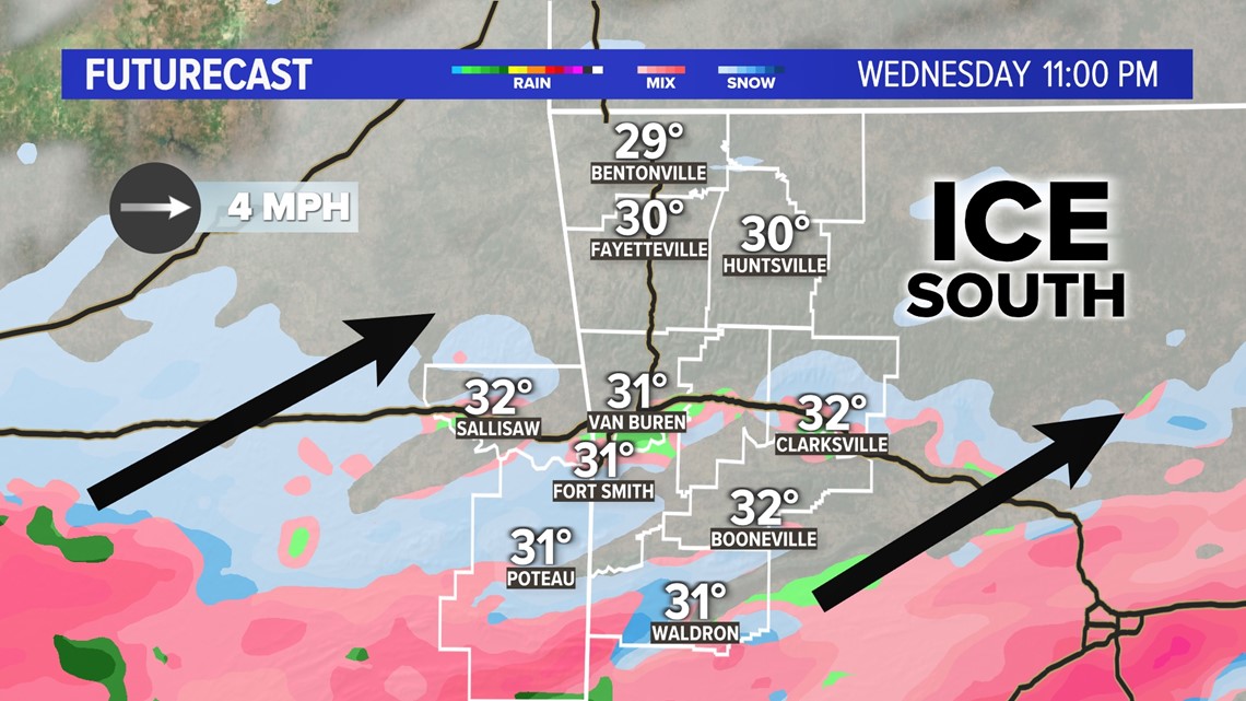
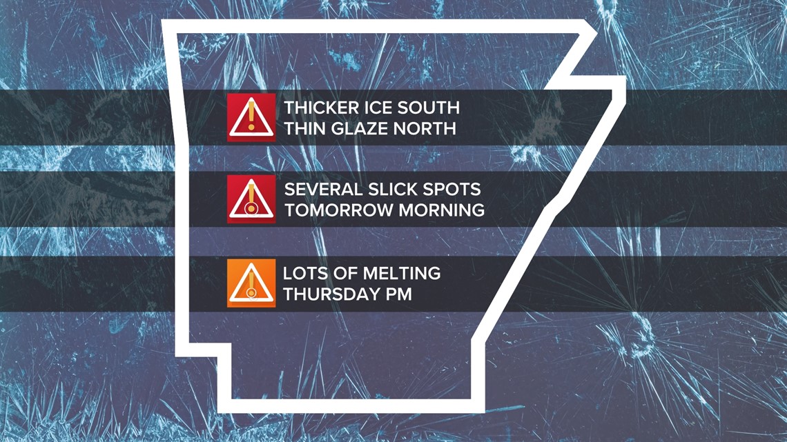
Tonight (Feb 1st to the 2nd), expect a wave of freezing rain to move in from Texas and southern Oklahoma. Icing threats will become widespread south of the Boston Mountains. A glaze of ice is expected south of the Arkansas River.
Tap HERE for closings.
GOOD NEWS FIRST
We have some dry air moving into northern Arkansas, which is severely limited icing risks across NWA and north-central Arkansas. Up to a thin glaze is expected from Bentonville to Fayetteville. Toward the south, there may be some warmer air that allows some rain drops to mix in with the ice. However, significant icing is still expected in spots.
HOW MUCH ICE?
Most of Arkansas may get at least a thin glaze. The darker purple colors below highlight areas where thicker ice is possible.

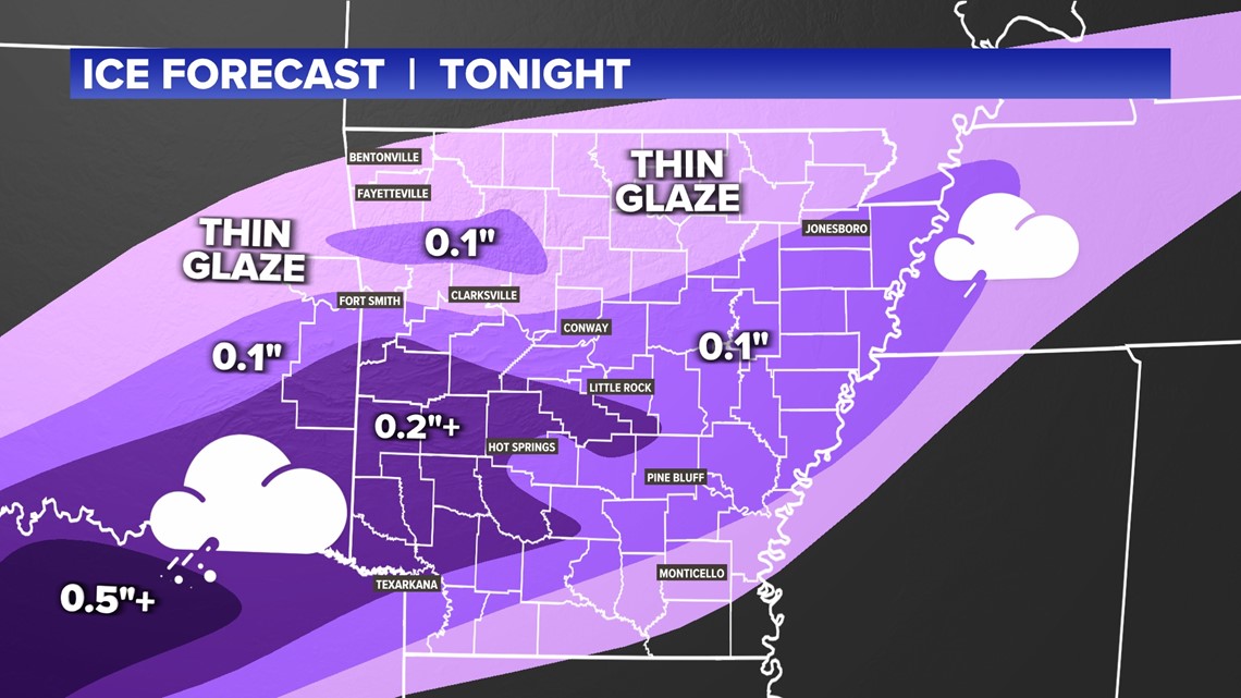
- NW Arkansas: Thin glaze
- Boston Mountains: Up to 0.1"
- Near Arkansas River: Thin glaze to 0.05"
- Southern River Valley: 0.1" to 0.2"
- Ouachitas: 0.2"+
- Central Arkansas: 0.1" to 0.2"
- Eastern Arkansas: 0.05" to 0.1"
Some spots locally could pick up a little bit more.
We'll be tracking the ice moving in from the southwest. Once temperatures are closer to 28 degrees (or colder), ice will form more easily on surfaces.

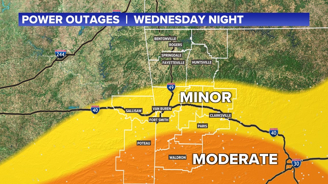
POWER OUTAGE FORECAST
For western Arkansas, there may be some minor power outages throughout the River Valley with more numerous power outages to the south, closer to the Ouachitas. River Valley power outages near Fort Smith would likely be very temporary. Some outages deep in the Oauchitas may take longer to restore, if they take place.

ROAD IMPACTS
Ice will likely be thicker in parts of the River Valley, but expect slick spots area-wide. A lot of melting took place on Wednesday, but even more will occur on Thursday as highs reach the 40s later in the day with some sunshine toward the west.

-5NEWS Weather