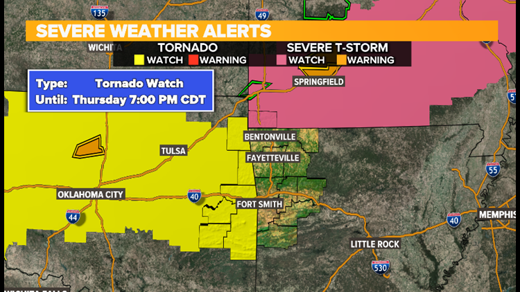
The National Weather Service has issued a Tornado Watch for eastern Oklahoma (shaded in yellow), which includes Le Flore and Sequoyah county until 7:00pm.

A Tornado Watch could be issued later on today for NW Arkansas and the River Valley, so need to keep an eye on it.

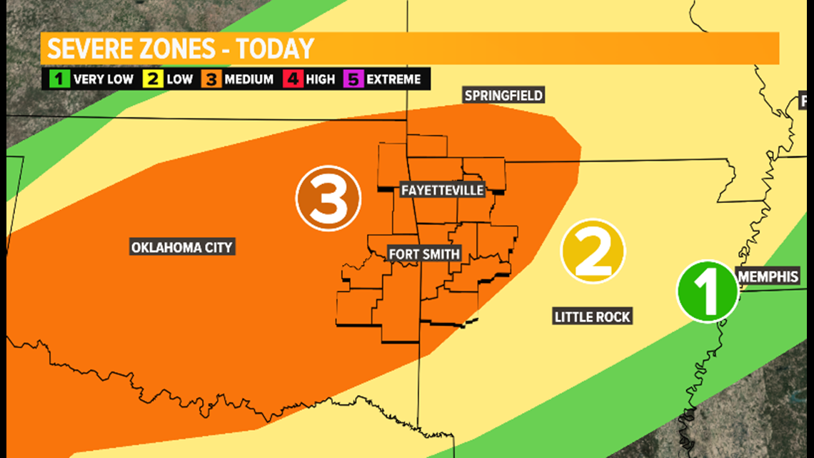
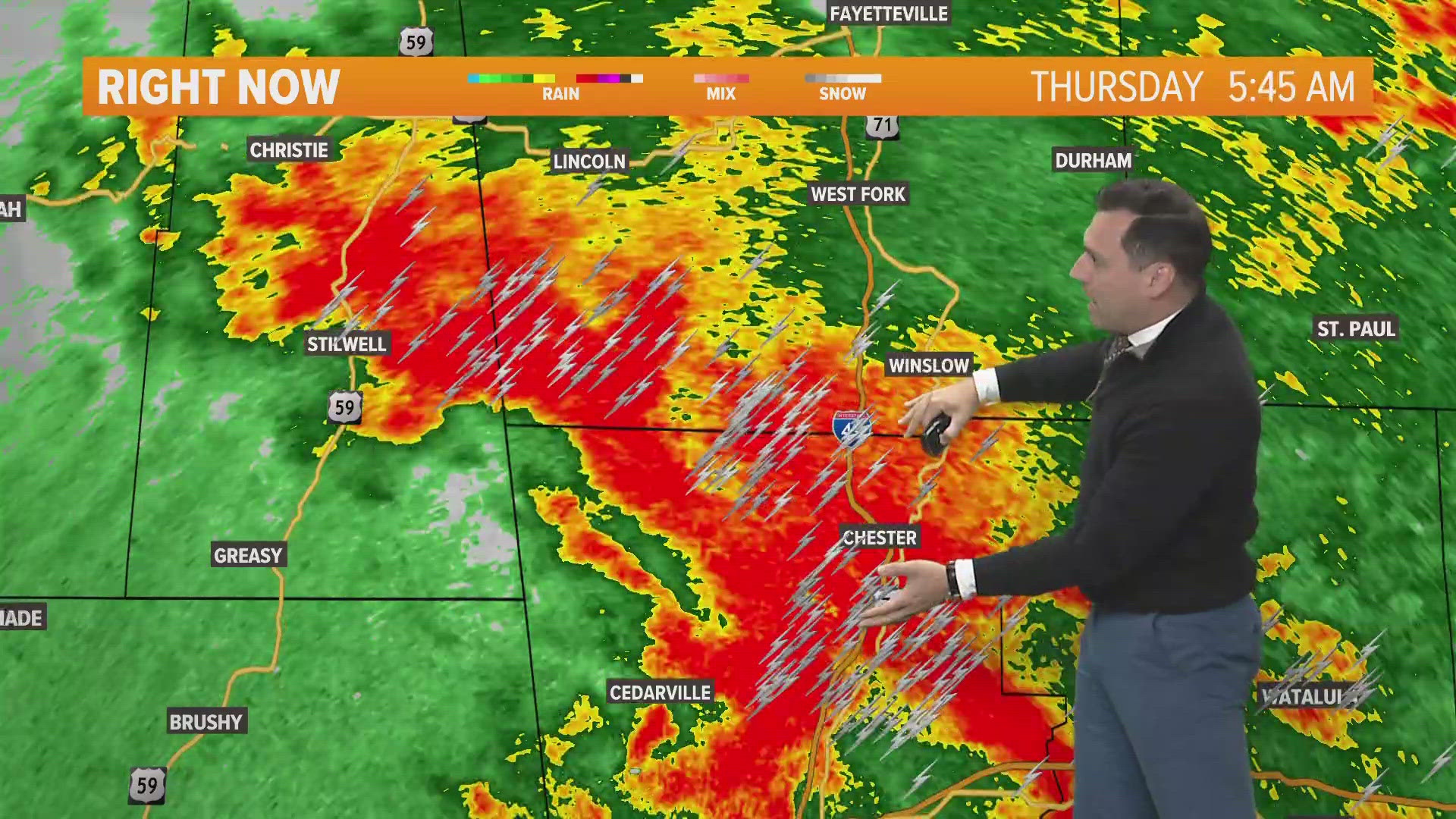
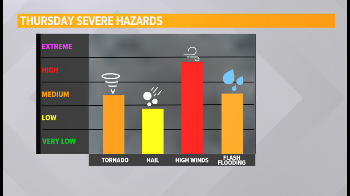
The SPC has all of the River Valley and NW Arkansas now under a Level 3 out of 5 risk for severe weather. All severe modes will be possible: quarter size hail, damaging winds, and a few isolated tornadoes.

A Flash Flood Watch is in effect for the counties shaded in green, mainly north of I-40, until 1:00am tonight.

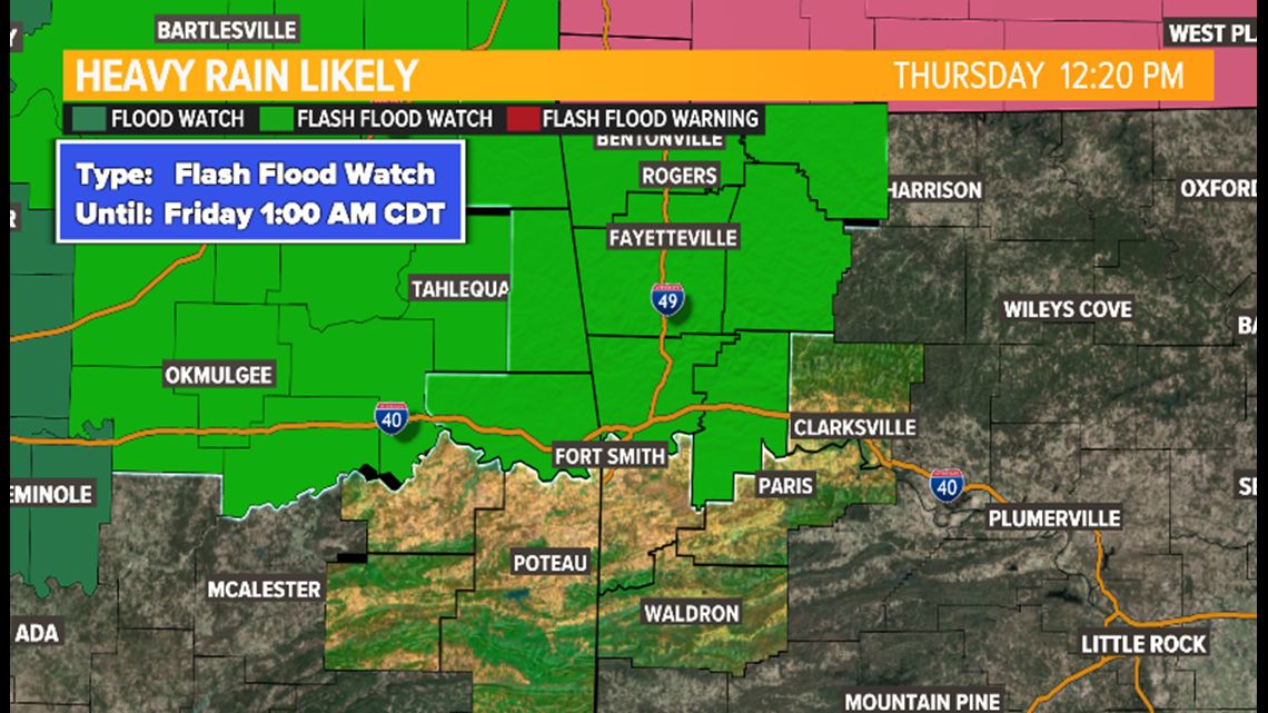
Models are showing rain totals ranging from 1 to 3 inches with isolated higher amounts possible.
Stay weather aware today!