
FAYETTEVILLE, Ark. — A strong storm system is scheduled to sweep through our region Monday, Jan. 2. There is a chance for some severe storms, especially around the I-40 corridor south into the Quachitas. The window for storms is a large one lasting from 1 p.m. to as late as midnight.
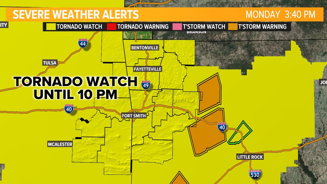
A Tornado Watch has been issued for Johnson, Logan, and Scott counties until 9 p.m.
The rest of western Arkansas and now eastern Oklahoma has been added to the Tornado Watch until 10 p.m.
More thunderstorms are developing across Oklahoma and will continue to move into Arkansas throughout the evening.

Click here for our interactive weather radar.
More storms will develop across the eastern half of Oklahoma and this afternoon before sweeping east across Arkansas Monday evening. Thunderstorm activity will mostly be off to our east by 1 a.m.

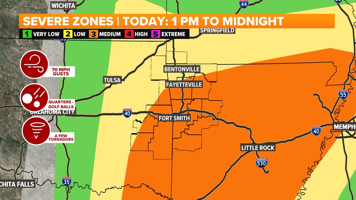
Make sure you have ways to receive weather alerts and stay weather aware throughout the day. Besides heavy downpours and frequent lightning, Monday's storms will be capable of producing damaging hail, wind gusts, and a few tornadoes. Rainfall totals will likely range from a .50 inch to 1.50 inches, with some locally higher amounts.
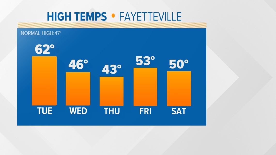
The storm system will clear out overnight, with an overall drier and cooler pattern through the rest of the workweek.
TODAY
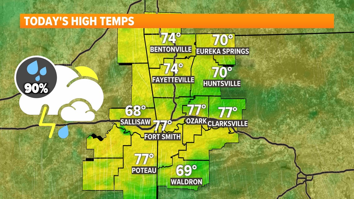
- Highs in the 70s
- Scattered PM thunderstorms (90%) likely
- A few strong/severe storms are expected
- Southerly winds 10 to 20 MPH
TONIGHT
- Lows in the 50s
- Lingering isolated (20%) shower
- Southwesterly winds 10 to 20 MPH

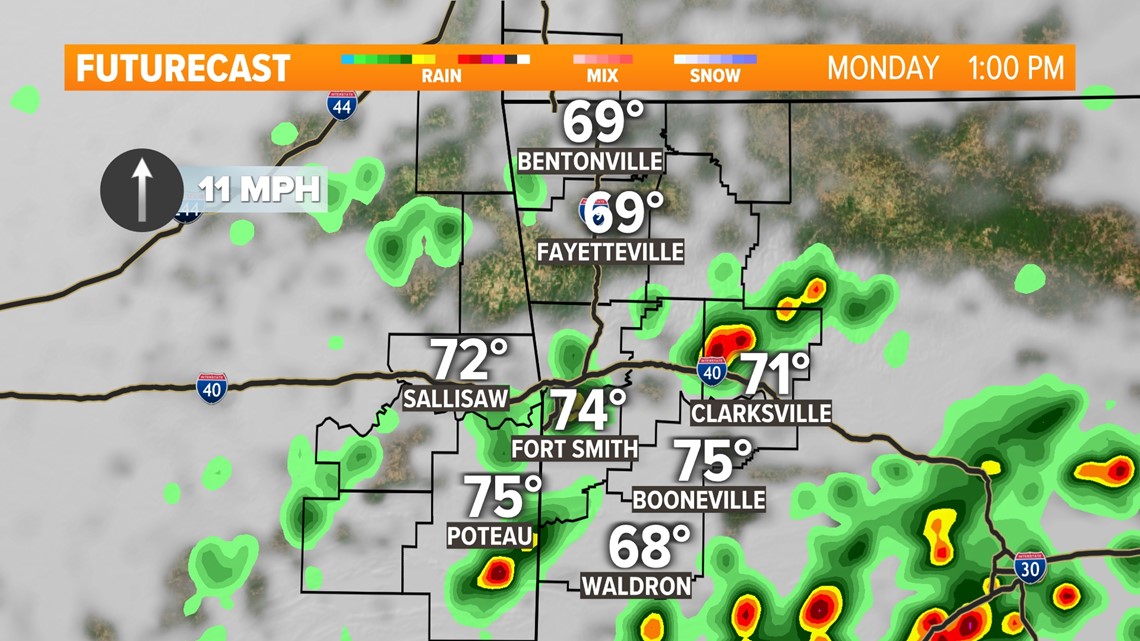
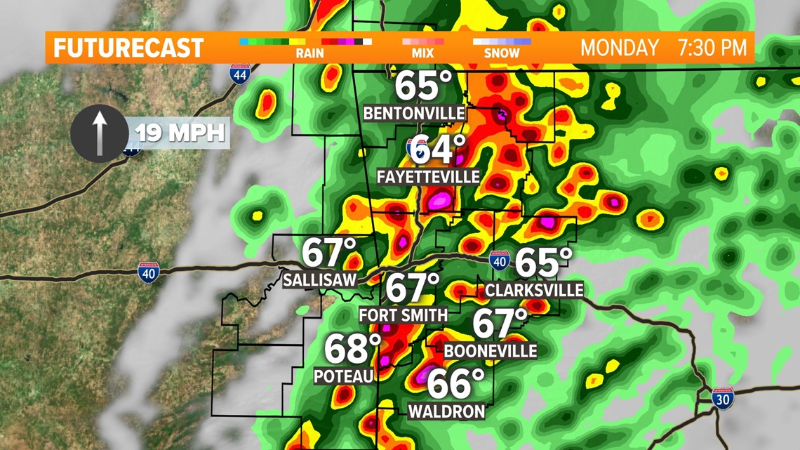
STORMS LIKELY MONDAY AFTERNOON & EVENING
Storms during the second half of the day on Monday are looking increasingly likely. Some will likely be severe, especially near and south of I-40. Rain will likely be widespread but flash flooding won't be much of a concern. Strong wind gusts, damaging hail, and a few tornadoes are potential threats.
MONDAY STORM TIMING
A few spotty light showers are possible during the AM hours, mainly in the River Valley. Rain and thunderstorm chances are highest for the PM hours. We're watching two potential waves of thunderstorm activity.
The first wave is for isolated thunderstorms around the River Valley in the early afternoon hours. The aforementioned storms will shift northeast into parts of NWA by late afternoon.
The second wave will push east out of Oklahoma as we get past sunset. Both waves will have the potential to be severe. Storms will exit east of our areas by midnight.


NEW YEAR, NEW PATTERN
The forecast will revert to more normal conditions following the storm chances on Monday. A cold front will arrive with these storms and winds will be out of the northwest following its passage. By the middle of the week, temperatures should return to more normal highs for January.


Where to find 5NEWS meteorologists on social media:
Zac Scott: Facebook
Download the 5NEWS app on your smartphone:
Stream 5NEWS 24/7 on the 5+ app: How to watch the 5+ app on your streaming device