
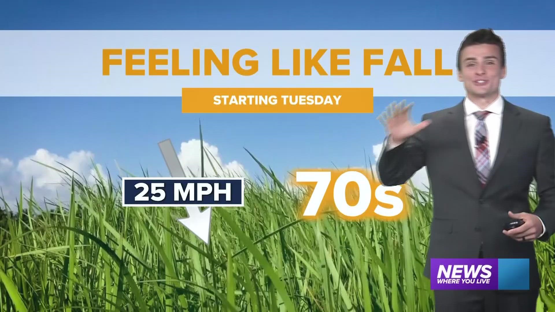
ARKANSAS, USA — A long-lasting break from the heat is in the forecast for Arkansas and Oklahoma. Instead of mid 90s for highs, we're expecting 70s in the afternoon for at least a couple days! A few showers and storms are possible Monday night with cooler air rushing in by Tuesday.
Tap HERE to track the rain with our live interactive radar.
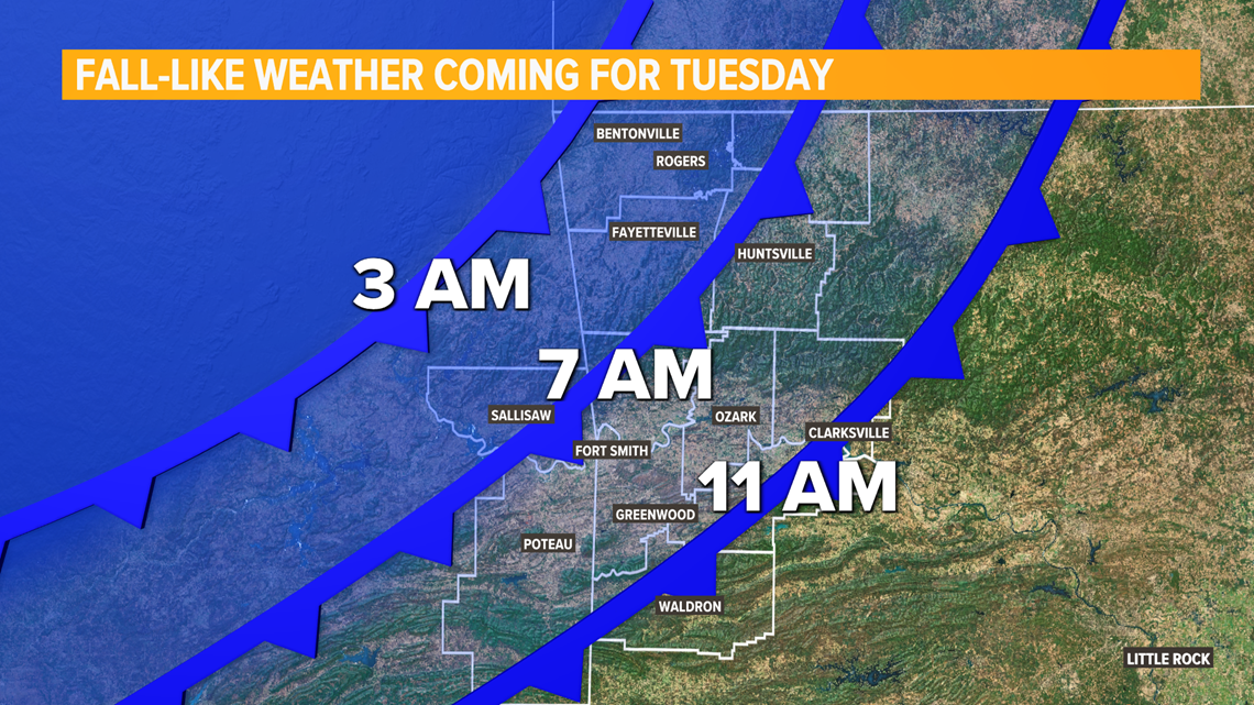
TIMING THE COLD FRONT
The boundary will arrive in two waves.
1) Expect scattered showers and storms (rainfall totals may be quite low, especially west of US-71).
2.) The cooler air will arrive after the rainfall (timing listed below).
Northwest Arkansas: 3-6 AM
Central River Valley (near Fort Smith): 6-9 AM
Eastern River Valley (near Clarksville & Paris): 9 AM - 12 PM

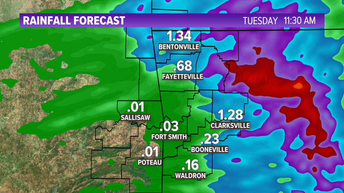
HOW MUCH WILL IT RAIN?
This will likely not be a big rainmaker for us. There may be some storms that produce locally some heavy rain, but many of us will wake up with less than a quarter inch by Tuesday morning. The heaviest rain will be east of US-71, and also north into Missouri.

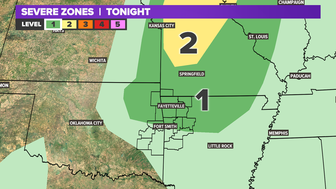
SEVERE WEATHER THREATS
Any storms that push into Arkansas will likely weaken on their journey south. Strong storms tonight should stay mainly north in Missouri. Our biggest threat will be a few gusty winds.

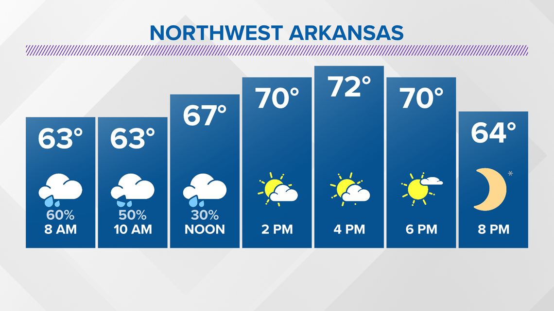
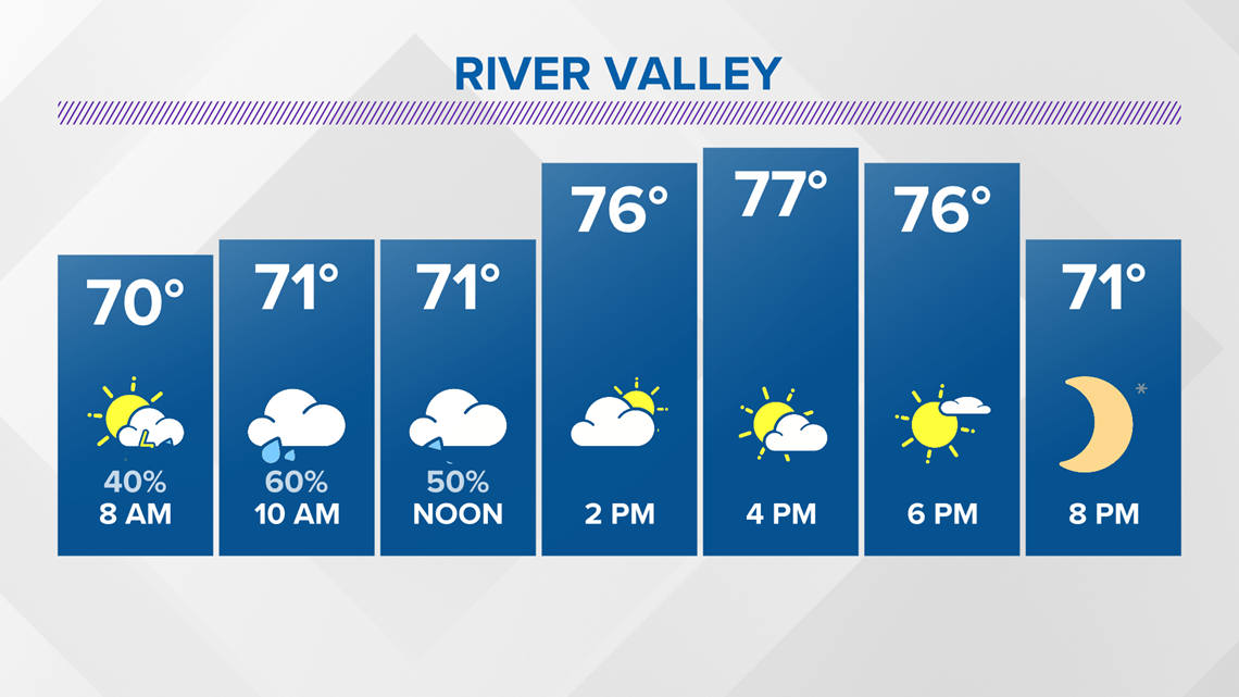
TUESDAY FORECAST
Enjoy a day with slowly clearing skies and highs in the 70s both in Northwest Arkansas and the River Valley! The humidity will be knocked out too. The next few mornings will be in the 40s/50s (Wednesday & Thursday).


-Matt, 5NEWS Chief Meteorologist