
ARKANSAS, USA — UPDATE: A severe thunderstorm watch has been issued by the National Weather Service for the southern Arkansas River Valley, the Ouachitas, and southeast Oklahoma. Storms are possible through 8 PM.
Friday May 19th could turn stormy on-and-off across Arkansas and eastern Oklahoma with multiple rounds of rain and thunder expected. Two primary waves are likely, one in the morning, followed by another in the late afternoon.
Tap HERE to track the incoming storms with our interactive radar.
Friday is a very busy day across Arkansas with graduations and sporting events/championships, so forecasting the timing is important. Here is our best guess..
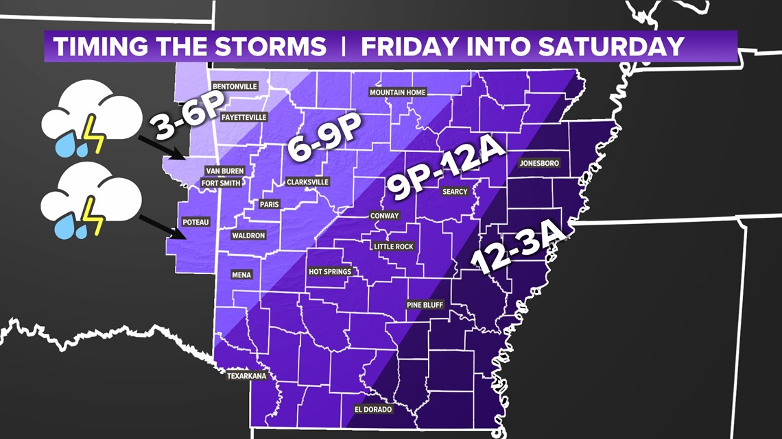
TIMING OUT THE STORMS
- Round 1: COMPLETE!
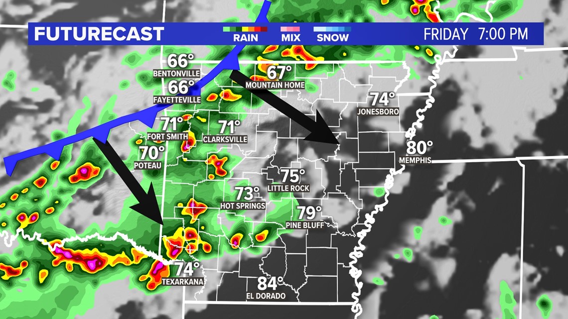
Crossing the AR-OK state line around 7-8AM, lasting possibly until noon, especially western Arkansas - Round 2: Isolated storms popping up over the state ahead of the cold front (see purple timing map) this afternoon and evening, especially south of I-40.
Western Arkansas should be wrapping up storms chances just after sunset. Eastern Arkansas may still have leftover storms past midnight, heading into early Saturday morning.

FIRST ROUND
COMPLETED -- We picked up anywhere from a half inch to a full inch of rainfall through the late morning hours.
SECOND ROUND
This round is much trickier. If we can reenergize the atmosphere after the morning round, we'll be watching a few pop-up storms spark in the afternoon as the cold front finally arrives. We have seen some cells redevelop over southern Oklahoma. These storms will likely impact the Texarkana region this evening. If we can get some cells to redevelop closer to Oklahoma City and Muskogee, then these cells would push into the Arkansas River Valley. The strongest ones will likely be in the Ouachitas.

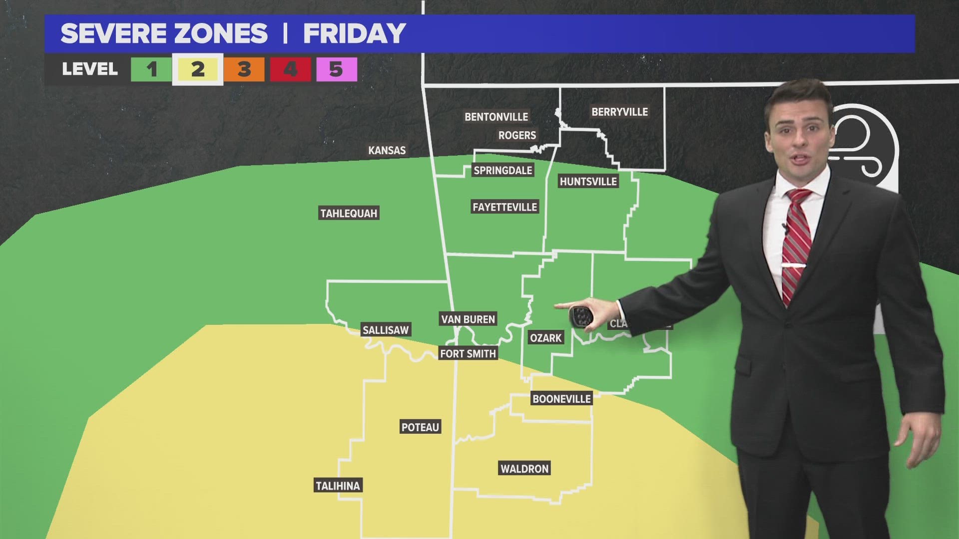
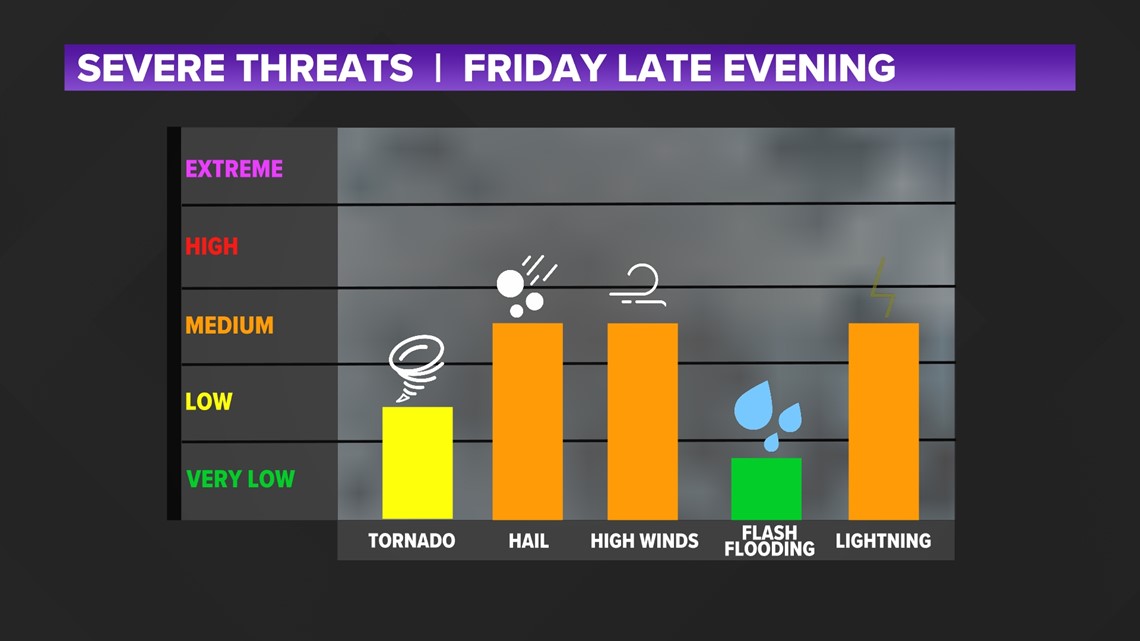
SEVERE THREATS
A level 2 severe risk for the afternoon/evening storms has been issued for the southwestern Arkansas (south of I-40 including the Ouachitas, and southeastern Oklahoma.. The strongest storms will likely be near Texarkana.

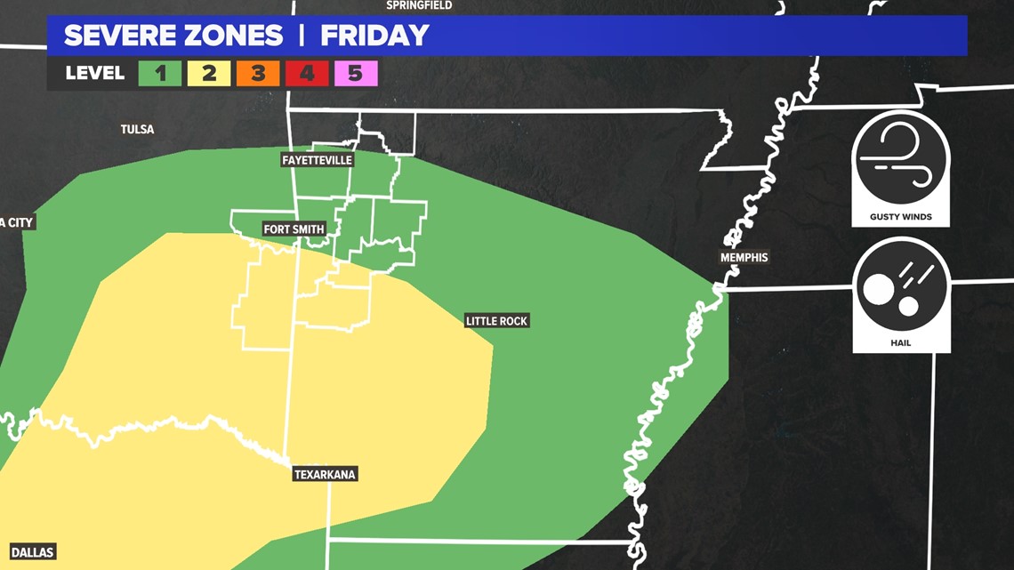
Hail and wind are the primary threats. That tends to be the case with storms travelling southeast. The tornado threats will be low, but not zero.

-5NEWS Weather