
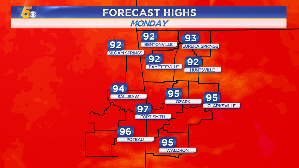
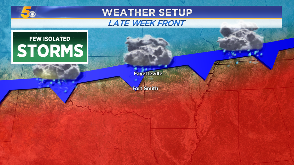
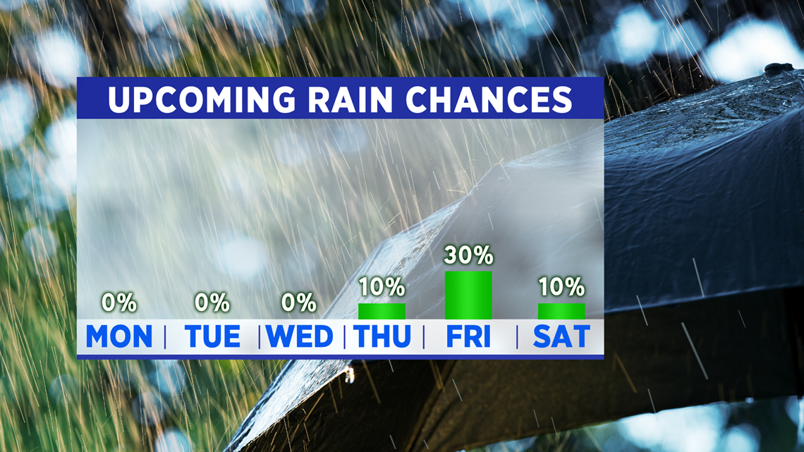
High pressure will continue to hold across Arkansas and eastern Oklahoma for much of the upcoming work week. Highs will hold in the low 90s while heat index values hover around the century mark. By the end of the week, a weak cold front will approach Arkansas and Oklahoma. It may give us a shower or storm Friday and a quick break from the heat, but as soon as the rain and clouds retreat back north, the sunshine and heat get turned right back on.
VIDEO FORECAST
MONDAY FORECAST
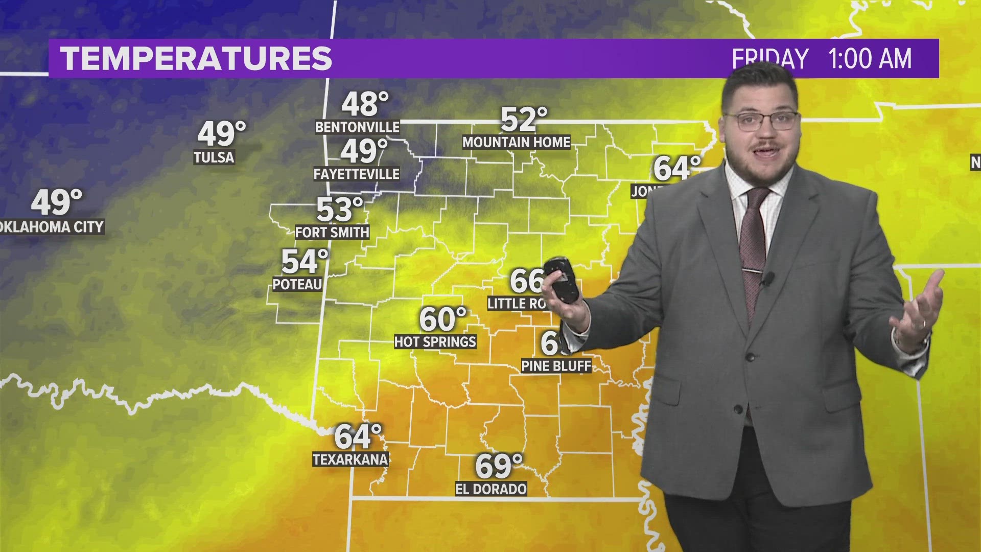
Lows will remain fairly warm in the 70s to start the morning (a few of us may get to the upper 60s). More sun than clouds is expected.

By the afternoon we should all reach the 90s for highs with heat index values near or above 100 degrees.

LITTLE RELIEF LATE WEEK?
By Thursday night into Friday, a weak front will try to push south but will most likely stall out over Arkansas and Oklahoma. It will give us the chance for a few isolated showers and storms before it lifts back towards the north. By the weekend, sunshine and heat will return quickly.
Rain Chances Late Week

-Matt