Rain will move into the area on Friday evening and then briefly changeover to snow before coming to an end during the day on Saturday.
The biggest change to the forecast is the speed of the system which appears to be trending faster and more progressive.
This means the window for any wintry weather will be during the first part of the day.

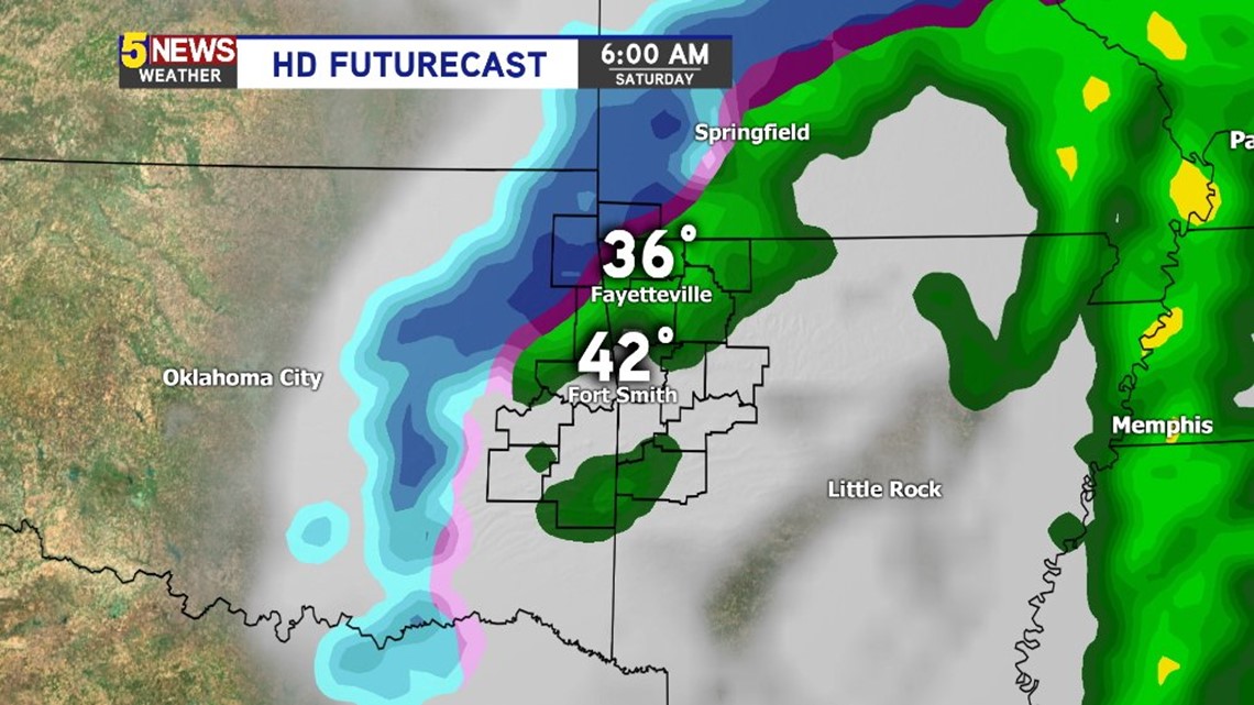
6AM SATURDAY: Temperatures will be above freezing and rain will be likely.


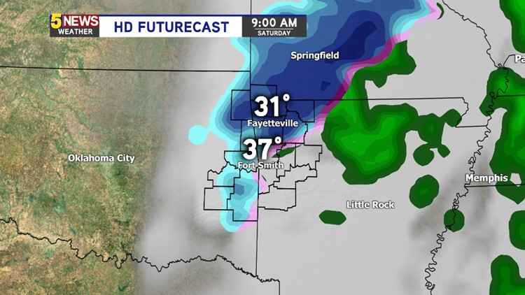
9AM SATURDAY: Temperatures will start to fall below freezing and rain will begin changing over to sleet and then light snow with minor accumulation possible.

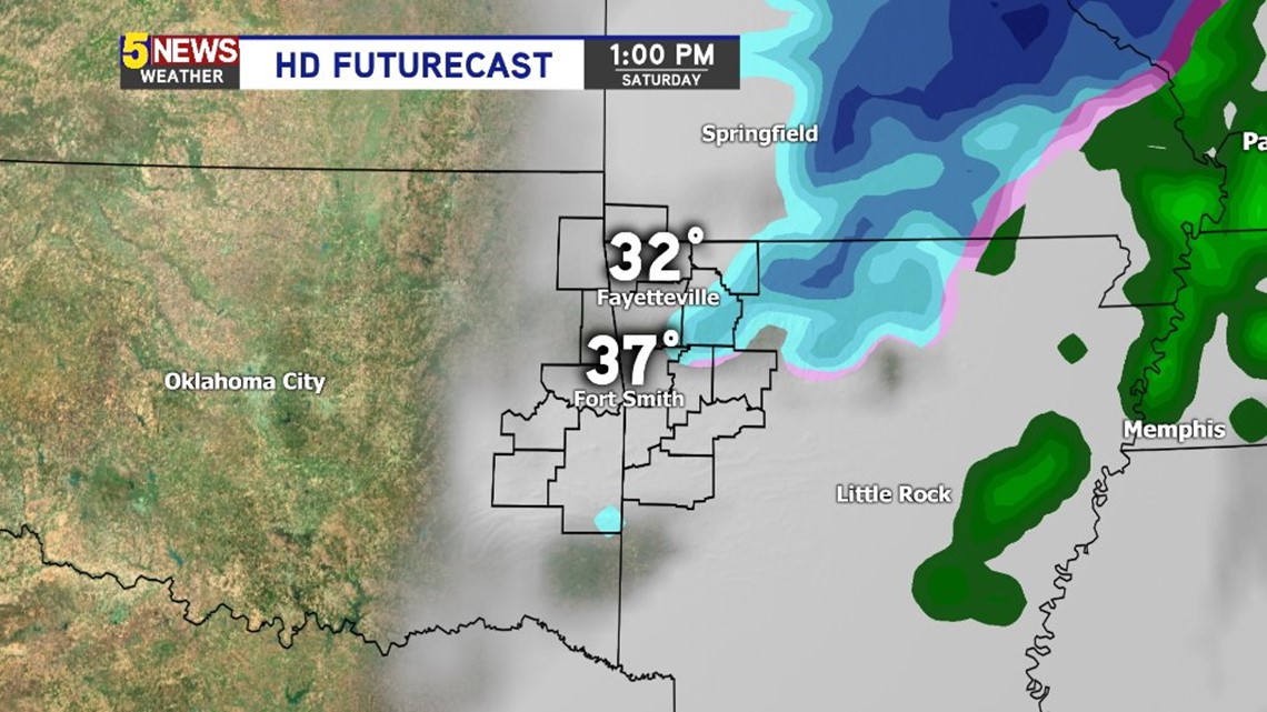
1PM SATURDAY: Most of the snow has exited the area and temperatures hold near freezing in NW Arkansas.
No additional snow will fall on Saturday night.
If traffic issues develop (and they may not) it would be Saturday from around 9am to 1pm.
More updates as new data arrives….
-Garrett