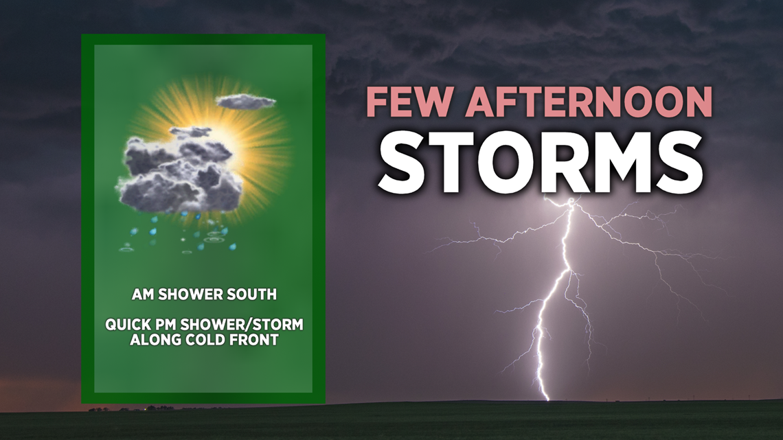
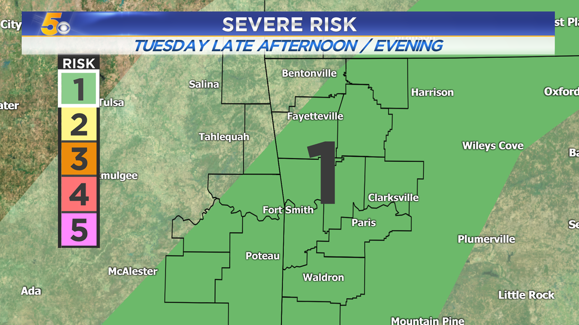
A cold front is approaching which will spark showers and storms for the afternoon and evening. One or two could turn severe while the majority provide some downpours as cooler air quickly moves in for the overnight hours.

VIDEO FORECAST
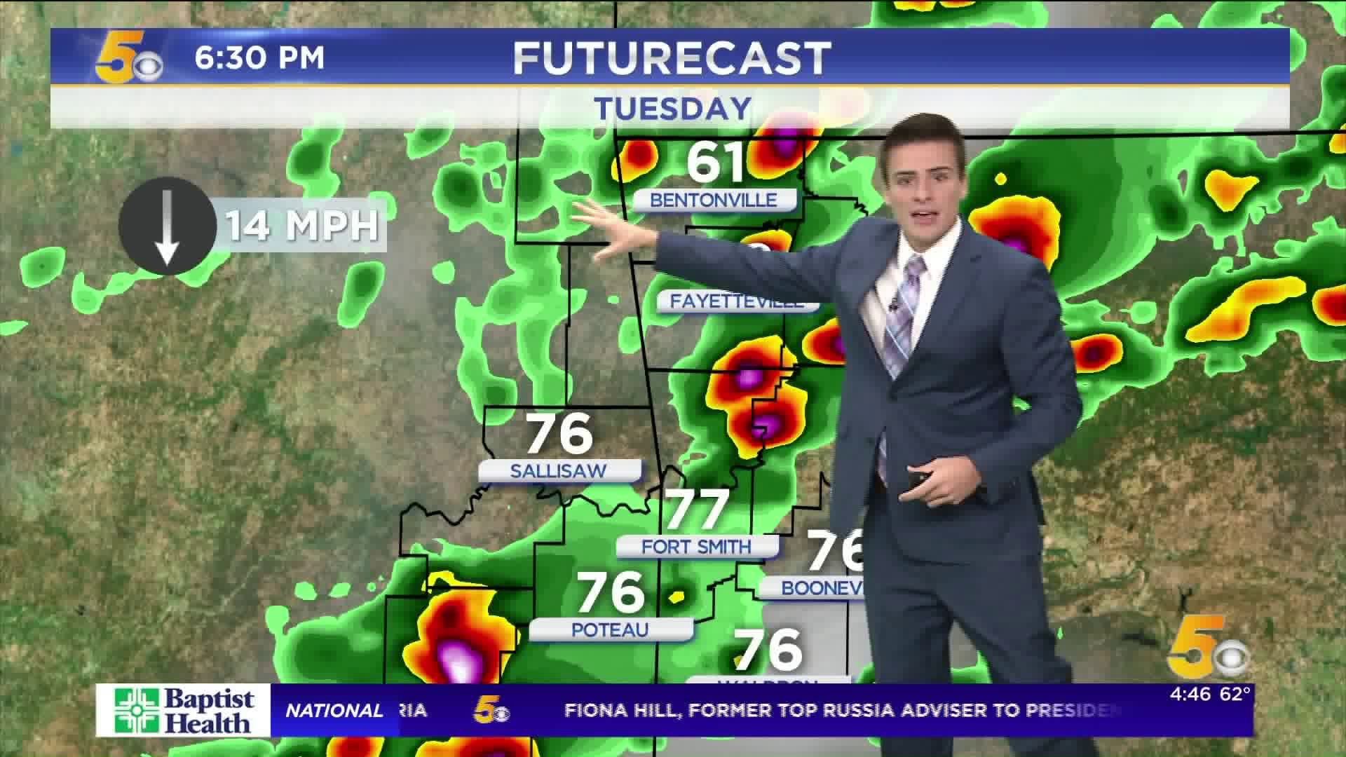
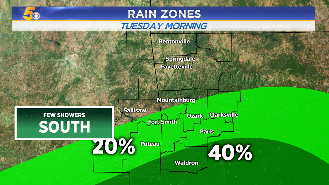
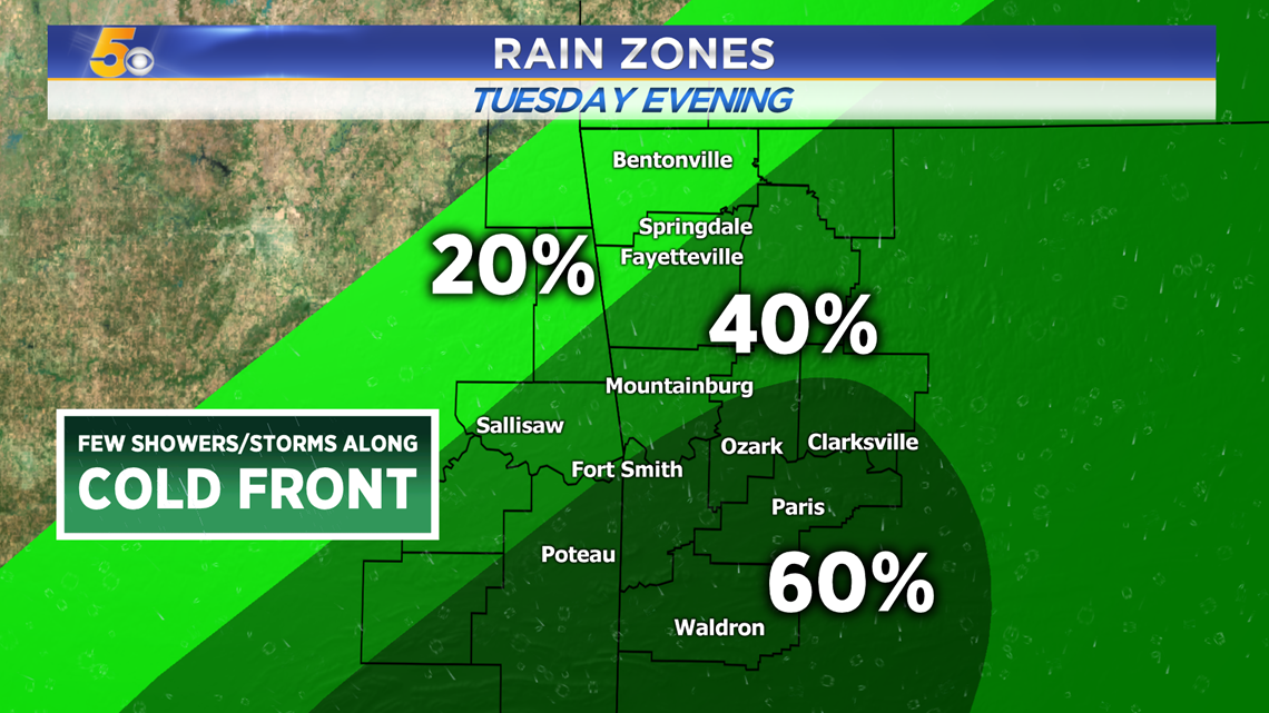
TUESDAY RAIN ZONES
There will be a quick shower possible close to the Ouachitas this morning, all south of I-40. Most of us will have a dry morning commute to work and school.

Later today in the afternoon, a complex of showers and storms will develop in eastern Oklahoma and dive south and east. The strongest storms will mainly impacting the River Valley with isolated downpours throughout Northwest Arkansas.


By the evening, most of the storms will be pushing south and east with much cooler air filling in behind.

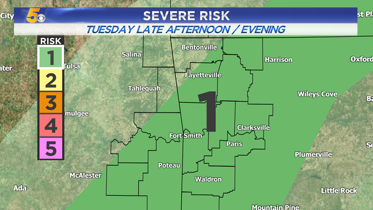
SEVERE ZONES
A few pockets of gusty winds and hail are possible. There will be some rotation in the atmosphere so an isolated wall cloud or tornado is possible especially farther south towards the Red River Valley.

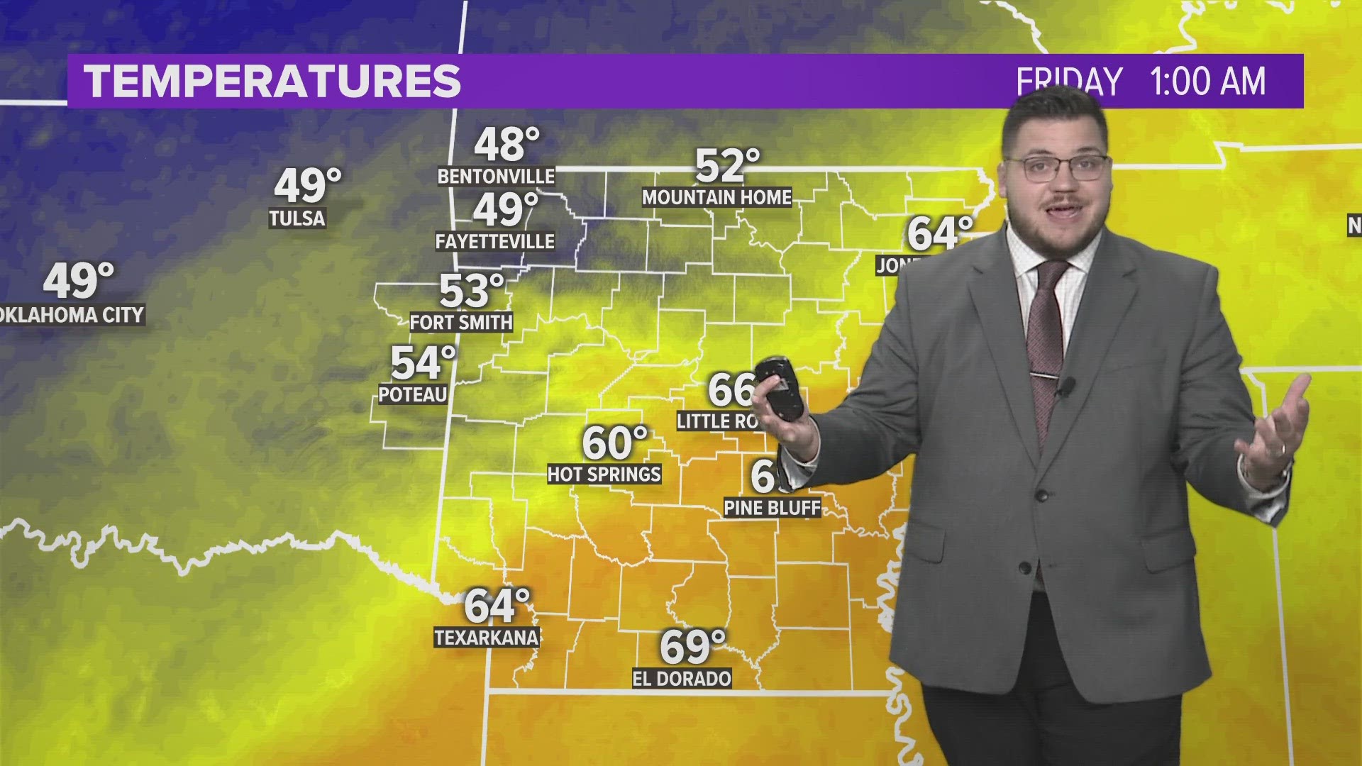
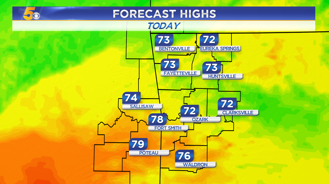
TUESDAY HIGHS

-Matt