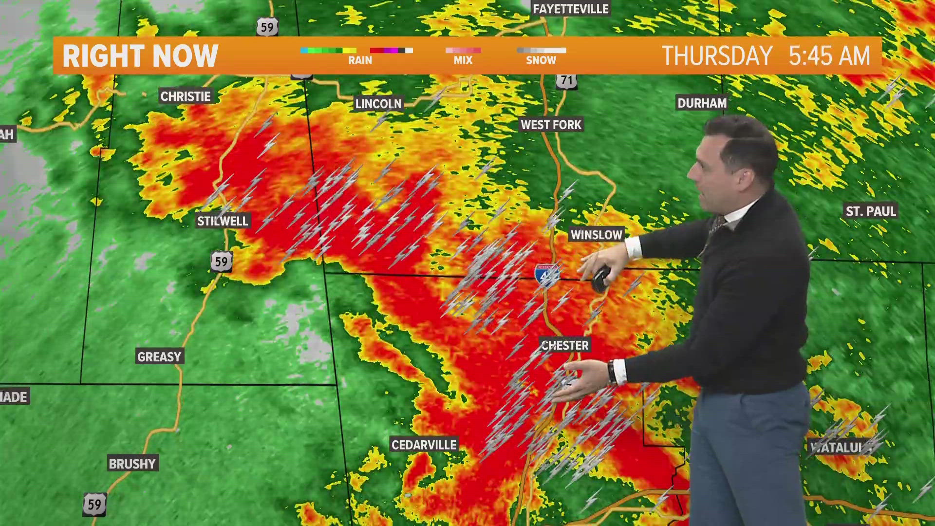
Severe storms are likely today across Arkansas and Oklahoma as a cold front approaches tonight. Damaging winds, a few tornadoes, and pockets of hail are all possible.

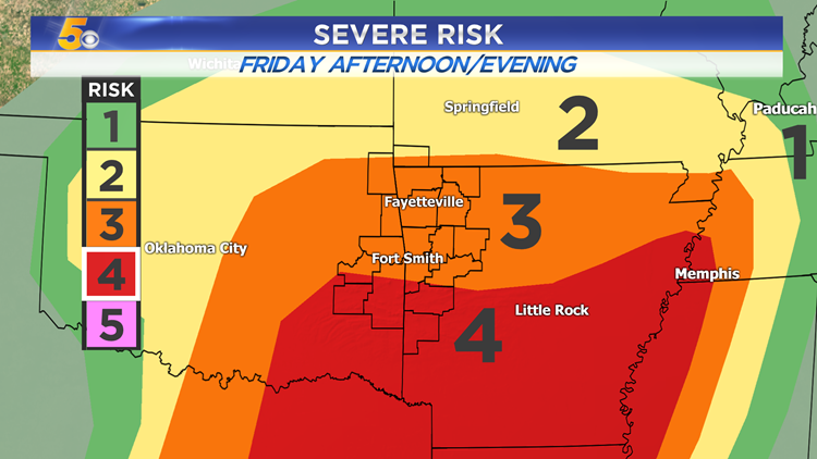
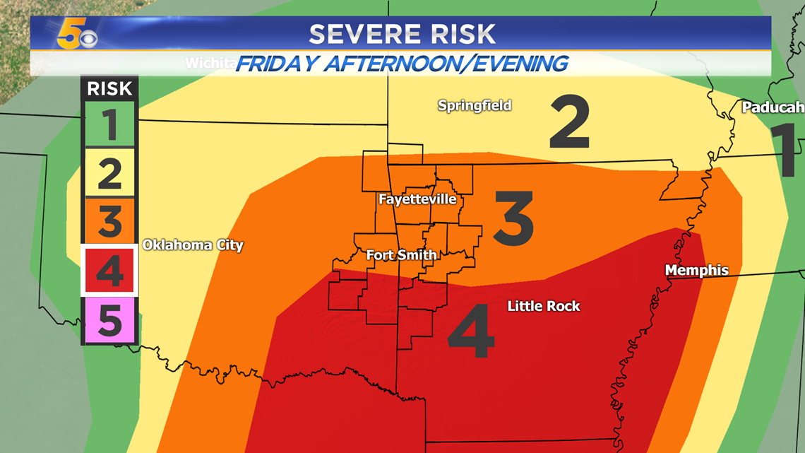
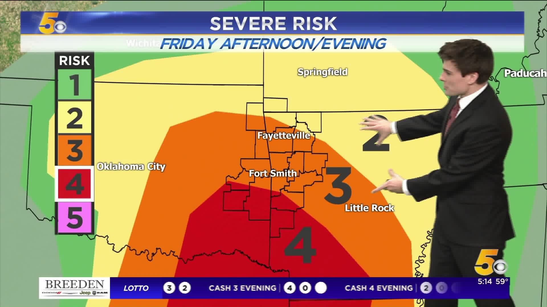
SEVERE ZONES: UPGRADED TO A LEVEL 4 FOR SOME

VIDEO FORECAST
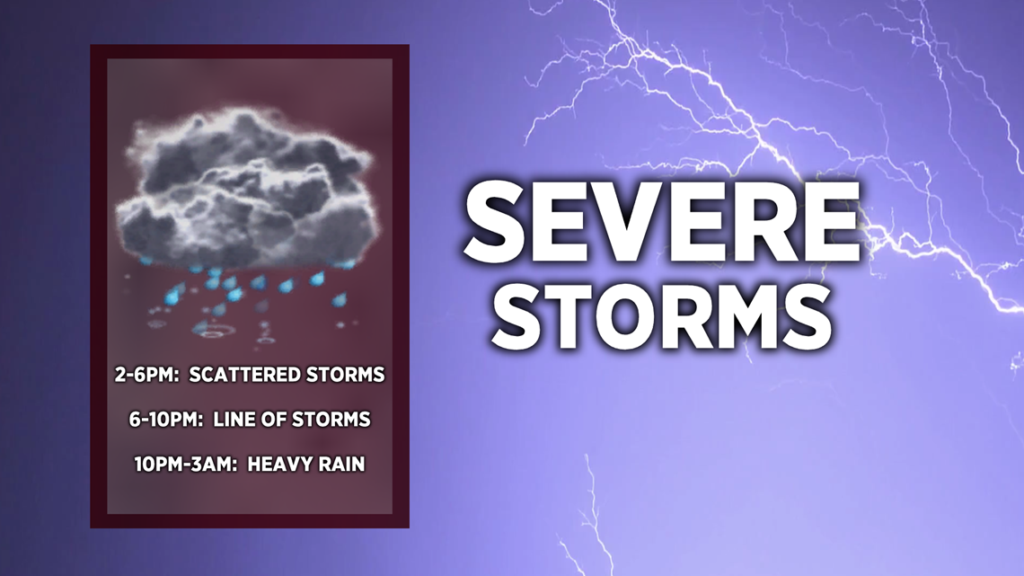
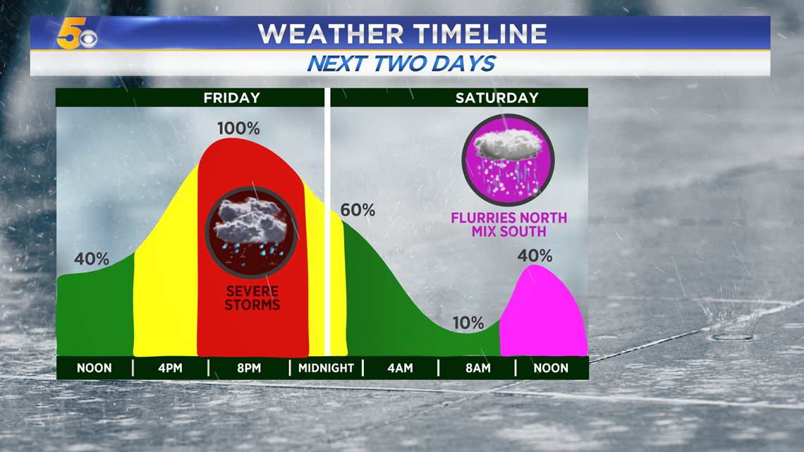
TIMING FOR FRIDAY STORMS
Friday Morning: Isolated showers, quick rumble of thunder
Friday Afternoon: Scattered strong-to-severe storms, some will rotate
Friday Evening: A line of storms with damaging winds will swing through with heavy rain on the back side -- a small spin-up tornado may be possible on the leading edge
Friday Night: Heavy rain will wind down
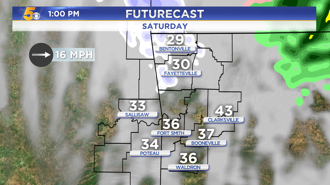
Saturday Morning/Midday: A few snow flurries are possible in NWA with some light sleet expected in the River Valley

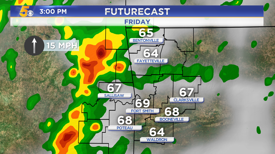
Friday Afternoon 2-6PM: Scattered storms may have some hail and rotation, moving from eastern Oklahoma into western Arkansas

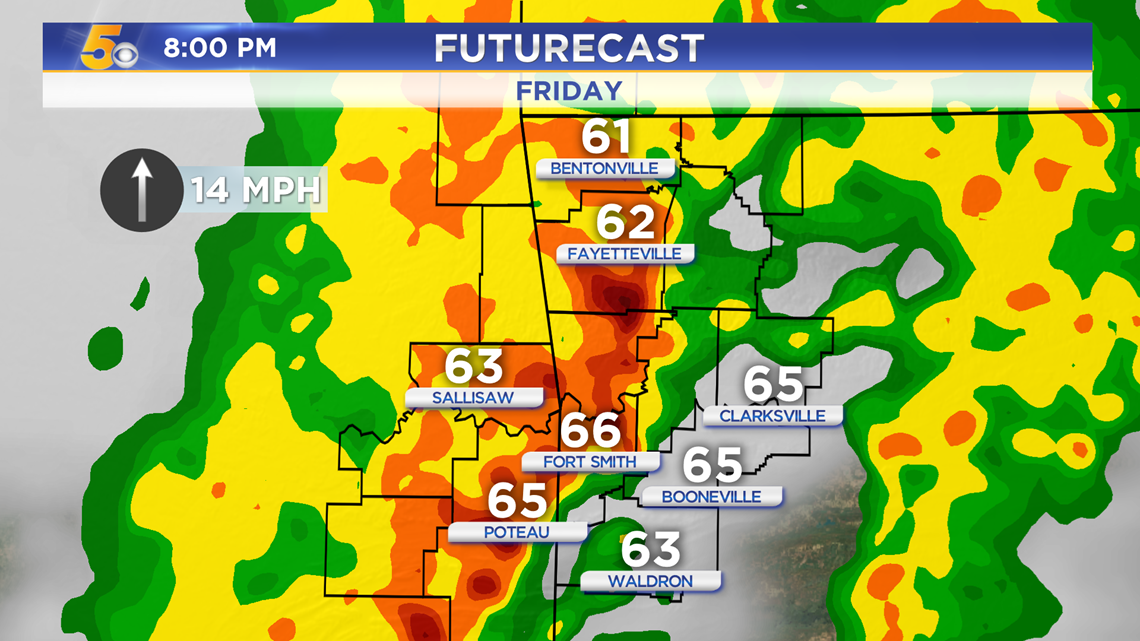
Friday Evening 6-10PM: A line of severe storms with damaging winds will sweep through west to east

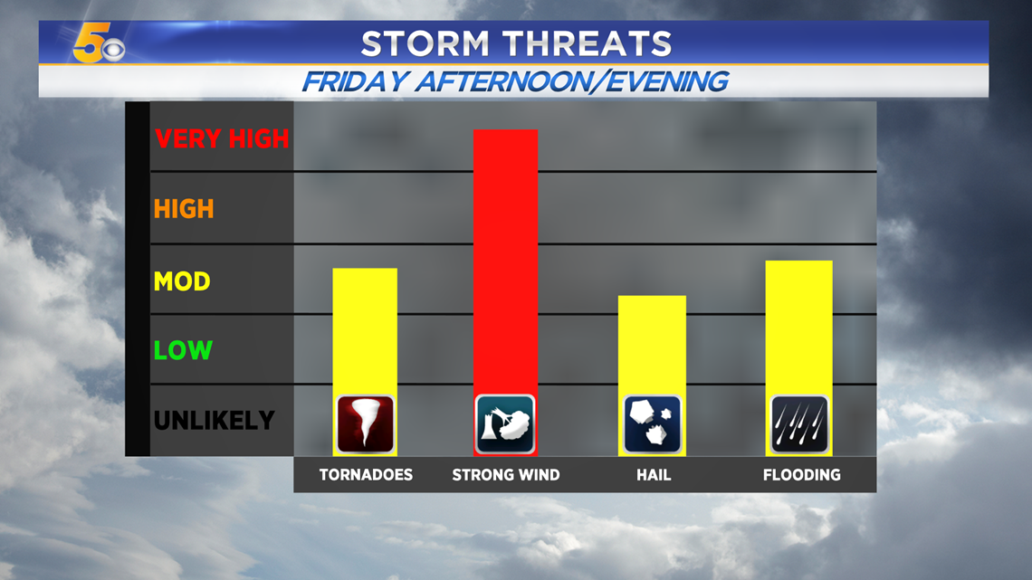
SEVERE THREATS
Damaging winds will be the primary threat with tornadoes, hail, and flooding up to a moderate threat level.

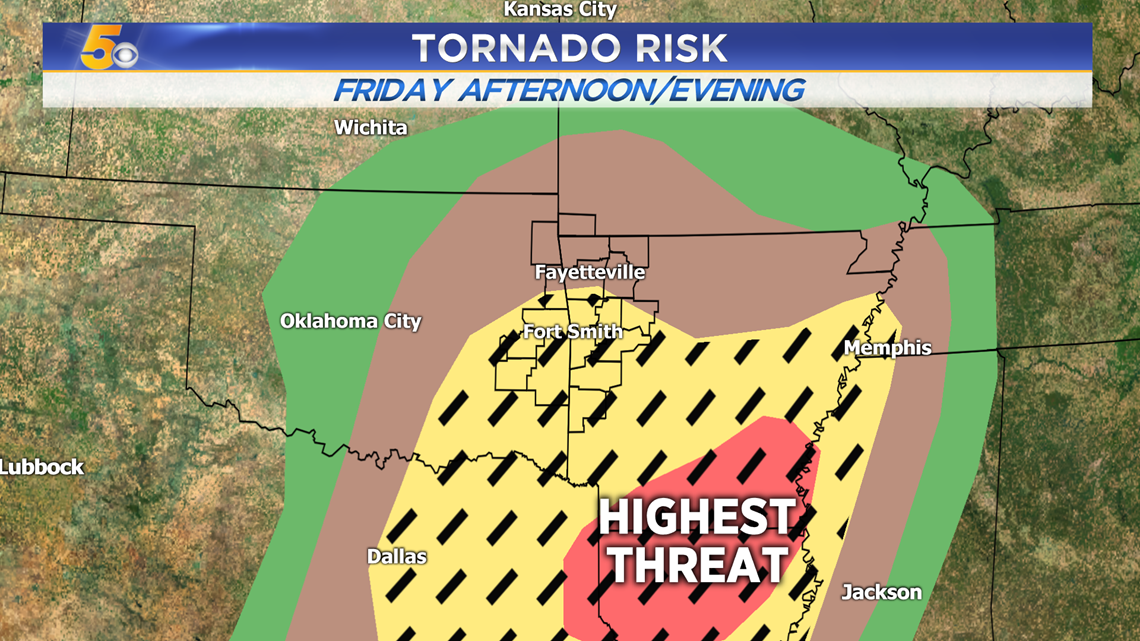
The highest threat for a tornado will be south of Fort Smith.

WINTRY SATURDAY?
Some light snow flurries and sleet may fall late Saturday morning and into the afternoon.

-Matt