
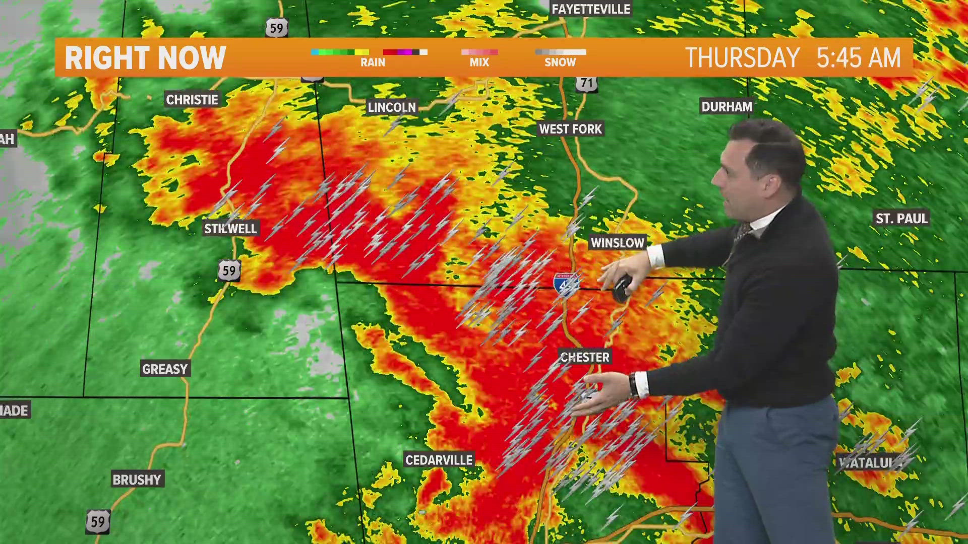
FAYETTEVILLE, Ark. — Multiple rounds of showers and storms are expected over the next several days. Thursday, rain chances and coverage will be the highest through the A.M. hours near and north of the I-40 corridor. Sunshine will likely break through the clouds a little better for parts of the the River Valley and Ouachita's.
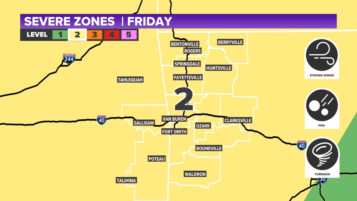
Once we get to Friday, warm air filters in from the south and more strong to severe storms are expected for the afternoon through the evening hours. This active pattern continues into the weekend with another system moving in late Saturday into Sunday.
Tap HERE to check our interactive weather radar.
A unstable environment will be present Friday through Sunday, bringing back the chances of strong to severe thunderstorms. All threats look to be available right now, as we could see strong winds, large hail, and an isolated tornado. Temperatures actually warm going into the end of the week and into the weekend. With the combination of higher humidity and a cold front sweeping in over the weekend, strong storms will be possible. The 5NEWS Weather team will be making adjustments on timing and threats over the next several days.
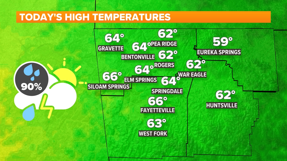
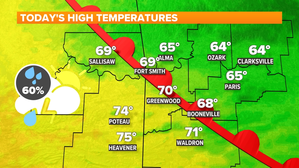
TODAY
- Mostly to partly cloudy
- Scattered showers & thunderstorms | 60-90%
- Dropping into the 60/70S
- Southeast winds 10 to 20 MPH | Gusts: 25 MPH
TONIGHT
- Mostly cloudy
- Spotty showers | 20-30%
- Highs in the 50/60s
- Southeast winds 10 to 20 MPH | Gusts: 25 MPH


STORM CHANCES FRIDAY AFTERNOON INTO THE EVENING
Friday's setup is all going to depend on the timing of that next front. Right now, models are suggesting that thunderstorms start to develop during the early afternoon and into the early evening. This scenario would be prime for the potential of strong to severe thunderstorms. If the line stalls or moves in a bit earlier, we could see weaker storms that may just being some stronger winds.

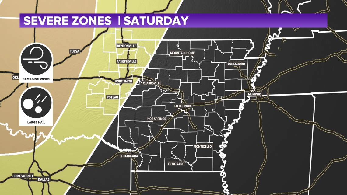
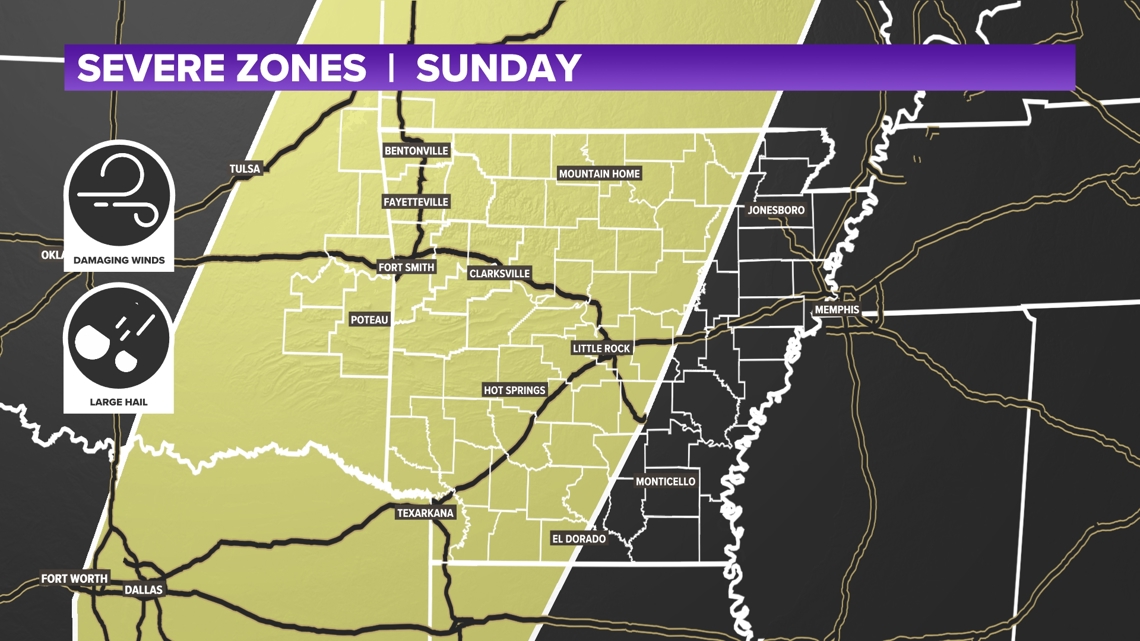
STORM CHANES SATURDAY INTO SUNDAY
Our second system moves in sometime late Saturday into Sunday morning, which will bring another chance of some strong to severe thunderstorms. Again, this system seems to be more put together as a line of thunderstorms develops and pushes into and unstable and humid atmosphere.


- Meteorologist Zac Scott
Watch 5NEWS on YouTube.
Download the 5NEWS app on your smartphone:
Stream 5NEWS 24/7 on the 5+ app: How to watch the 5+ app on your streaming device
To report a typo or grammatical error, please email KFSMDigitalTeam@tegna.com and detail which story you're referring to.