
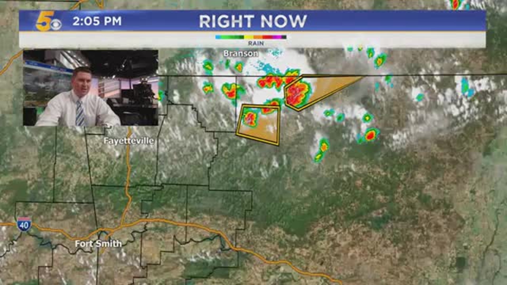

[Above: Most recent radar image]
The high pressure ridge which has been anchored over the area giving us hotter-than-normal temperatures and heat indices will gradually shift out of the area allowing for a weak front to approach from the north.
Given the high moisture content and the slow movement of any thunderstorms, very heavy rain will be possible in some spots.
Additionally, the cooler air aloft created by thunderstorm updrafts will descend rapidly into the warm air with peak daytime heating. This will create the potential for damaging winds and the risk of trees being uprooted where soil is most saturated.
Long term, a subtle return of the heat arrives by later this weekend but an even stronger front will arrive around the last of August and first of September. This will drive temperatures down and be a welcome break from the simmering dog days we've been experiencing.
Key Takeaways:
- Heavy rain, damaging downburst wind risk Thu/Fri
- Warmer early next week
- Strong cold front by the end of next week, Fall Weather?
-Garrett