Enjoy sunshine for now because by the weekend our next system arrives bringing us the potential for some strong thunderstorms.

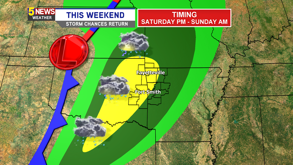
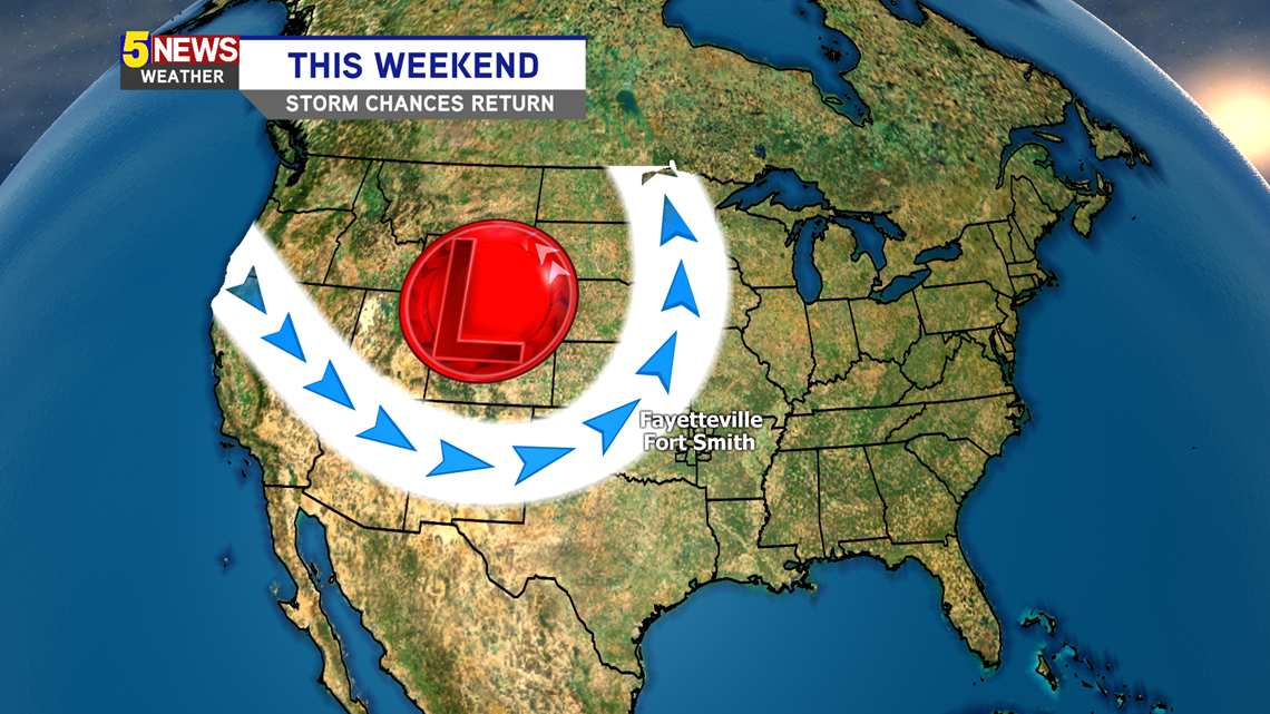
High pressure should keep the Ozarks mainly dry Tuesday-Friday, except for a stray pop-up shower thanks to Northwest Flow. That means the majority of the work week we should have pleasant weather. By Saturday, a trough will be approaching, as well as a negatively-tilted shortwave, which is conducive for thunderstorm development. By the afternoon, a cold front will be sweeping across Oklahoma, firing storms along it and pushing east towards Arkansas. Timing is subject to change as more information comes in, but here’s what the potential looks like right now:

TIMING
Saturday Afternoon/Evening/Night – Sunday Morning (moving west to east)
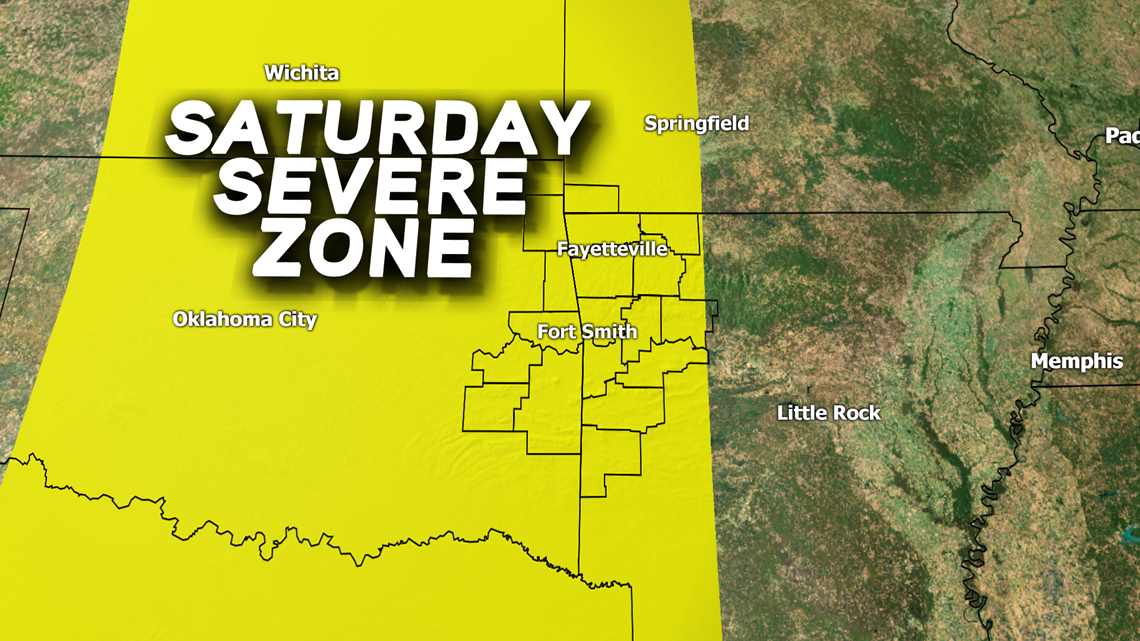
THREATS
Gusty winds, lightning, hail, and isolated tornadoes (the flash flooding is risk lower thanks quick storm movement along a line)
WHERE
The strongest storms may be in eastern Oklahoma as they lose steam a bit crossing into Arkansas. This depends on the placement of the cold front and how fast the upper-level trough leaves the Rockies. Area subject to be modified. On Sunday, the severe threat shifts towards eastern Arkansas.

Stay tuned for more updates.
-Matt