The next front set to move thru the area on Thursday Night and Friday Morning will bring significant impacts across the entire region.
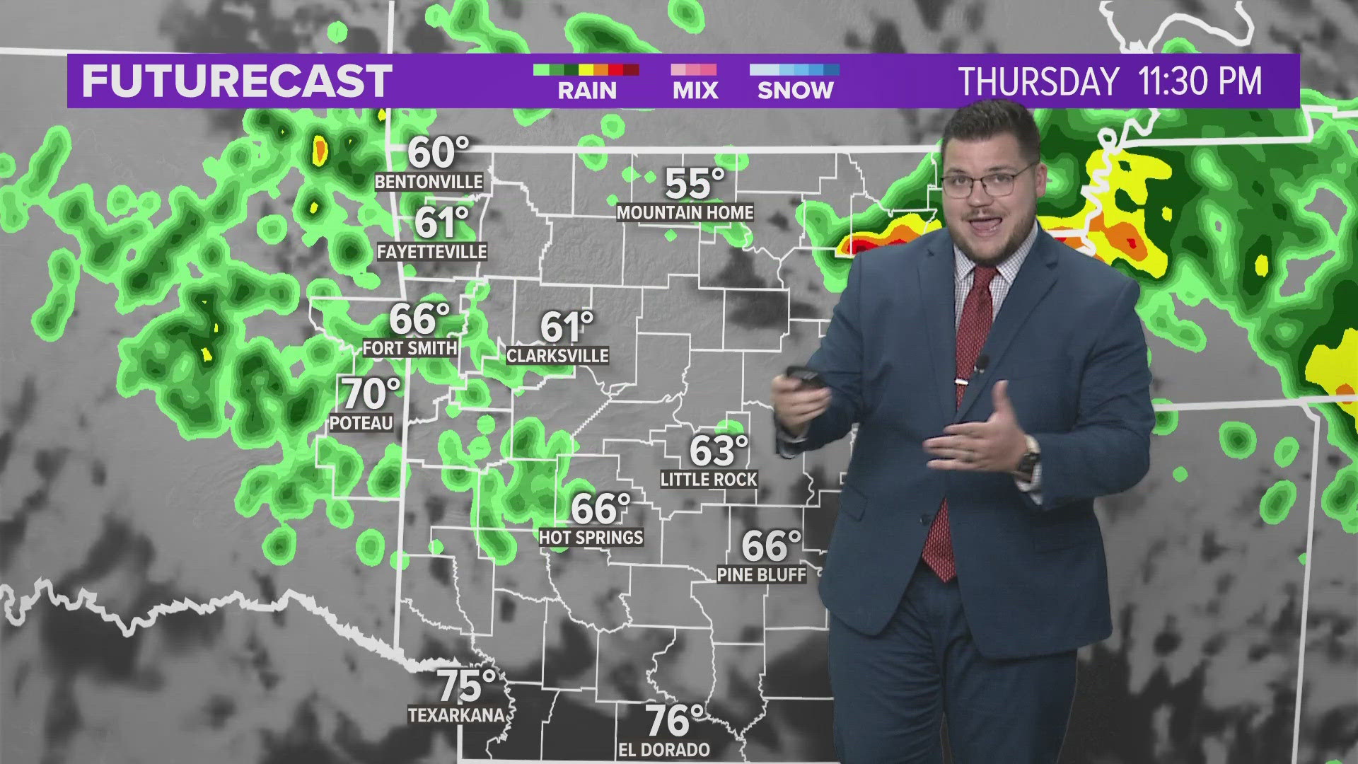
Here’s a look at some the data I’m seeing this afternoon…
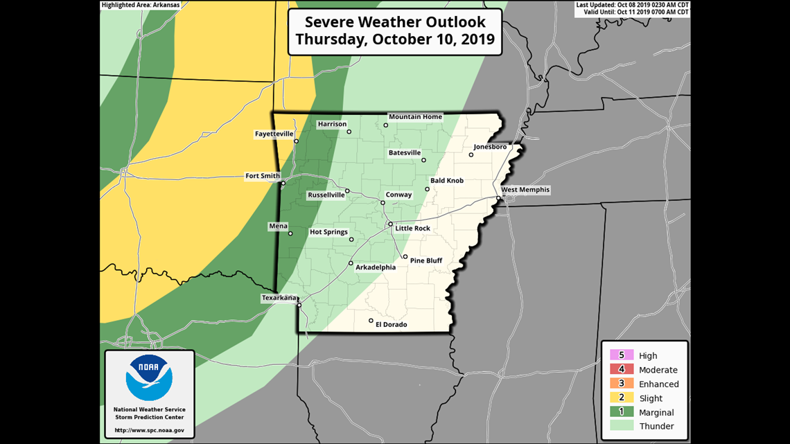
The best chance for severe weather will be Thursday night into the overnight hours. The orientation from the NE to the SW of the front will give NW Arkansas a slightly higher severe weather risk than farther south. Damaging wind is the most likely severe threat.
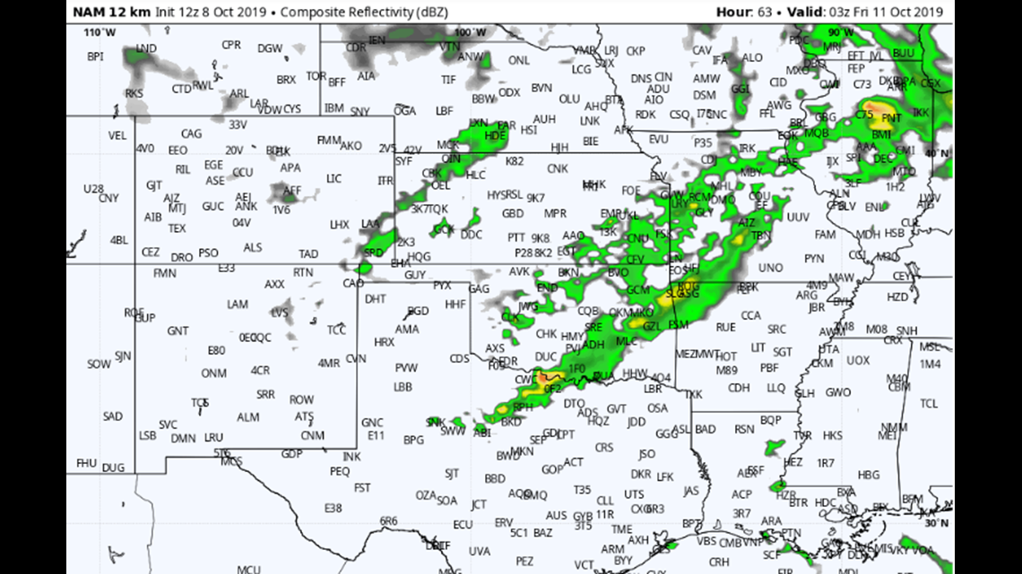
Current data suggest the heaviest will be underway by Thursday evening around 10pm.
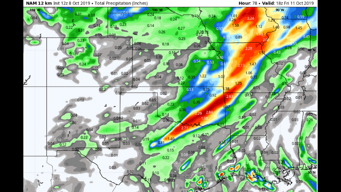
Forecast rainfall totals will be in the 2″ range for this event. This could cause flash flooding quickly in places like Benton County where several inches fell this past weekend.
The highest likelihood for flash flooding will be across NW Arkansas on Friday morning.

Anyone ready for wind chills in the 20s and 30s? This is around 10am Friday. Breezy north winds will drive temperatures down into the 30s and 40s. The wind chill will be a factor for the first time this season.
Additionally, some of the data I’m looking at suggests a frost could be possible on Saturday morning. Perhaps 30 degrees in NW Arkansas and 35 in the River Valley. Expect frost advisories to be issued later this weekend into the weekend.
Hang on… we’re in for weather whiplash this week!
-Garrett