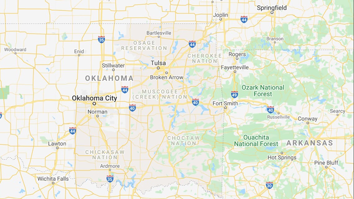
OKLAHOMA, USA — The reservation boundaries for Cherokee Nation, Choctaw Nation, Osage Nation, Muscogee Creek Nation and Chickasaw Nation are now shown on Google Maps.
Choctaw Nation said this will make it easier for people to search and view the reservation boundaries with just a few clicks.
“After the monumental US Supreme Court ruling in McGirt vs Oklahoma, we’ve had many questions about our reservation boundaries, which always existed on paper maps," stated Cherokee Nation Principal Cheif, Chuck Hoskin Jr. "Now that our reservation is labeled on Google Maps, it’s easy for people around the world to search and see our reservation boundaries.”
Cherokee Nation citizen, Joseph Erb, provided feedback about the reservation mapping project, which includes mapping for all five civilized tribes.
“It is an exciting step forward to be included on the map,” Erb said. “This is a visual reminder that our nation is still here and a contemporary Indigenous nation of Continent.”
Image of reservations on Google Maps (Cherokee Nation, Choctaw Nation, Osage Nation, Muscogee Creek Nation and Chickasaw Nation):

On July 16, 2020, Oklahoma’s attorney general and five major Native American tribes in Oklahoma announced an agreement on proposed federal legislation regarding civil and criminal jurisdiction following a recent U.S. Supreme Court decision.
Republican Attorney General, Mike Hunter, announced the deal with leaders of the Cherokee, Chickasaw, Choctaw, Muscogee (Creek) and Seminole nations after the high court ruled that much of eastern Oklahoma remains an Indian reservation, according to an Associated Press report.
The Associated Press report said, "Under the agreement, the state would have criminal jurisdiction over non-Native American offenders throughout the treaty territories, with some exceptions, while the tribes would have overlapping jurisdiction over most offenders who are tribal citizens. Federal prosecutors would still have jurisdiction under the Major Crimes Act over certain serious crimes committed by Native Americans."
To view Choctaw Nation's reservation on Google Maps, click here.
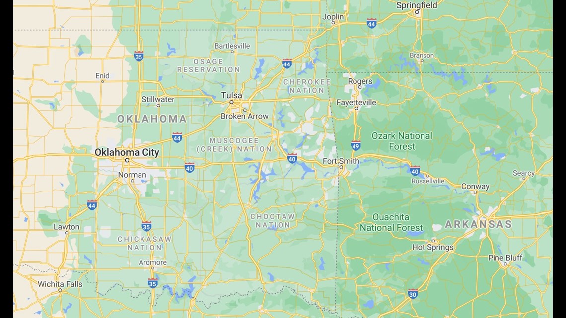
To view Cherokee Nation's reservation on Google Maps, click here.
Image of Choctaw Nation reservation now on Google Maps:

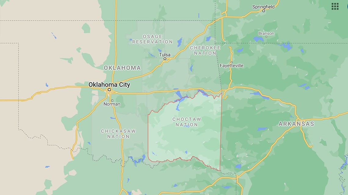
Image of Cherokee Nation reservation now on Google Maps:

The Choctaw Nation is an American Indian territory covering about 6,952,960 acres, occupying portions of southeastern Oklahoma in the United States and the third-largest federally recognized tribe in the United States and the second-largest Indian reservation in the area after the Navajo.
The Cherokee Nation, also known as the Cherokee Nation of Oklahoma, is the largest of three Cherokee federally recognized tribes in the United States. The Cherokee Nation reservation boundaries include 7,000 miles in northeastern Oklahoma.
Watch: Local attorney weighs in on Oklahoma land ruling